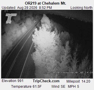
Bald Peak
Montaña · Chehalem Mountains · Estados Unidos
Bald Peak is a mountain top and highest point in the Chehalem Mountains in the Northwest area of the U.S. state of Oregon. Located in Yamhill County near the county line with Washington County, the summit at 1624+ feet is the highest point in the Willamette Valley.
De Wikipedia, CC BY-SA · Leer el artículo
En la cumbre · pronóstico para las 22:00
46 °FNublado · viento de 9 mph del S
 Verla en 3D
Pronóstico del tiempo en Bald Peak
- 22:0046 °FS 9 mph–
- 1:0046 °FS 8 mph0,05 pulg.
- 4:0044 °FS 6 mph0,13 pulg.
- 7:0044 °FSO 5 mph0,05 pulg.
- 10:0047 °FSO 3 mph0,01 pulg.
- 13:0052 °FO 6 mph0,02 pulg.
- 16:0052 °FO 9 mph–
- 19:0045 °FSO 7 mph–
| Día | Cielo | Máx. / mín. | Lluvia | Viento hasta |
|---|---|---|---|---|
| mar, 27 oct | Lluvia | 52 °F / 42 °F | 0,27 pulg. | 10 mph |
| mié, 28 oct | Lluvia | 51 °F / 36 °F | 0,2 pulg. | 13 mph |
| jue, 29 oct | Lluvia | 44 °F / 35 °F | 0,18 pulg. | 4 mph |
| vie, 30 oct | Lluvia débil | 44 °F / 33 °F | 0,1 pulg. | 6 mph |
| sáb, 31 oct | Lluvia | 42 °F / 33 °F | 0,1 pulg. | 4 mph |
| dom, 1 nov | Nublado | 46 °F / 32 °F | – | 5 mph |
| lun, 2 nov | Nublado | 49 °F / 34 °F | – | 8 mph |
Pronóstico de MET Norway (CC BY 4.0), actualizado a las 22:20 GMT-7. Horas locales.
Ficha técnica
- Tipo
- Montaña
- Cordillera
- Chehalem Mountains
- País
- Estados Unidos
- Coordenadas
- 45.396°N 123.056°W
- Fuente
- Wikidata, CC0
Bald Peak
Mountain in Oregon, United States
Bald Peak is a mountain top and highest point in the Chehalem Mountains in the Northwest area of the U.S. state of Oregon. Located in Yamhill County near the county line with Washington County, the summit at 1624+ feet is the highest point in the Willamette Valley. Bald Peak State Scenic Viewpoint is a 26-acre (11 ha) state park located on the peak.
De Wikipedia, CC BY-SA · Leer el artículo
Picos cerca de Bald Peak
- Cooper Mountain764 ft · a 16 kmEn el mapa
- Mount Sylvania978 ft · a 27 kmEn el mapa
- South Saddle Mountain3465 ft · a 30 kmEn el mapa
- Amity Hills791 ft · a 31 kmEn el mapa
- Trask Mountain3426 ft · a 31 kmEn el mapa
- Round Top2983 ft · a 39 kmEn el mapa
- Mount Scott1091 ft · a 40 kmEn el mapa
- Larch Mountain3452 ft · a 41 kmEn el mapa
- Rocky Butte612 ft · a 42 kmEn el mapa
- Powell Butte614 ft · a 44 kmEn el mapa
Montañas más altas de Estados Unidos
- Denali20.308 ftEn el mapa
- Monte San Elías18.009 ftEn el mapa
- Monte Foraker17.402 ftEn el mapa
- Monte Bona16.535 ftEn el mapa
- Monte Blackburn16.390 ftEn el mapa
- Monte Sanford16.237 ftEn el mapa
- Monte Vancouver15.787 ftEn el mapa
- Monte Churchill15.636 ftEn el mapa
- Monte Fairweather15.325 ftEn el mapa
- Mount Hubbard14.951 ftEn el mapa