Castle Dome
7054 ft2150 m
Montaña · Estados Unidos
Castle Dome is a 7,054-foot (2,150 m) elevation Navajo Sandstone summit located in Zion National Park, in Washington County of southwest Utah, United States. Castle Dome is situated northwest of Zion Lodge, towering 2,800 feet (850 m) above the lodge and the floor of Zion Canyon.
De Wikipedia, CC BY-SA · Leer el artículo
En la cumbre · pronóstico para las 23:00
34 °FDespejado · viento de 6 mph del NE
 Verla en 3D
Clima en la cumbre de Castle Dome, 7054 ft
- 23:0034 °FNE 6 mph–
- 2:0033 °FN 7 mph–
- 5:0032 °FNE 7 mph–
- 8:0030 °FNE 7 mph–
- 11:0051 °FSE 7 mph–
- 14:0055 °FSO 9 mph–
- 17:0054 °FSO 8 mph–
- 20:0042 °FN 3 mph–
| Día | Cielo | Máx. / mín. | Lluvia | Viento hasta |
|---|---|---|---|---|
| mar, 27 oct | Despejado | 55 °F / 30 °F | – | 9 mph |
| mié, 28 oct | Mayormente despejado | 55 °F / 31 °F | – | 8 mph |
| jue, 29 oct | Nublado | 54 °F / 33 °F | – | 10 mph |
| vie, 30 oct | Lluvia fuerte | 49 °F / 40 °F | 0,67 pulg. | 6 mph |
| sáb, 31 oct | Lluvia | 46 °F / 39 °F | 0,67 pulg. | 5 mph |
| dom, 1 nov | Lluvia | 43 °F / 30 °F | 0,61 pulg. | 5 mph |
| lun, 2 nov | Despejado | 43 °F / 26 °F | – | 4 mph |
Pronóstico de MET Norway (CC BY 4.0), actualizado a las 19:17 GMT-6. Horas locales.
Ficha técnica
- Tipo
- Montaña
- Altitud sobre el nivel del mar
- 7054 ft (2150 m)
- País
- Estados Unidos
- Coordenadas
- 37.266°N 112.971°W
- Fuente
- Wikidata, CC0
Castle Dome (Zion National Park)
Mountain in Utah, United States
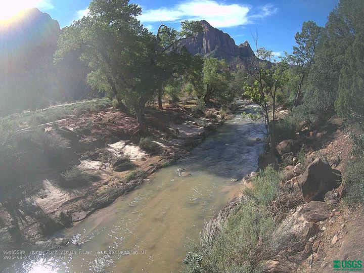
Castle Dome is a 7,054-foot (2,150 m) elevation Navajo Sandstone summit located in Zion National Park, in Washington County of southwest Utah, United States. Castle Dome is situated northwest of Zion Lodge, towering 2,800 feet (850 m) above the lodge and the floor of Zion Canyon. It is set on the west side of the North Fork Virgin River which drains precipitation runoff from this mountain.
De Wikipedia, CC BY-SA · Leer el artículo
Picos cerca de Castle Dome
- Mount Majestic6949 ft · a 0,8 kmEn el mapa
- Lady Mountain6903 ft · a 1,4 kmEn el mapa
- Cathedral Mountain6929 ft · a 1,5 kmEn el mapa
- Angels Landing5774 ft · a 2 kmEn el mapa
- Red Arch Mountain5892 ft · a 2,3 kmEn el mapa
- Isaac Peak6726 ft · a 2,4 kmEn el mapa
- Abraham Peak7014 ft · a 2,5 kmEn el mapa
- Mount Moroni5650 ft · a 2,6 kmEn el mapa
- Observation Point6506 ft · a 3 kmEn el mapa
- Three Patriarchs7014 ft · a 3,3 kmEn el mapa
Montañas más altas de Estados Unidos
- Denali20.308 ftEn el mapa
- Monte San Elías18.009 ftEn el mapa
- Monte Foraker17.402 ftEn el mapa
- Monte Bona16.535 ftEn el mapa
- Monte Blackburn16.390 ftEn el mapa
- Monte Sanford16.237 ftEn el mapa
- Monte Vancouver15.787 ftEn el mapa
- Monte Churchill15.636 ftEn el mapa
- Monte Fairweather15.325 ftEn el mapa
- Mount Hubbard14.951 ftEn el mapa
Cámaras web cerca de Castle Dome
Ciudades cerca de Castle Dome
- Springdalea 9,9 km
- Hurricanea 30 km
- Cedar Citya 46 km
- Washingtona 50 km
- Fredoniaa 53 km
- Enocha 56 km