Castle Dome
7,054 ft2,150 m
Mountain · United States
Castle Dome is a 7,054-foot (2,150 m) elevation Navajo Sandstone summit located in Zion National Park, in Washington County of southwest Utah, United States. Castle Dome is situated northwest of Zion Lodge, towering 2,800 feet (850 m) above the lodge and the floor of Zion Canyon.
From Wikipedia, CC BY-SA · Read the article
At the summit · forecast for 6:00 PM
49 °FClear · wind 3 mph from the SW
 See it in 3D
Weather at the summit of Castle Dome, 7,054 ft
- 6:00 PM49 °FSW 3 mph–
- 9:00 PM39 °FNE 4 mph–
- 12:00 AM33 °FN 7 mph–
- 3:00 AM33 °FN 6 mph–
- 6:00 AM31 °FNE 7 mph–
- 9:00 AM37 °FNE 7 mph–
- 12:00 PM53 °FS 8 mph–
- 3:00 PM55 °FSW 9 mph–
| Day | Sky | High / low | Rain | Wind up to |
|---|---|---|---|---|
| Tue, Oct 27 | Clear | 55 °F / 30 °F | – | 9 mph |
| Wed, Oct 28 | Partly cloudy | 55 °F / 30 °F | – | 8 mph |
| Thu, Oct 29 | Cloudy | 54 °F / 33 °F | – | 8 mph |
| Fri, Oct 30 | Heavy rain | 49 °F / 40 °F | 0.67 in | 6 mph |
| Sat, Oct 31 | Rain | 46 °F / 39 °F | 0.67 in | 5 mph |
| Sun, Nov 1 | Rain | 43 °F / 30 °F | 0.61 in | 5 mph |
| Mon, Nov 2 | Clear | 43 °F / 26 °F | – | 4 mph |
Forecast by MET Norway (CC BY 4.0), updated 05:20 PM MDT. Times are local.
Facts
- What it is
- Mountain
- Height above sea level
- 7,054 ft (2,150 m)
- Country
- United States
- Coordinates
- 37.266°N 112.971°W
- Source
- Wikidata, CC0
Castle Dome (Zion National Park)
Mountain in Utah, United States
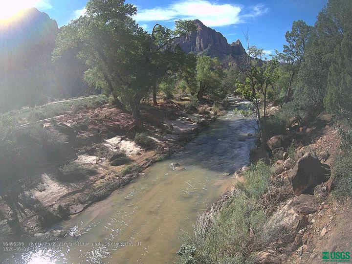
Castle Dome is a 7,054-foot (2,150 m) elevation Navajo Sandstone summit located in Zion National Park, in Washington County of southwest Utah, United States. Castle Dome is situated northwest of Zion Lodge, towering 2,800 feet (850 m) above the lodge and the floor of Zion Canyon. It is set on the west side of the North Fork Virgin River which drains precipitation runoff from this mountain.
From Wikipedia, CC BY-SA · Read the article
Peaks near Castle Dome
- Mount Majestic6,949 ft · 0.8 km awayOn the map
- Lady Mountain6,903 ft · 1.4 km awayOn the map
- Cathedral Mountain6,929 ft · 1.5 km awayOn the map
- Angels Landing5,774 ft · 2 km awayOn the map
- Red Arch Mountain5,892 ft · 2.3 km awayOn the map
- Isaac Peak6,726 ft · 2.4 km awayOn the map
- Abraham Peak7,014 ft · 2.5 km awayOn the map
- Mount Moroni5,650 ft · 2.6 km awayOn the map
- Observation Point6,506 ft · 3 km awayOn the map
- Three Patriarchs7,014 ft · 3.3 km awayOn the map
Highest mountains in United States
- Denali20,308 ftOn the map
- Mount Saint Elias18,009 ftOn the map
- Mount Foraker17,402 ftOn the map
- Mount Bona16,535 ftOn the map
- Mount Blackburn16,390 ftOn the map
- Mount Sanford16,237 ftOn the map
- Mount Vancouver15,787 ftOn the map
- Mount Churchill15,636 ftOn the map
- Mount Fairweather15,325 ftOn the map
- Mount Hubbard14,951 ftOn the map
Webcams near Castle Dome
Towns near Castle Dome
- Springdale9.9 km away
- Hurricane30 km away
- Cedar City46 km away
- Washington50 km away
- Fredonia53 km away
- Enoch56 km away