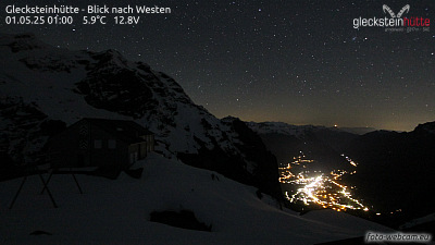
Montañas de Suiza
First
2184 m7165 ft
Montaña · Bernese Prealps · Suiza
First is a mountain location and minor summit on the slopes of the Schwarzhorn in the Bernese Oberland. It is mostly known as a cable car station above Grindelwald (Firstbahn) and as a popular hiking area with the Bachalpsee in proximity. It is also the destination of the classic hike: Schynige Platte-Faulhorn-First.
De Wikipedia, CC BY-SA · Leer el artículo
En la cumbre · pronóstico para las 1:00
6 °CMayormente despejado · viento de 3 km/h del S
 Verla en 3D
Clima en la cumbre de First, 2184 m
- 1:006 °CS 3 km/h–
- 4:004 °CS 4 km/h–
- 7:004 °CS 4 km/h–
- 10:0010 °CNO 3 km/h–
- 13:0012 °CNO 5 km/h–
- 16:0011 °CO 4 km/h–
- 19:006 °CS 2 km/h–
- 22:002 °CS 4 km/h–
| Día | Cielo | Máx. / mín. | Lluvia | Viento hasta |
|---|---|---|---|---|
| Hoy | Despejado | 12 °C / 1 °C | – | 6 km/h |
| mié, 28 oct | Lluvia débil | 4 °C / -0 °C | 1,6 mm | 8 km/h |
| jue, 29 oct | Mayormente despejado | 7 °C / -0 °C | – | 6 km/h |
| vie, 30 oct | Despejado | 8 °C / 1 °C | – | 2 km/h |
| sáb, 31 oct | Mayormente despejado | 8 °C / 1 °C | – | 1 km/h |
| dom, 1 nov | Despejado | 7 °C / 1 °C | – | 3 km/h |
| lun, 2 nov | Despejado | 5 °C / -2 °C | – | 3 km/h |
Pronóstico de MET Norway (CC BY 4.0), actualizado a las 20:16 CET. Horas locales.
Ficha técnica
- Tipo
- Montaña
- Altitud sobre el nivel del mar
- 2184 m (7165 ft)
- Cordillera
- Bernese Prealps
- País
- Suiza
- Coordenadas
- 46.660°N 8.053°E
- Fuente
- Wikidata, CC0
Picos cerca de First
- Faulhorn2681 m · a 4,4 kmEn el mapa
- Wetterhorn3690 m · a 5,3 kmEn el mapa
- Schreckhorn4078 m · a 9,3 kmEn el mapa
- Eiger3967 m · a 9,9 kmEn el mapa
- Männlichen2343 m · a 10 kmEn el mapa
- Lauteraarhorn4042 m · a 10 kmEn el mapa
- Lauberhorn2472 m · a 11 kmEn el mapa
- Klein Fiescherhorn3895 m · a 12 kmEn el mapa
- Mönch4110 m · a 12 kmEn el mapa
- Fiescherhorn4049 m · a 12 kmEn el mapa
Los más altos de Bernese Prealps
- Schilthorn2970 mEn el mapa
- Schwarzhorn2928 mEn el mapa
- Drättehorn2794 mEn el mapa
- Reeti2757 mEn el mapa
- Ärmighorn2742 mEn el mapa
- Giferspitz2542 mEn el mapa
- Tschuggen2521 mEn el mapa
- Schwalmerngrat2521 mEn el mapa
- First2184 mEn el mapa
Montañas más altas de Suiza
- Pico Dufour4634 mEn el mapa
- Dom4546 mEn el mapa
- Liskamm4532 mEn el mapa
- Weisshorn4505 mEn el mapa
- Cervino4478 mEn el mapa
- Dent Blanche4357 mEn el mapa
- Grand Combin4309 mEn el mapa
- Finsteraarhorn4274 mEn el mapa
- Zinalrothorn4221 mEn el mapa
- Alphubel4206 mEn el mapa