Gjaidstein
2794 m9167 ft
Montaña · Dachstein · Austria
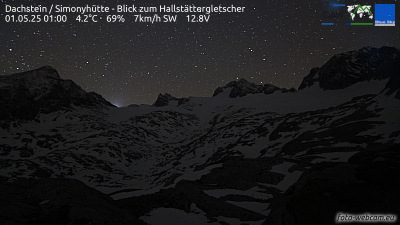
The Hoher Gjaidstein is a 2,794 metres (9,167 ft) high mountain peak in the Dachstein Mountains in Upper Austria east and above the Hallstätter Glacier. It may be reached from the summit station of the Dachstein South Face Cable Car or from the Simony Hut each of which is an easy grade I climb.
De Wikipedia, CC BY-SA · Leer el artículo
En la cumbre · pronóstico para las 4:00
-3 °CParcialmente nublado · viento de 4 km/h del SO
 Verla en 3D
Clima en la cumbre de Gjaidstein, 2794 m
- 4:00-3 °CSO 4 km/h–
- 7:00-4 °CO 4 km/h–
- 10:000 °CO 7 km/h0,2 mm
- 13:001 °CNO 10 km/h1,5 mm
- 16:00-2 °CNO 6 km/h6 mm
- 19:00-3 °CNO 7 km/h6,3 mm
- 22:00-4 °CNO 8 km/h2,8 mm
- 1:00-4 °CNO 6 km/h1,1 mm
| Día | Cielo | Máx. / mín. | Lluvia | Viento hasta |
|---|---|---|---|---|
| Hoy | Nieve | 2 °C / -4 °C | 16 mm | 11 km/h |
| jue, 29 oct | Nublado | -3 °C / -7 °C | 2,1 mm | 6 km/h |
| vie, 30 oct | Mayormente despejado | -3 °C / -10 °C | – | 8 km/h |
| sáb, 31 oct | Despejado | -1 °C / -11 °C | – | 4 km/h |
| dom, 1 nov | Nublado | -6 °C / -8 °C | – | 7 km/h |
| lun, 2 nov | Nieve | -7 °C / -10 °C | 5,8 mm | 10 km/h |
| mar, 3 nov | Nieve fuerte | -9 °C / -10 °C | 20,6 mm | 10 km/h |
Pronóstico de MET Norway (CC BY 4.0), actualizado a las 20:17 CET. Horas locales.
Ficha técnica
- Tipo
- Montaña
- Altitud sobre el nivel del mar
- 2794 m (9167 ft)
- Prominencia
- 167 m (548 ft)
- Aislamiento
- a 1,4 km de un terreno más alto
- Cordillera
- Dachstein
- País
- Austria
- Coordenadas
- 47.482°N 13.632°E
- Fuente
- Wikidata, CC0
Gjaidstein
The Hoher Gjaidstein is a 2,794 metres (9,167 ft) high mountain peak in the Dachstein Mountains in Upper Austria east and above the Hallstätter Glacier. It may be reached from the summit station of the Dachstein South Face Cable Car or from the Simony Hut each of which is an easy grade I climb. As well as the Hoher Gjaidstein there is also the Niederen Gjaidstein and the Kleinen Gjaidstein.
De Wikipedia, CC BY-SA · Leer el artículo
Picos cerca de Gjaidstein
- Hoher Dachstein2995 m · a 2,1 kmEn el mapa
- Bischofsmütze2458 m · a 9,2 kmEn el mapa
- Planai1906 m · a 11 kmEn el mapa
- Hauser Kaibling2015 m · a 16 kmEn el mapa
- Gamsfeld2027 m · a 19 kmEn el mapa
- Hochwildstelle2747 m · a 22 kmEn el mapa
- Loser1837 m · a 22 kmEn el mapa
- Hochgolling2862 m · a 26 kmEn el mapa
- Grimming2351 m · a 29 kmEn el mapa
- Werfener Hochthron2363 m · a 29 kmEn el mapa
Los más altos de Dachstein
- Torstein2948 mEn el mapa
- Gjaidstein2794 mEn el mapa
- Sinabell2349 mEn el mapa
- Plassen1953 mEn el mapa
Montañas más altas de Austria
- Grossglockner3798 mEn el mapa
- Wildspitze3768 mEn el mapa
- Weißkugel3738 mEn el mapa
- Großvenediger3657 mEn el mapa
- Hintere Schwärze3624 mEn el mapa
- Großes Wiesbachhorn3564 mEn el mapa
- Ramolkogel3549 mEn el mapa
- Schalfkogel3537 mEn el mapa
- Watzespitze3532 mEn el mapa
- Fineilspitze3514 mEn el mapa
Cámaras web cerca de Gjaidstein



Historia alrededor de Gjaidstein
Ciudades cerca de Gjaidstein
- Salzburga 56 km
- Saalfelden am Steinernen Meera 59 km
- Bad Reichenhalla 63 km
- Freilassinga 63 km