Gjaidstein
2,794 m9,167 ft
Mountain · Dachstein · Austria
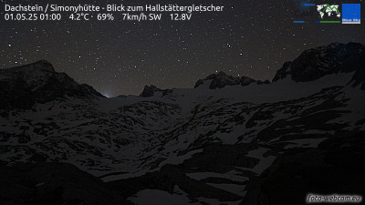
The Hoher Gjaidstein is a 2,794 metres (9,167 ft) high mountain peak in the Dachstein Mountains in Upper Austria east and above the Hallstätter Glacier. It may be reached from the summit station of the Dachstein South Face Cable Car or from the Simony Hut each of which is an easy grade I climb.
From Wikipedia, CC BY-SA · Read the article
At the summit · forecast for 1:00 AM
-9 °CClear · wind 5 km/h from the S
 See it in 3D
Weather at the summit of Gjaidstein, 2,794 m
- 1:00 AM-9 °CS 5 km/h–
- 4:00 AM-7 °CS 5 km/h–
- 7:00 AM-5 °CS 5 km/h–
- 10:00 AM-3 °CSW 5 km/h–
- 1:00 PM2 °CW 4 km/h–
- 4:00 PM1 °CW 1 km/h–
- 7:00 PM-4 °CS 4 km/h–
- 10:00 PM-4 °CS 5 km/h–
| Day | Sky | High / low | Rain | Wind up to |
|---|---|---|---|---|
| Today | Clear | 3 °C / -9 °C | – | 5 km/h |
| Wed, Oct 28 | Light snow | 1 °C / -5 °C | 6.8 mm | 10 km/h |
| Thu, Oct 29 | Cloudy | -4 °C / -7 °C | – | 6 km/h |
| Fri, Oct 30 | Clear | -1 °C / -10 °C | – | 5 km/h |
| Sat, Oct 31 | Clear | 2 °C / -11 °C | – | 5 km/h |
| Sun, Nov 1 | Clear | 2 °C / -8 °C | – | 4 km/h |
| Mon, Nov 2 | Mostly clear | -4 °C / -10 °C | – | 7 km/h |
Forecast by MET Norway (CC BY 4.0), updated 12:20 AM GMT+1. Times are local.
Facts
- What it is
- Mountain
- Height above sea level
- 2,794 m (9,167 ft)
- Prominence
- 167 m (548 ft)
- Isolation
- 1.4 km to higher ground
- Range
- Dachstein
- Country
- Austria
- Coordinates
- 47.482°N 13.632°E
- Source
- Wikidata, CC0
Gjaidstein
The Hoher Gjaidstein is a 2,794 metres (9,167 ft) high mountain peak in the Dachstein Mountains in Upper Austria east and above the Hallstätter Glacier. It may be reached from the summit station of the Dachstein South Face Cable Car or from the Simony Hut each of which is an easy grade I climb. As well as the Hoher Gjaidstein there is also the Niederen Gjaidstein and the Kleinen Gjaidstein.
From Wikipedia, CC BY-SA · Read the article
Peaks near Gjaidstein
- Hoher Dachstein2,995 m · 2.1 km awayOn the map
- Bischofsmütze2,458 m · 9.2 km awayOn the map
- Planai1,906 m · 11 km awayOn the map
- Hauser Kaibling2,015 m · 16 km awayOn the map
- Gamsfeld2,027 m · 19 km awayOn the map
- Hochwildstelle2,747 m · 22 km awayOn the map
- Loser1,837 m · 22 km awayOn the map
- Hochgolling2,862 m · 26 km awayOn the map
- Grimming2,351 m · 29 km awayOn the map
- Werfener Hochthron2,363 m · 29 km awayOn the map
Highest in the Dachstein
- Torstein2,948 mOn the map
- Gjaidstein2,794 mOn the map
- Sinabell2,349 mOn the map
- Plassen1,953 mOn the map
Highest mountains in Austria
- Grossglockner3,798 mOn the map
- Wildspitze3,768 mOn the map
- Weißkugel3,738 mOn the map
- Großvenediger3,657 mOn the map
- Hintere Schwärze3,624 mOn the map
- Großes Wiesbachhorn3,564 mOn the map
- Ramolkogel3,549 mOn the map
- Schalfkogel3,537 mOn the map
- Watzespitze3,532 mOn the map
- Fineilspitze3,514 mOn the map
Webcams near Gjaidstein



History around Gjaidstein
Towns near Gjaidstein
- Salzburg56 km away
- Saalfelden am Steinernen Meer59 km away
- Bad Reichenhall63 km away
- Freilassing63 km away