Hoher Kasten
1794 m5886 ft
Montaña · Prealpes appenzelleses · Suiza
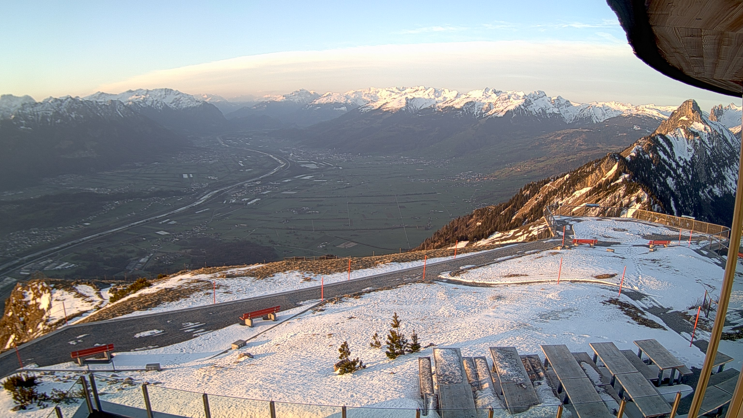
The Hoher Kasten is a mountain in the Appenzell Alps in Eastern Switzerland, overlooking the Alpine Rhine Valley, which forms the Austria–Switzerland and Liechtenstein–Switzerland borders. It is located on the border between the cantons of Appenzell Innerrhoden and St. Gallen.
De Wikipedia, CC BY-SA · Leer el artículo
En la cumbre · pronóstico para las 21:00
3 °CMayormente despejado · viento de 5 km/h del SO
 Verla en 3D
Clima en la cumbre de Hoher Kasten, 1794 m
- 21:003 °CSO 5 km/h–
- 0:001 °CSO 7 km/h–
- 3:000 °CSO 11 km/h–
- 6:002 °CSO 9 km/h0,1 mm
- 9:005 °CNO 10 km/h1,4 mm
- 12:004 °CN 9 km/h1,2 mm
- 15:003 °CN 5 km/h1,2 mm
- 18:002 °CN 3 km/h1 mm
| Día | Cielo | Máx. / mín. | Lluvia | Viento hasta |
|---|---|---|---|---|
| mié, 28 oct | Lluvia | 5 °C / 0 °C | 5 mm | 12 km/h |
| jue, 29 oct | Mayormente despejado | 4 °C / -4 °C | – | 9 km/h |
| vie, 30 oct | Parcialmente nublado | 3 °C / -4 °C | – | 7 km/h |
| sáb, 31 oct | Parcialmente nublado | 2 °C / -6 °C | – | 6 km/h |
| dom, 1 nov | Parcialmente nublado | 2 °C / -6 °C | – | 6 km/h |
| lun, 2 nov | Mayormente despejado | 0 °C / -4 °C | – | 6 km/h |
| mar, 3 nov | Nublado | 1 °C / -8 °C | 0,1 mm | 6 km/h |
Pronóstico de MET Norway (CC BY 4.0), actualizado a las 20:17 CET. Horas locales.
Ficha técnica
- Tipo
- Montaña
- Altitud sobre el nivel del mar
- 1794 m (5886 ft)
- Prominencia
- 204 m (669 ft)
- Aislamiento
- a 3,5 km de un terreno más alto
- Cordillera
- Prealpes appenzelleses
- Pico padre
- Säntis
- País
- Suiza
- Coordenadas
- 47.284°N 9.485°E
- Fuente
- Wikidata, CC0
Hoher Kasten
Mountain in Switzerland
The Hoher Kasten is a mountain in the Appenzell Alps in Eastern Switzerland, overlooking the Alpine Rhine Valley, which forms the Austria–Switzerland and Liechtenstein–Switzerland borders. It is located on the border between the cantons of Appenzell Innerrhoden and St. Gallen. A revolving restaurant, offering panoramic views, has been built on the top.
De Wikipedia, CC BY-SA · Leer el artículo
Picos cerca de Hoher Kasten
- Altmann2435 m · a 9,9 kmEn el mapa
- Säntis2501 m · a 11 kmEn el mapa
- Drei Schwestern2053 m · a 14 kmEn el mapa
- Galinakopf2198 m · a 18 kmEn el mapa
- Hoher Freschen2004 m · a 22 kmEn el mapa
- Naafkopf2571 m · a 26 kmEn el mapa
- Falknis2562 m · a 27 kmEn el mapa
- Grauspitz2599 m · a 27 kmEn el mapa
- Glatthorn2133 m · a 30 kmEn el mapa
- Damülser Mittagsspitze2095 m · a 30 kmEn el mapa
Pico padre
El pico más alto más cercano respecto al que se mide su prominencia.
- Säntis2501 mEn el mapa
Picos por debajo de Hoher Kasten
- Kamor1751 mEn el mapa
Los más altos de Prealpes appenzelleses
- Säntis2501 mEn el mapa
- Gamsberg2385 mEn el mapa
- Furgglenfirst1951 mEn el mapa
- Speer1951 mEn el mapa
- Mattstock1937 mEn el mapa
- Hoher Kasten1794 mEn el mapa
- Stockberg1782 mEn el mapa
- Kronberg1663 mEn el mapa
- Tweralpspitz1331 mEn el mapa
Montañas más altas de Suiza
- Pico Dufour4634 mEn el mapa
- Dom4546 mEn el mapa
- Liskamm4532 mEn el mapa
- Weisshorn4505 mEn el mapa
- Cervino4478 mEn el mapa
- Dent Blanche4357 mEn el mapa
- Grand Combin4309 mEn el mapa
- Finsteraarhorn4274 mEn el mapa
- Zinalrothorn4221 mEn el mapa
- Alphubel4206 mEn el mapa