Hoher Kasten
1.794 m5.886 pés
Montanha · Pré-Alpes de Appenzell e de São Galo · Suíça
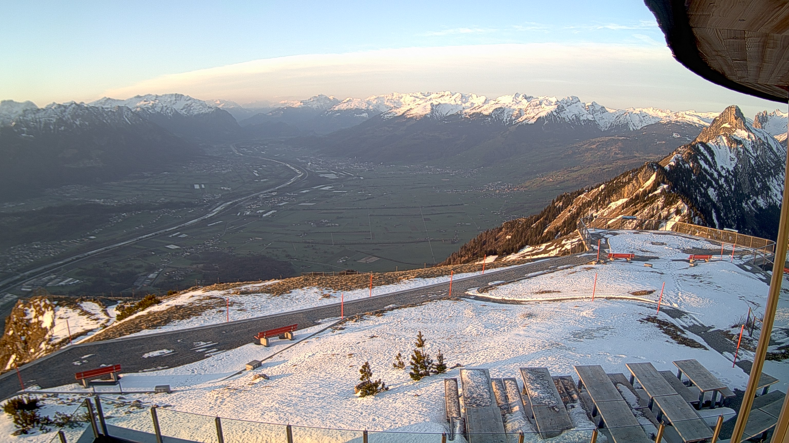
The Hoher Kasten is a mountain in the Appenzell Alps in Eastern Switzerland, overlooking the Alpine Rhine Valley, which forms the Austria–Switzerland and Liechtenstein–Switzerland borders. It is located on the border between the cantons of Appenzell Innerrhoden and St. Gallen.
Da Wikipedia, CC BY-SA · Ler o artigo
No cume · previsão para 21:00
2 °CPoucas nuvens · vento de 7 km/h de SO
 Ver em 3D
Clima no cume de Hoher Kasten, 1.794 m
- 21:002 °CSO 7 km/h–
- 0:001 °CSO 6 km/h–
- 3:000 °CSO 9 km/h–
- 6:002 °CSO 7 km/h–
- 9:003 °CN 10 km/h2,3 mm
- 12:003 °CN 6 km/h1,3 mm
- 15:003 °CN 4 km/h0,7 mm
- 18:002 °CN 3 km/h0,6 mm
| Dia | Céu | Máx. / mín. | Chuva | Vento até |
|---|---|---|---|---|
| qua., 28 de out. | Chuva | 3 °C / 0 °C | 4,9 mm | 11 km/h |
| qui., 29 de out. | Poucas nuvens | 4 °C / -3 °C | – | 7 km/h |
| sex., 30 de out. | Parcialmente nublado | 2 °C / -4 °C | – | 6 km/h |
| sáb., 31 de out. | Parcialmente nublado | 2 °C / -6 °C | – | 6 km/h |
| dom., 1 de nov. | Parcialmente nublado | 2 °C / -6 °C | – | 6 km/h |
| seg., 2 de nov. | Poucas nuvens | 0 °C / -4 °C | – | 6 km/h |
| ter., 3 de nov. | Nublado | 1 °C / -8 °C | 0,1 mm | 6 km/h |
Previsão: MET Norway (CC BY 4.0), atualizada às 18:17 GMT+1. Horários locais.
Ficha técnica
- Tipo
- Montanha
- Altitude acima do nível do mar
- 1.794 m (5.886 pés)
- Proeminência
- 204 m (669 pés)
- Isolamento
- a 3,5 km de um terreno mais alto
- Cordilheira
- Pré-Alpes de Appenzell e de São Galo
- Pico pai
- Säntis
- País
- Suíça
- Coordenadas
- 47.284°N 9.485°E
- Fonte
- Wikidata, CC0
Hoher Kasten
Mountain in Switzerland
The Hoher Kasten is a mountain in the Appenzell Alps in Eastern Switzerland, overlooking the Alpine Rhine Valley, which forms the Austria–Switzerland and Liechtenstein–Switzerland borders. It is located on the border between the cantons of Appenzell Innerrhoden and St. Gallen. A revolving restaurant, offering panoramic views, has been built on the top.
Da Wikipedia, CC BY-SA · Ler o artigo
Picos perto de Hoher Kasten
- Altmann2.435 m · a 9,9 kmNo mapa
- Säntis2.501 m · a 11 kmNo mapa
- Drei Schwestern2.053 m · a 14 kmNo mapa
- Galinakopf2.198 m · a 18 kmNo mapa
- Hoher Freschen2.004 m · a 22 kmNo mapa
- Naafkopf2.571 m · a 26 kmNo mapa
- Falknis2.562 m · a 27 kmNo mapa
- Grauspitz2.599 m · a 27 kmNo mapa
- Glatthorn2.133 m · a 30 kmNo mapa
- Damülser Mittagsspitze2.095 m · a 30 kmNo mapa
Pico pai
Picos abaixo de Hoher Kasten
Os mais altos de Pré-Alpes de Appenzell e de São Galo
Montanhas mais altas de Suíça
- Pico Dufour4.634 mNo mapa
- Dom de Mischabel4.546 mNo mapa
- Liskamm4.532 mNo mapa
- Weisshorn4.505 mNo mapa
- Matterhorn4.478 mNo mapa
- Dente Branco4.357 mNo mapa
- Grand Combin4.309 mNo mapa
- Finsteraarhorn4.274 mNo mapa
- Zinalrothorn4.221 mNo mapa
- Alphubel4.206 mNo mapa