Pine Mountain
Montaña · Estados Unidos
Pine Mountain is a rhyolitic mountain east of Bend and south of U.S. Route 20 (US 20) in eastern Deschutes County, Oregon, United States. It is the site of an astronomical observatory called the Pine Mountain Observatory.
De Wikipedia, CC BY-SA · Leer el artículo
En la cumbre · pronóstico para las 4:00
25 °FMayormente despejado · viento de 7 mph del S
Pronóstico del tiempo en Pine Mountain
- 4:0025 °FS 7 mph–
- 7:0026 °FS 10 mph–
- 10:0034 °FS 11 mph–
- 13:0039 °FSO 12 mph–
- 16:0040 °FSO 10 mph–
- 19:0035 °FS 4 mph–
- 22:0031 °FSO 3 mph–
- 1:0027 °FS 4 mph–
| Día | Cielo | Máx. / mín. | Lluvia | Viento hasta |
|---|---|---|---|---|
| Hoy | Nublado | 40 °F / 25 °F | – | 12 mph |
| jue, 29 oct | Parcialmente nublado | 46 °F / 26 °F | – | 10 mph |
| vie, 30 oct | Despejado | 43 °F / 30 °F | – | 6 mph |
| sáb, 31 oct | Nublado | 39 °F / 29 °F | 0,07 pulg. | 4 mph |
| dom, 1 nov | Despejado | 38 °F / 26 °F | – | 4 mph |
| lun, 2 nov | Mayormente despejado | 44 °F / 27 °F | – | 11 mph |
| mar, 3 nov | Nublado | 49 °F / 33 °F | – | 8 mph |
Pronóstico de MET Norway (CC BY 4.0), actualizado a las 12:17 GMT-7. Horas locales.
Ficha técnica
- Tipo
- Montaña
- País
- Estados Unidos
- Coordenadas
- 43.803°N 120.914°W
- Fuente
- Wikidata, CC0
Pine Mountain (Oregon)
Mountain in Oregon
Pine Mountain is a rhyolitic mountain east of Bend and south of U.S. Route 20 (US 20) in eastern Deschutes County, Oregon, United States. It is the site of an astronomical observatory called the Pine Mountain Observatory. The mountain is a part of the Deschutes Formation and is the southeasternmost exposure of the formation and is of similar age to Cline Buttes.
De Wikipedia, CC BY-SA · Leer el artículo
Picos cerca de Pine Mountain
- Newberry Volcano7986 ft · a 30 kmEn el mapa
- Lava Butte5023 ft · a 38 kmEn el mapa
- East Lava Field5614 ft · a 39 kmEn el mapa
- Pilot Butte4142 ft · a 41 kmEn el mapa
- Powell Buttes5216 ft · a 42 kmEn el mapa
- Fort Rock4699 ft · a 50 kmEn el mapa
- Four Craters Lava Field4924 ft · a 53 kmEn el mapa
- China HatVolcán · a 17 kmEn el mapa
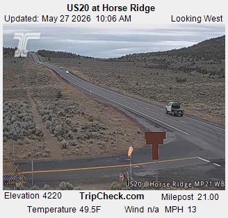
- Horse RidgeMontaña · a 17 kmEn el mapa
- Paulina PeakMontaña · a 30 kmEn el mapa
Montañas más altas de Estados Unidos
- Denali20.308 ftEn el mapa
- Monte San Elías18.009 ftEn el mapa
- Monte Foraker17.402 ftEn el mapa
- Monte Bona16.535 ftEn el mapa
- Monte Blackburn16.390 ftEn el mapa
- Monte Sanford16.237 ftEn el mapa
- Monte Vancouver15.787 ftEn el mapa
- Monte Churchill15.636 ftEn el mapa
- Monte Fairweather15.325 ftEn el mapa
- Mount Hubbard14.951 ftEn el mapa