Pine Mountain
Mountain · United States
Pine Mountain is a rhyolitic mountain east of Bend and south of U.S. Route 20 (US 20) in eastern Deschutes County, Oregon, United States. It is the site of an astronomical observatory called the Pine Mountain Observatory.
From Wikipedia, CC BY-SA · Read the article
At the summit · forecast for 6:00 PM
39 °FMostly clear · wind 7 mph from the SW
Pine Mountain weather forecast
- 6:00 PM39 °FSW 7 mph–
- 9:00 PM34 °FS 9 mph–
- 12:00 AM36 °FS 9 mph–
- 3:00 AM36 °FSW 10 mph–
- 6:00 AM35 °FSW 10 mph0.04 in
- 9:00 AM34 °FS 8 mph0.02 in
- 12:00 PM39 °FW 9 mph0.01 in
- 3:00 PM42 °FNW 11 mph–
| Day | Sky | High / low | Rain | Wind up to |
|---|---|---|---|---|
| Tue, Oct 27 | Partly cloudy | 42 °F / 29 °F | 0.06 in | 13 mph |
| Wed, Oct 28 | Cloudy | 40 °F / 25 °F | – | 13 mph |
| Thu, Oct 29 | Partly cloudy | 41 °F / 26 °F | 0 in | 5 mph |
| Fri, Oct 30 | Clear | 40 °F / 23 °F | – | 5 mph |
| Sat, Oct 31 | Light rain | 38 °F / 26 °F | 0.02 in | 8 mph |
| Sun, Nov 1 | Clear | 38 °F / 23 °F | – | 7 mph |
| Mon, Nov 2 | Cloudy | 44 °F / 28 °F | – | 9 mph |
Forecast by MET Norway (CC BY 4.0), updated 04:20 PM PDT. Times are local.
Facts
- What it is
- Mountain
- Country
- United States
- Coordinates
- 43.803°N 120.914°W
- Source
- Wikidata, CC0
Pine Mountain (Oregon)
Mountain in Oregon
Pine Mountain is a rhyolitic mountain east of Bend and south of U.S. Route 20 (US 20) in eastern Deschutes County, Oregon, United States. It is the site of an astronomical observatory called the Pine Mountain Observatory. The mountain is a part of the Deschutes Formation and is the southeasternmost exposure of the formation and is of similar age to Cline Buttes.
From Wikipedia, CC BY-SA · Read the article
Peaks near Pine Mountain
- Newberry Volcano7,986 ft · 30 km awayOn the map
- Lava Butte5,023 ft · 38 km awayOn the map
- East Lava Field5,614 ft · 39 km awayOn the map
- Pilot Butte4,142 ft · 41 km awayOn the map
- Powell Buttes5,216 ft · 42 km awayOn the map
- Fort Rock4,699 ft · 50 km awayOn the map
- Four Craters Lava Field4,924 ft · 53 km awayOn the map
- China HatVolcano · 17 km awayOn the map
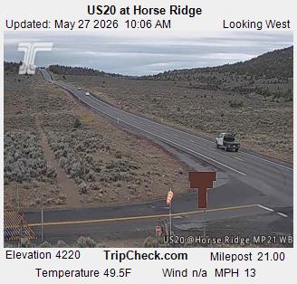
- Horse RidgeMountain · 17 km awayOn the map
- Paulina PeakMountain · 30 km awayOn the map
Highest mountains in United States
- Denali20,308 ftOn the map
- Mount Saint Elias18,009 ftOn the map
- Mount Foraker17,402 ftOn the map
- Mount Bona16,535 ftOn the map
- Mount Blackburn16,390 ftOn the map
- Mount Sanford16,237 ftOn the map
- Mount Vancouver15,787 ftOn the map
- Mount Churchill15,636 ftOn the map
- Mount Fairweather15,325 ftOn the map
- Mount Hubbard14,951 ftOn the map