Mountains in United States
See it in 3DChina Hat
Volcano · Cascade Range · United States
China Hat is a volcanic butte on the southeastern flank of Newberry Volcano in Deschutes County, Oregon, United States. It is a rhyolitic dome dating from the age of the Middle Pleistocene. Both China Hat and nearby East Butte are covered by Mazama Ash and Newberry Ash.
From Wikipedia, CC BY-SA · Read the article
Facts
- What it is
- Volcano
- Range
- Cascade Range
- Country
- United States
- Coordinates
- 43.681°N 121.034°W
- Source
- Wikidata, CC0
Peaks near China Hat
- Newberry Volcano7,986 ft · 18 km awayOn the map
- East Lava Field5,614 ft · 32 km awayOn the map
- Fort Rock4,699 ft · 34 km awayOn the map
- Lava Butte5,023 ft · 37 km awayOn the map
- Four Craters Lava Field4,924 ft · 46 km awayOn the map
- Pilot Butte4,142 ft · 47 km awayOn the map
- Powell Buttes5,216 ft · 56 km awayOn the map
- Pine MountainMountain · 17 km awayOn the map
- Paulina PeakMountain · 18 km awayOn the map
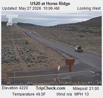
- Horse RidgeMountain · 26 km awayOn the map
Highest in the Cascade Range
- Mount Rainier14,400 ftOn the map
- Mount Adams12,280 ftOn the map
- Mount McLoughlin9,495 ftOn the map
- Mount Thielsen9,183 ftOn the map
- Broken Top9,177 ftOn the map
- Black Peak8,976 ftOn the map
- Dome Peak8,921 ftOn the map
- Silver Star Mountain8,875 ftOn the map
Highest mountains in United States
- Denali20,308 ftOn the map
- Mount Saint Elias18,009 ftOn the map
- Mount Foraker17,402 ftOn the map
- Mount Bona16,535 ftOn the map
- Mount Blackburn16,390 ftOn the map
- Mount Sanford16,237 ftOn the map
- Mount Vancouver15,787 ftOn the map
- Mount Churchill15,636 ftOn the map
- Mount Fairweather15,325 ftOn the map
- Mount Hubbard14,951 ftOn the map