Ping Shan
189 m620 ft
Colina · China
Ping Shan is a hill in Kwun Tong District, eastern Kowloon that lies between the communities of Ngau Chi Wan, Kowloon Bay and Jordan Valley, Hong Kong. Most of it was the Ping Shan Stone Quarry before redevelopedment into a new neighbourhood with numerous public housing estates and schools.
De Wikipedia, CC BY-SA · Leer el artículo
En la cumbre · pronóstico para las 9:00
26 °CMayormente despejado · viento de 26 km/h del NE
 Verla en 3D
Clima en la cumbre de Ping Shan, 189 m
- 9:0026 °CNE 26 km/h–
- 12:0028 °CE 26 km/h0,2 mm
- 15:0027 °CE 23 km/h0,1 mm
- 18:0025 °CE 24 km/h–
- 21:0025 °CE 26 km/h0,1 mm
- 0:0024 °CE 33 km/h0,9 mm
- 3:0023 °CE 40 km/h–
- 6:0023 °CNE 41 km/h–
| Día | Cielo | Máx. / mín. | Lluvia | Viento hasta |
|---|---|---|---|---|
| Hoy | Parcialmente nublado | 28 °C / 24 °C | 0,4 mm | 28 km/h |
| mié, 28 oct | Despejado | 27 °C / 23 °C | 0,9 mm | 42 km/h |
| jue, 29 oct | Despejado | 27 °C / 22 °C | – | 37 km/h |
| vie, 30 oct | Despejado | 27 °C / 24 °C | – | 15 km/h |
| sáb, 31 oct | Mayormente despejado | 27 °C / 24 °C | 0,1 mm | 18 km/h |
| dom, 1 nov | Despejado | 27 °C / 24 °C | 1,5 mm | 16 km/h |
| lun, 2 nov | Despejado | 30 °C / 24 °C | 0,3 mm | 12 km/h |
Pronóstico de MET Norway (CC BY 4.0), actualizado a las 07:20 GMT+8. Horas locales.
Ficha técnica
- Tipo
- Colina
- Altitud sobre el nivel del mar
- 189 m (620 ft)
- País
- China
- Coordenadas
- 22.331°N 114.219°E
- Fuente
- Wikidata, CC0
Ping Shan, Kowloon
Hill in Hong Kong
Ping Shan is a hill in Kwun Tong District, eastern Kowloon that lies between the communities of Ngau Chi Wan, Kowloon Bay and Jordan Valley, Hong Kong. Most of it was the Ping Shan Stone Quarry before redevelopedment into a new neighbourhood with numerous public housing estates and schools. Being unlabelled in most maps, it was often mistaken as part of the forementioned neighbourhoods and Ngau Tau Kok.
De Wikipedia, CC BY-SA · Leer el artículo
Picos cerca de Ping Shan
- Kowloon Peak602 m · a 1,3 kmEn el mapa
- Cheung Shan585 m · a 1,8 kmEn el mapa
- Hammer Hill140 m · a 2 kmEn el mapa
- Tai Sheung Tok399 m · a 2,1 kmEn el mapa
- Tung Shan544 m · a 2,5 kmEn el mapa
- Tate's Cairn577 m · a 3 kmEn el mapa
- Temple Hill488 m · a 3,1 kmEn el mapa
- Pak Hok Shan77 m · a 3,1 kmEn el mapa
- Black Hill304 m · a 3,5 kmEn el mapa
- Checkerboard Hill98 m · a 3,6 kmEn el mapa
Montañas más altas de China
- Everest8849 mEn el mapa
- Lhotse8516 mEn el mapa
- Makalu8485 mEn el mapa
- Cho Oyu8188 mEn el mapa
- Gasherbrum I8080 mEn el mapa
- Broad Peak8051 mEn el mapa
- Gasherbrum II8034 mEn el mapa
- Shisha Pangma8027 mEn el mapa
- Gyachung Kang7952 mEn el mapa
- Gasherbrum III7946 mEn el mapa
Cámaras web cerca de Ping Shan
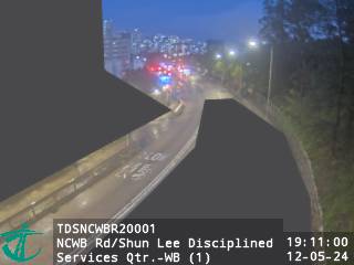 New Clear Water Bay Road near Shun Lee Disciplined Services Quarters - Westbound (1)a 0,2 km de la cumbre
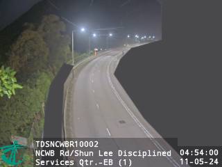 New Clear Water Bay Road near Shun Lee Disciplined Services Quarters - Eastbound (1)a 0,2 km de la cumbre
- New Clear Water Bay Road near Shun Lee Disciplined Services Quarters - Eastbound (1) [TDSNCWBR10002]a 0,2 km de la cumbre
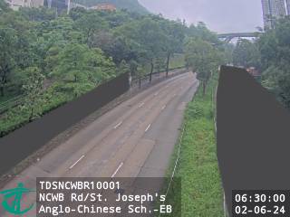 New Clear Water Bay Road near St. Joseph's Anglo-Chinese School - Eastbounda 0,3 km de la cumbre
Historia alrededor de Ping Shan
Ciudades cerca de Ping Shan
- Choi Wana 0,6 km
- Choi Wan Estate (I & II)a 0,6 km
- Choi Hung Estatea 1,5 km
- Tak Long Estatea 1,6 km
- Sau Mau Pinga 2 km
- Kwun Tonga 2,1 km