Temple Hill
488 m1601 ft
Montaña · China
Temple Hill, also known as Tsz Wan Shan, is a hill between New Kowloon and the New Territories, Hong Kong. It peaks at 488 m. Beneath its south side is the residential area of Tsz Wan Shan and Buddhist temples. Sha Tin Pass runs between the hill and Unicorn Ridge.
De Wikipedia, CC BY-SA · Leer el artículo
En la cumbre · pronóstico para las 19:00
22 °CDespejado · viento de 17 km/h del E
 Verla en 3D
Clima en la cumbre de Temple Hill, 488 m
- 19:0022 °CE 17 km/h–
- 22:0021 °CE 20 km/h0,2 mm
- 1:0020 °CE 25 km/h0,2 mm
- 4:0020 °CE 29 km/h–
- 7:0020 °CE 30 km/h–
- 10:0023 °CE 30 km/h–
- 13:0025 °CE 28 km/h–
- 16:0024 °CE 27 km/h–
| Día | Cielo | Máx. / mín. | Lluvia | Viento hasta |
|---|---|---|---|---|
| mié, 28 oct | Despejado | 25 °C / 20 °C | 0,3 mm | 31 km/h |
| jue, 29 oct | Mayormente despejado | 25 °C / 19 °C | – | 28 km/h |
| vie, 30 oct | Despejado | 27 °C / 19 °C | – | 12 km/h |
| sáb, 31 oct | Parcialmente nublado | 25 °C / 20 °C | – | 14 km/h |
| dom, 1 nov | Mayormente despejado | 27 °C / 21 °C | 1,4 mm | 11 km/h |
| lun, 2 nov | Mayormente despejado | 29 °C / 21 °C | 0,7 mm | 9 km/h |
| mar, 3 nov | Mayormente despejado | 26 °C / 21 °C | 1,6 mm | 14 km/h |
Pronóstico de MET Norway (CC BY 4.0), actualizado a las 09:17 GMT+8. Horas locales.
Ficha técnica
- Tipo
- Montaña
- Altitud sobre el nivel del mar
- 488 m (1601 ft)
- País
- China
- Coordenadas
- 22.356°N 114.207°E
- Fuente
- Wikidata, CC0
Temple Hill (Hong Kong)
Hill between New Kowloon and the New Territories, Hong Kong
Temple Hill, also known as Tsz Wan Shan, is a hill between New Kowloon and the New Territories, Hong Kong. It peaks at 488 m. Beneath its south side is the residential area of Tsz Wan Shan and Buddhist temples. Sha Tin Pass runs between the hill and Unicorn Ridge. The summit of the hill is located within Sha Tin District.
De Wikipedia, CC BY-SA · Leer el artículo
Picos cerca de Temple Hill
- Tate's Cairn577 m · a 1,2 kmEn el mapa
- Tung Shan544 m · a 1,6 kmEn el mapa
- Cheung Shan585 m · a 1,9 kmEn el mapa
- Lion Rock495 m · a 2 kmEn el mapa
- Kowloon Peak602 m · a 2,4 kmEn el mapa
- Hammer Hill140 m · a 2,6 kmEn el mapa
- Pak Hok Shan77 m · a 3,1 kmEn el mapa
- Ping Shan189 m · a 3,1 kmEn el mapa
- West Buffalo Hill604 m · a 3,2 kmEn el mapa
- Checkerboard Hill98 m · a 3,3 kmEn el mapa
Montañas más altas de China
- Everest8849 mEn el mapa
- Lhotse8516 mEn el mapa
- Makalu8485 mEn el mapa
- Cho Oyu8188 mEn el mapa
- Gasherbrum I8080 mEn el mapa
- Broad Peak8051 mEn el mapa
- Gasherbrum II8034 mEn el mapa
- Shisha Pangma8027 mEn el mapa
- Gyachung Kang7952 mEn el mapa
- Gasherbrum III7946 mEn el mapa
Cámaras web cerca de Temple Hill
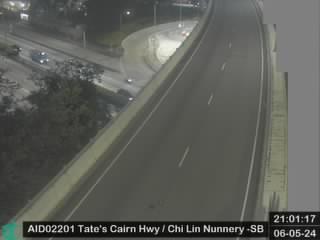 Tate's Cairn Highway near Chi Lin Nunnery - Southbounda 1,8 km de la cumbre
 Lung Cheung Road/Po Kong Village Roada 1,8 km de la cumbre
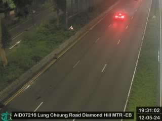 Lung Cheung Road near Lung Poon Court Commercial Centre - Eastbounda 1,8 km de la cumbre
- Lung Cheung Road near Lung Poon Court Commercial Centre - Eastbound [AID07216]a 1,8 km de la cumbre
Historia alrededor de Temple Hill
Ciudades cerca de Temple Hill
- Tsz Wan Shana 0,8 km
- Tsz Ching Estatea 0,8 km
- Chuk Yuena 1,8 km
- Chuk Yuen North Estatea 1,9 km
- Shui Chuen Oa 1,9 km
- Choi Hung Estatea 2,2 km