Sehome
Colina · Estados Unidos
Sehome is a neighborhood in Bellingham, Washington, United States. It was the first town on Bellingham Bay and was founded in May 1858 by coal mine manager Edmund C. Fitzhugh, who named the settlement for his father-in-law, S'Klallam chief Sehome.
De Wikipedia, CC BY-SA · Leer el artículo
En la cumbre · pronóstico para las 20:00
49 °FParcialmente nublado · viento de 2 mph del SE
 Verla en 3D
Pronóstico del tiempo en Sehome
- 20:0049 °FSE 2 mph–
- 23:0049 °FSE 4 mph–
- 2:0048 °FSE 6 mph–
- 5:0047 °FS 6 mph–
- 8:0047 °FS 6 mph0,02 pulg.
- 11:0047 °FS 10 mph0,08 pulg.
- 14:0049 °FS 13 mph0,17 pulg.
- 17:0049 °FSO 20 mph–
| Día | Cielo | Máx. / mín. | Lluvia | Viento hasta |
|---|---|---|---|---|
| mar, 27 oct | Lluvia fuerte | 49 °F / 46 °F | 0,57 pulg. | 24 mph |
| mié, 28 oct | Mayormente despejado | 49 °F / 43 °F | 0,48 pulg. | 17 mph |
| jue, 29 oct | Lluvia débil | 47 °F / 42 °F | 0,38 pulg. | 18 mph |
| vie, 30 oct | Lluvia | 45 °F / 43 °F | 0,15 pulg. | 7 mph |
| sáb, 31 oct | Nublado | 45 °F / 43 °F | 0,01 pulg. | 9 mph |
| dom, 1 nov | Parcialmente nublado | 49 °F / 43 °F | – | 11 mph |
| lun, 2 nov | Parcialmente nublado | 52 °F / 42 °F | – | 6 mph |
Pronóstico de MET Norway (CC BY 4.0), actualizado a las 18:17 GMT-7. Horas locales.
Ficha técnica
- Tipo
- Colina
- País
- Estados Unidos
- Coordenadas
- 48.740°N 122.476°W
- Fuente
- Wikidata, CC0
Sehome, Bellingham, Washington
Neighborhood in Whatcom, Washington, United States
Sehome is a neighborhood in Bellingham, Washington, United States. It was the first town on Bellingham Bay and was founded in May 1858 by coal mine manager Edmund C. Fitzhugh, who named the settlement for his father-in-law, S'Klallam chief Sehome. The townsite was originally owned by the Bellingham Bay and British Columbia Railroad, which operated the Bellingham Bay Coal Mine until it closed in 1878.
De Wikipedia, CC BY-SA · Leer el artículo
Picos cerca de Sehome
- Galbraith Mountain1785 ft · a 10 kmEn el mapa
- Sumas Mountain3428 ft · a 27 kmEn el mapa
- Mount Constitution2408 ft · a 27 kmEn el mapa
- Mount Erie1273 ft · a 34 kmEn el mapa
- Monte Baker10.781 ft · a 49 kmEn el mapa
- Sumas Peak2986 ft · a 49 kmEn el mapa
- Vedder Mountain3031 ft · a 50 kmEn el mapa
- Mount Warburton Pike1316 ft · a 51 kmEn el mapa
- Dewdney Peak3051 ft · a 54 kmEn el mapa
- Table Mountain5742 ft · a 57 kmEn el mapa
Montañas más altas de Estados Unidos
- Denali20.308 ftEn el mapa
- Monte San Elías18.009 ftEn el mapa
- Monte Foraker17.402 ftEn el mapa
- Monte Bona16.535 ftEn el mapa
- Monte Blackburn16.390 ftEn el mapa
- Monte Sanford16.237 ftEn el mapa
- Monte Vancouver15.787 ftEn el mapa
- Monte Churchill15.636 ftEn el mapa
- Monte Fairweather15.325 ftEn el mapa
- Mount Hubbard14.951 ftEn el mapa
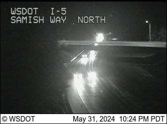
Cámaras web cerca de Sehome


Historia alrededor de Sehome
Ciudades cerca de Sehome
- Bellinghama 2,3 km
- Lyndena 23 km
- Anacortesa 27 km
- Sedro-Woolleya 31 km
- Burlingtona 32 km
- Mount Vernona 37 km