Sehome
Hill · United States
Sehome is a neighborhood in Bellingham, Washington, United States. It was the first town on Bellingham Bay and was founded in May 1858 by coal mine manager Edmund C. Fitzhugh, who named the settlement for his father-in-law, S'Klallam chief Sehome.
From Wikipedia, CC BY-SA · Read the article
At the summit · forecast for 7:00 PM
49 °FPartly cloudy · wind 3 mph from the SW
 See it in 3D
Sehome weather forecast
- 7:00 PM49 °FSW 3 mph–
- 10:00 PM49 °FSE 4 mph–
- 1:00 AM48 °FSE 5 mph–
- 4:00 AM47 °FS 6 mph–
- 7:00 AM47 °FS 6 mph0.01 in
- 10:00 AM47 °FS 8 mph0.04 in
- 1:00 PM49 °FS 11 mph0.18 in
- 4:00 PM49 °FS 19 mph0.04 in
| Day | Sky | High / low | Rain | Wind up to |
|---|---|---|---|---|
| Tue, Oct 27 | Heavy rain | 49 °F / 46 °F | 0.57 in | 24 mph |
| Wed, Oct 28 | Mostly clear | 49 °F / 43 °F | 0.48 in | 17 mph |
| Thu, Oct 29 | Light rain | 47 °F / 42 °F | 0.38 in | 18 mph |
| Fri, Oct 30 | Rain | 45 °F / 43 °F | 0.15 in | 7 mph |
| Sat, Oct 31 | Cloudy | 45 °F / 43 °F | 0.01 in | 9 mph |
| Sun, Nov 1 | Partly cloudy | 49 °F / 43 °F | – | 11 mph |
| Mon, Nov 2 | Partly cloudy | 52 °F / 42 °F | – | 6 mph |
Forecast by MET Norway (CC BY 4.0), updated 06:17 PM PDT. Times are local.
Facts
- What it is
- Hill
- Country
- United States
- Coordinates
- 48.740°N 122.476°W
- Source
- Wikidata, CC0
Sehome, Bellingham, Washington
Neighborhood in Whatcom, Washington, United States
Sehome is a neighborhood in Bellingham, Washington, United States. It was the first town on Bellingham Bay and was founded in May 1858 by coal mine manager Edmund C. Fitzhugh, who named the settlement for his father-in-law, S'Klallam chief Sehome. The townsite was originally owned by the Bellingham Bay and British Columbia Railroad, which operated the Bellingham Bay Coal Mine until it closed in 1878.
From Wikipedia, CC BY-SA · Read the article
Peaks near Sehome
- Galbraith Mountain1,785 ft · 10 km awayOn the map
- Sumas Mountain3,428 ft · 27 km awayOn the map
- Mount Constitution2,408 ft · 27 km awayOn the map
- Mount Erie1,273 ft · 34 km awayOn the map
- Mount Baker10,781 ft · 49 km awayOn the map
- Sumas Peak2,986 ft · 49 km awayOn the map
- Vedder Mountain3,031 ft · 50 km awayOn the map
- Mount Warburton Pike1,316 ft · 51 km awayOn the map
- Dewdney Peak3,051 ft · 54 km awayOn the map
- Table Mountain5,742 ft · 57 km awayOn the map
Highest mountains in United States
- Denali20,308 ftOn the map
- Mount Saint Elias18,009 ftOn the map
- Mount Foraker17,402 ftOn the map
- Mount Bona16,535 ftOn the map
- Mount Blackburn16,390 ftOn the map
- Mount Sanford16,237 ftOn the map
- Mount Vancouver15,787 ftOn the map
- Mount Churchill15,636 ftOn the map
- Mount Fairweather15,325 ftOn the map
- Mount Hubbard14,951 ftOn the map
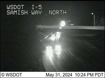
Webcams near Sehome


History around Sehome
Towns near Sehome
- Bellingham2.3 km away
- Lynden23 km away
- Anacortes27 km away
- Sedro-Woolley31 km away
- Burlington32 km away
- Mount Vernon37 km away