Montañas de China
Sze Fong Shan
785 m2575 ft
Montaña · China
Sze Fong Shan, located in Tai Po District of the New Territories, is the fourth highest peak in Hong Kong. With a height of 784 m (2,572 ft), it is northeast of Tai Mo Shan. The Eighth Stage of the MacLehose Trail passes near it.
De Wikipedia, CC BY-SA · Leer el artículo
En la cumbre · pronóstico para las 11:00
25 °CMayormente despejado · viento de 10 km/h del NE
 Verla en 3D
Clima en la cumbre de Sze Fong Shan, 785 m
- 11:0025 °CNE 10 km/h–
- 14:0026 °CSO 13 km/h0,1 mm
- 17:0023 °CS 10 km/h–
- 20:0020 °CSE 9 km/h–
- 23:0019 °CSE 10 km/h–
- 2:0019 °CE 9 km/h–
- 5:0018 °CE 11 km/h–
- 8:0020 °CE 15 km/h–
| Día | Cielo | Máx. / mín. | Lluvia | Viento hasta |
|---|---|---|---|---|
| Hoy | Parcialmente nublado | 27 °C / 19 °C | 0,1 mm | 15 km/h |
| sáb, 31 oct | Mayormente despejado | 24 °C / 18 °C | – | 20 km/h |
| dom, 1 nov | Lluvia débil | 24 °C / 19 °C | 0,8 mm | 20 km/h |
| lun, 2 nov | Mayormente despejado | 27 °C / 20 °C | 0,3 mm | 9 km/h |
| mar, 3 nov | Mayormente despejado | 25 °C / 20 °C | 0,9 mm | 17 km/h |
| mié, 4 nov | Mayormente despejado | 24 °C / 20 °C | 2 mm | 15 km/h |
| jue, 5 nov | Lluvia | 23 °C / 19 °C | 9,3 mm | 4 km/h |
Pronóstico de MET Norway (CC BY 4.0), actualizado a las 03:20 GMT+8. Horas locales.
Ficha técnica
- Tipo
- Montaña
- Altitud sobre el nivel del mar
- 785 m (2575 ft)
- País
- China
- Coordenadas
- 22.418°N 114.136°E
- Fuente
- Wikidata, CC0
Picos cerca de Sze Fong Shan
- Tai Mo Shan957 m · a 1,5 kmEn el mapa
- Miu Ko Toi765 m · a 2,2 kmEn el mapa
- Grassy Hill647 m · a 3 kmEn el mapa
- Tai To Yan566 m · a 4,1 kmEn el mapa
- Needle Hill532 m · a 4,2 kmEn el mapa
- Pak Tai To Yan480 m · a 5,3 kmEn el mapa
- Kai Kung Leng572 m · a 7,3 kmEn el mapa
- Beacon Hill457 m · a 8,3 kmEn el mapa
- Lion Rock495 m · a 8,9 kmEn el mapa
- Temple Hill488 m · a 10 kmEn el mapa
Montañas más altas de China
- Everest8849 mEn el mapa
- Lhotse8516 mEn el mapa
- Makalu8485 mEn el mapa
- Cho Oyu8188 mEn el mapa
- Gasherbrum I8080 mEn el mapa
- Broad Peak8051 mEn el mapa
- Gasherbrum II8034 mEn el mapa
- Shisha Pangma8027 mEn el mapa
- Gyachung Kang7952 mEn el mapa
- Gasherbrum III7946 mEn el mapa
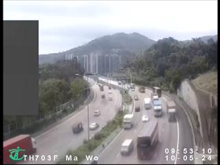
Cámaras web cerca de Sze Fong Shan



Historia alrededor de Sze Fong Shan
Ciudades cerca de Sze Fong Shan
- Tai Poa 5 km
- Discovery Parka 5,2 km
- Hong Lok Yuena 5,4 km
- Kwai Chunga 5,5 km
- Pat Heunga 5,5 km
- Tsuen Wana 5,6 km