Whites Hill
Montaña · Australia
Whites Hill is a hill in the suburb of Camp Hill, City of Brisbane, Queensland, Australia. Surrounding the hill is Whites Hill Reserve, a public reserve occupying the south of the suburbs of Camp Hill and Carina Heights. The reserve covers an area of over 170 hectares.
De Wikipedia, CC BY-SA · Leer el artículo
En la cumbre · pronóstico para las 16:00
22 °CNublado · viento de 9 km/h del NO
 Verla en 3D
Pronóstico del tiempo en Whites Hill
- 16:0022 °CNO 9 km/h–
- 19:0021 °CNO 8 km/h0,1 mm
- 22:0019 °CSO 10 km/h–
- 1:0017 °CSO 11 km/h–
- 4:0015 °CSO 14 km/h–
- 7:0019 °CSO 11 km/h–
- 10:0025 °CSE 13 km/h–
- 13:0026 °CE 13 km/h–
| Día | Cielo | Máx. / mín. | Lluvia | Viento hasta |
|---|---|---|---|---|
| jue, 29 oct | Mayormente despejado | 26 °C / 15 °C | – | 19 km/h |
| vie, 30 oct | Lluvia débil | 24 °C / 16 °C | 0,1 mm | 18 km/h |
| sáb, 31 oct | Nublado | 23 °C / 17 °C | – | 13 km/h |
| dom, 1 nov | Lluvia | 26 °C / 17 °C | 1,2 mm | 16 km/h |
| lun, 2 nov | Lluvia | 26 °C / 19 °C | 3,1 mm | 13 km/h |
| mar, 3 nov | Nublado | 25 °C / 19 °C | 0,7 mm | 13 km/h |
| mié, 4 nov | Parcialmente nublado | 29 °C / 20 °C | 10,5 mm | 13 km/h |
Pronóstico de MET Norway (CC BY 4.0), actualizado a las 15:21 GMT+10. Horas locales.
Ficha técnica
- Tipo
- Montaña
- País
- Australia
- Coordenadas
- 27.510°S 153.083°E
- Fuente
- Wikidata, CC0
Whites Hill
Hill in Queensland, Australia
Whites Hill is a hill in the suburb of Camp Hill, City of Brisbane, Queensland, Australia. Surrounding the hill is Whites Hill Reserve, a public reserve occupying the south of the suburbs of Camp Hill and Carina Heights. The reserve covers an area of over 170 hectares. The reserve offering many sporting and recreational facilities. Whites Hill lies within the catchment area of Bulimba Creek.
De Wikipedia, CC BY-SA · Leer el artículo
Picos cerca de Whites Hill
- Mount Petrie170 m · a 5,6 kmEn el mapa
- North Stradbroke Island95 m · a 39 kmEn el mapa
- Mount ThompsonMontaña · a 2,6 kmEn el mapa
- Toohey MountainMontaña · a 5,3 kmEn el mapa
- Enoggera HillColina · a 15 kmEn el mapa
- Tamborine Mountain525 m · a 48 kmEn el mapa
- Glow-Worm Caves Tamborine MountainMontaña · a 49 kmEn el mapa
- Mount MeeMontaña · a 57 kmEn el mapa
Montañas más altas de Australia
- Pico Mawson2745 mEn el mapa
- Monte Kosciuszko2228 mEn el mapa
- Rams Head2190 mEn el mapa
- Monte Bogong1986 mEn el mapa
- Monte Feathertop1922 mEn el mapa
- Bimberi Peak1912 mEn el mapa
- Mount Loch1865 mEn el mapa
- Monte Hotham1861 mEn el mapa
- Mount Gingera1857 mEn el mapa
- Mount Kelly1829 mEn el mapa
Cámaras web cerca de Whites Hill
 Woolloongabba - Pacific Motorway & Arrow Street - Northwesta 4,7 km de la cumbre
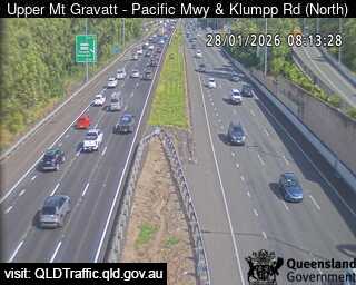 Upper Mount Gravatt - Pacific Motorway & Klumpp Road - Northa 4,8 km de la cumbre
 Wishart - Mt Gravatt Capalaba Road before Gateway Motorway - Easta 5,1 km de la cumbre
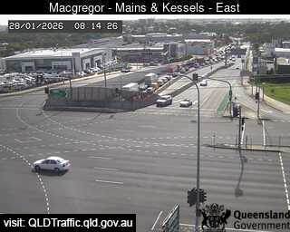 Macgregor - Mains Road & Kessels Road - Easta 5,9 km de la cumbre
Historia alrededor de Whites Hill
- World Expo 88 opens in Brisbane, Queensland, Australia1988
- Whiskey Au Go Go fire1973
- Great Fire of Brisbane1864
- 24 July 2019 University of Queensland protest2019
- Murder of Sophie Collombet2014
- Hillcrest shooting1996
- 1976 Spring Hill shooting1976
- First reported skyjacking/hijacking in the world Trans Australia Airlines Flight 4081960
Ciudades cerca de Whites Hill
- Brisbanea 7,2 km
- Capalabaa 12 km
- Logan Citya 15 km
- Narangbaa 36 km
- Gold Coasta 64 km
- Caloundraa 79 km