Ackerlspitze
2,329 m7,641 ft
山 · Kaiser Mountains · オーストリア
At 2,329 metres above sea level, the Ackerlspitze is the second highest peak in the Kaisergebirge range in the east of the Austrian state of Tyrol. The mountain is located in the eastern part of the range, also referred to as the Ostkaiser or East Kaiser.
出典: Wikipedia、CC BY-SA · 記事を読む
山頂 · 0:00 の予報
-9 °C快晴 · 南東の風 8 km/h
 3D で見る
Ackerlspitze 山頂の天気(2,329 m)
- 0:00-9 °C南東 8 km/h–
- 3:00-8 °C南東 10 km/h–
- 6:00-5 °C南東 10 km/h–
- 9:000 °C南 9 km/h–
- 12:007 °C南西 4 km/h–
- 15:008 °C北東 3 km/h–
- 18:002 °C東 2 km/h–
- 21:00-2 °C南東 4 km/h–
| 日付 | 天気 | 最高 / 最低 | 雨 | 最大風速 |
|---|---|---|---|---|
| 10月27日(火) | 快晴 | 9 °C / -10 °C | – | 10 km/h |
| 10月28日(水) | 大雪 | 1 °C / -5 °C | 6.3 mm | 9 km/h |
| 10月29日(木) | 晴れ | 3 °C / -4 °C | – | 8 km/h |
| 10月30日(金) | 快晴 | 3 °C / -8 °C | – | 4 km/h |
| 10月31日(土) | 快晴 | 1 °C / -8 °C | – | 5 km/h |
| 11月1日(日) | 晴れ | 0 °C / -8 °C | – | 5 km/h |
| 11月2日(月) | 晴れ時々曇り | -2 °C / -7 °C | – | 3 km/h |
MET Norway(CC BY 4.0)による予報。20:16 GMT+1 更新。時刻は現地時間です。
基本データ
- 種類
- 山
- 標高
- 2,329 m (7,641 ft)
- 孤立度
- より高い地点まで 3.4 km
- 山脈
- Kaiser Mountains
- 座標
- 47.550°N 12.333°E
Ackerlspitze
Peak in the Kaisergebirge range in the east of the Austrian state of Tyrol
At 2,329 metres above sea level, the Ackerlspitze is the second highest peak in the Kaisergebirge range in the east of the Austrian state of Tyrol. The mountain is located in the eastern part of the range, also referred to as the Ostkaiser or East Kaiser. To the east it is flanked by the Maukspitze (2.231 m), to the north it sends a ridge to the Lärcheck (2,123 m).
出典: Wikipedia、CC BY-SA · 記事を読む
Ackerlspitze周辺の山
- Predigtstuhl2,116 m · 2.4 km先地図上
- Fleischbank2,186 m · 2.4 km先地図上
- Ellmauer Halt2,344 m · 2.7 km先地図上
- Totenkirchl2,190 m · 2.7 km先地図上
- Treffauer2,304 m · 3.2 km先地図上
- Hackenköpfe2,126 m · 6 km先地図上
- Petersköpfl1,745 m · 9.3 km先地図上
- Naunspitze1,633 m · 9.5 km先地図上
- Hohe Salve1,828 m · 13 km先地図上
- ハーネンカム1,712 m · 14 km先地図上
Kaiser Mountainsの最高峰
- Ellmauer Halt2,344 m地図上
- Ackerlspitze2,329 m地図上
- Hackenköpfe2,126 m地図上
オーストリアの高い山
- グロースグロックナー山3,798 m地図上
- ヴィルトシュピッツェ3,768 m地図上
- ヴァイスクーゲル3,738 m地図上
- Großvenediger3,657 m地図上
- Hintere Schwärze3,624 m地図上
- Großes Wiesbachhorn3,564 m地図上
- Ramolkogel3,549 m地図上
- Schalfkogel3,537 m地図上
- ヴァッツェシュピッツェ3,532 m地図上
- フィンアイルシュピッツェ3,514 m地図上
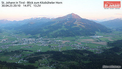
Ackerlspitze周辺のライブカメラ


Ackerlspitze周辺の歴史
Ackerlspitze周辺の町
- Rosenheim38 km先
- Kolbermoor39 km先
- Saalfelden am Steinernen Meer41 km先
- Traunstein42 km先
- Bad Aibling42 km先
- Bad Reichenhall45 km先