Ackerlspitze
2.329 m7.641 pés
Montanha · Montes do Kaiser · Áustria
At 2,329 metres above sea level, the Ackerlspitze is the second highest peak in the Kaisergebirge range in the east of the Austrian state of Tyrol. The mountain is located in the eastern part of the range, also referred to as the Ostkaiser or East Kaiser.
Da Wikipedia, CC BY-SA · Ler o artigo
No cume · previsão para 0:00
-9 °CCéu limpo · vento de 8 km/h de SE
 Ver em 3D
Clima no cume de Ackerlspitze, 2.329 m
- 0:00-9 °CSE 8 km/h–
- 3:00-8 °CSE 10 km/h–
- 6:00-5 °CSE 10 km/h–
- 9:000 °CS 9 km/h–
- 12:007 °CSO 4 km/h–
- 15:008 °CNE 3 km/h–
- 18:002 °CL 2 km/h–
- 21:00-2 °CSE 4 km/h–
| Dia | Céu | Máx. / mín. | Chuva | Vento até |
|---|---|---|---|---|
| Hoje | Céu limpo | 9 °C / -10 °C | – | 10 km/h |
| qua., 28 de out. | Neve forte | 1 °C / -5 °C | 6,3 mm | 9 km/h |
| qui., 29 de out. | Poucas nuvens | 3 °C / -4 °C | – | 8 km/h |
| sex., 30 de out. | Céu limpo | 3 °C / -8 °C | – | 4 km/h |
| sáb., 31 de out. | Céu limpo | 1 °C / -8 °C | – | 5 km/h |
| dom., 1 de nov. | Poucas nuvens | 0 °C / -8 °C | – | 5 km/h |
| seg., 2 de nov. | Parcialmente nublado | -2 °C / -7 °C | – | 3 km/h |
Previsão: MET Norway (CC BY 4.0), atualizada às 20:16 GMT+1. Horários locais.
Ficha técnica
- Tipo
- Montanha
- Altitude acima do nível do mar
- 2.329 m (7.641 pés)
- Isolamento
- a 3,4 km de um terreno mais alto
- Cordilheira
- Montes do Kaiser
- País
- Áustria
- Coordenadas
- 47.550°N 12.333°E
- Fonte
- Wikidata, CC0
Ackerlspitze
Peak in the Kaisergebirge range in the east of the Austrian state of Tyrol
At 2,329 metres above sea level, the Ackerlspitze is the second highest peak in the Kaisergebirge range in the east of the Austrian state of Tyrol. The mountain is located in the eastern part of the range, also referred to as the Ostkaiser or East Kaiser. To the east it is flanked by the Maukspitze (2.231 m), to the north it sends a ridge to the Lärcheck (2,123 m).
Da Wikipedia, CC BY-SA · Ler o artigo
Picos perto de Ackerlspitze
- Predigtstuhl2.116 m · a 2,4 kmNo mapa
- Fleischbank2.186 m · a 2,4 kmNo mapa
- Ellmauer Halt2.344 m · a 2,7 kmNo mapa
- Totenkirchl2.190 m · a 2,7 kmNo mapa
- Treffauer2.304 m · a 3,2 kmNo mapa
- Hackenköpfe2.126 m · a 6 kmNo mapa
- Petersköpfl1.745 m · a 9,3 kmNo mapa
- Naunspitze1.633 m · a 9,5 kmNo mapa
- Hohe Salve1.828 m · a 13 kmNo mapa
- Hahnenkamm1.712 m · a 14 kmNo mapa
Os mais altos de Montes do Kaiser
- Ellmauer Halt2.344 mNo mapa
- Ackerlspitze2.329 mNo mapa
- Hackenköpfe2.126 mNo mapa
Montanhas mais altas de Áustria
- Grossglockner3.798 mNo mapa
- Wildspitze3.768 mNo mapa
- Weißkugel3.738 mNo mapa
- Großvenediger3.657 mNo mapa
- Hintere Schwärze3.624 mNo mapa
- Großes Wiesbachhorn3.564 mNo mapa
- Ramolkogel3.549 mNo mapa
- Schalfkogel3.537 mNo mapa
- Watzespitze3.532 mNo mapa
- Fineilspitze3.514 mNo mapa
Webcams perto de Ackerlspitze

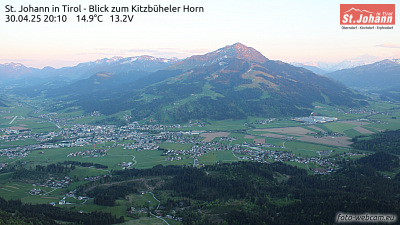

História ao redor de Ackerlspitze
Cidades perto de Ackerlspitze
- Rosenheima 38 km
- Kolbermoora 39 km
- Saalfelden am Steinernen Meera 41 km
- Traunsteina 42 km
- Bad Aiblinga 42 km
- Bad Reichenhalla 45 km