フィンシュターアールホルン
4,274 m14,022 ft
山 · ベルナー・アルプス · スイス
The Finsteraarhorn is a mountain lying on the border between the cantons of Bern and Valais. It is the highest mountain of the Bernese Alps and the most prominent peak of Switzerland. The Finsteraarhorn is the ninth-highest mountain and third-most prominent peak in the Alps.
出典: Wikipedia、CC BY-SA · 記事を読む
ベルナー・アルプス、Bernese Alps in the wide meaning、Finsteraarhorn-Oberaarhorn-Galmihorn Groupの最高地点
山頂 · 19:00 の予報
-11 °C霧 · 北西の風 4 km/h
 3D で見る
フィンシュターアールホルン 山頂の天気(4,274 m)
- 19:00-11 °C北西 4 km/h–
- 22:00-16 °C北西 6 km/h–
- 1:00-16 °C北西 6 km/h0.2 mm
- 4:00-11 °C北西 5 km/h0.3 mm
- 7:00-14 °C北西 4 km/h–
- 10:00-12 °C北西 4 km/h–
- 13:00-10 °C北西 5 km/h–
- 16:00-11 °C北 5 km/h–
| 日付 | 天気 | 最高 / 最低 | 雨 | 最大風速 |
|---|---|---|---|---|
| 10月28日(水) | 快晴 | -10 °C / -19 °C | 0.5 mm | 6 km/h |
| 10月29日(木) | 快晴 | -9 °C / -16 °C | – | 5 km/h |
| 10月30日(金) | 快晴 | -10 °C / -18 °C | – | 4 km/h |
| 10月31日(土) | 快晴 | -10 °C / -20 °C | – | 4 km/h |
| 11月1日(日) | 快晴 | -9 °C / -17 °C | – | 4 km/h |
| 11月2日(月) | 快晴 | -12 °C / -21 °C | – | 5 km/h |
| 11月3日(火) | 晴れ | -13 °C / -22 °C | – | 6 km/h |
MET Norway(CC BY 4.0)による予報。18:17 GMT+1 更新。時刻は現地時間です。
基本データ
Finsteraarhorn
Mountain in the Bernese Alps
The Finsteraarhorn is a mountain lying on the border between the cantons of Bern and Valais. It is the highest mountain of the Bernese Alps and the most prominent peak of Switzerland. The Finsteraarhorn is the ninth-highest mountain and third-most prominent peak in the Alps. In 2001 the whole massif and surrounding glaciers were designated as part of the Jungfrau-Aletsch World Heritage Site.
出典: Wikipedia、CC BY-SA · 記事を読む
フィンシュターアールホルン周辺の山
- Agassizhorn3,947 m · 1.4 km先地図上
- グリュンホルン4,043 m · 3.7 km先地図上
- Oberaarhorn3,631 m · 3.8 km先地図上
- Hinter Fiescherhorn4,025 m · 4.6 km先地図上
- Lauteraarhorn4,042 m · 5.1 km先地図上
- Gross Fiescherhorn4,049 m · 5.2 km先地図上
- Gross Wannenhorn3,906 m · 5.3 km先地図上
- シュレックホルン4,078 m · 5.9 km先地図上
- メンヒ4,110 m · 10 km先地図上
- アイガー3,967 m · 10 km先地図上
親ピーク
フィンシュターアールホルンの下位の山
ベルナー・アルプスの最高峰
スイスの高い山
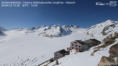
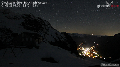
フィンシュターアールホルン周辺のライブカメラ


フィンシュターアールホルン周辺の歴史
フィンシュターアールホルン周辺の町
- Thun45 km先
- Steffisburg46 km先
- Domodossola49 km先
- Sierre53 km先
- Kriens56 km先
- リタウ58 km先