スイスの山
グリュンホルン
4,043 m13,264 ft
山 · Jungfrau-Fiescherhorn Group · スイス
The Grünhorn is a mountain in the Bernese Alps range of the Swiss Alps. It is located on the ridge between the two largest glaciers of the Alps: the Aletsch Glacier to the west and the Fiescher Glacier to the east. To the south lies the Gross Wannenhorn and, to the north, the Gross Fiescherhorn.
出典: Wikipedia、CC BY-SA · 記事を読む
山頂 · 1:00 の予報
-15 °C霧 · 北西の風 6 km/h
 3D で見る
グリュンホルン 山頂の天気(4,043 m)
- 1:00-15 °C北西 6 km/h0.2 mm
- 4:00-10 °C北西 4 km/h–
- 7:00-13 °C北西 4 km/h–
- 10:00-10 °C北西 3 km/h–
- 13:00-9 °C北西 5 km/h–
- 16:00-10 °C北西 5 km/h–
- 19:00-14 °C北西 5 km/h–
- 22:00-19 °C北西 5 km/h–
| 日付 | 天気 | 最高 / 最低 | 雨 | 最大風速 |
|---|---|---|---|---|
| 今日 | 晴れ | -9 °C / -19 °C | 0.2 mm | 6 km/h |
| 10月29日(木) | 快晴 | -7 °C / -15 °C | – | 5 km/h |
| 10月30日(金) | 快晴 | -9 °C / -17 °C | – | 4 km/h |
| 10月31日(土) | 快晴 | -8 °C / -18 °C | – | 4 km/h |
| 11月1日(日) | 快晴 | -7 °C / -15 °C | – | 4 km/h |
| 11月2日(月) | 快晴 | -11 °C / -20 °C | – | 5 km/h |
| 11月3日(火) | 晴れ | -11 °C / -20 °C | – | 6 km/h |
MET Norway(CC BY 4.0)による予報。20:17 GMT+1 更新。時刻は現地時間です。
基本データ
- 種類
- 山
- 標高
- 4,043 m (13,264 ft)
- プロミネンス
- 303 m (994 ft)
- 孤立度
- より高い地点まで 2.5 km
- 山脈
- Jungfrau-Fiescherhorn Group
- 国
- スイス
- 座標
- 46.532°N 8.078°E
グリュンホルン周辺の山
- Hinter Fiescherhorn4,025 m · 1.8 km先地図上
- Gross Fiescherhorn4,049 m · 2.5 km先地図上
- Agassizhorn3,947 m · 3.2 km先地図上
- フィンシュターアールホルン4,274 m · 3.7 km先地図上
- Gross Wannenhorn3,906 m · 4.5 km先地図上
- メンヒ4,110 m · 6.8 km先地図上
- Lauteraarhorn4,042 m · 6.9 km先地図上
- シュレックホルン4,078 m · 7.1 km先地図上
- Oberaarhorn3,631 m · 7.4 km先地図上
- アイガー3,967 m · 7.5 km先地図上
親ピーク
プロミネンスの基準となる、最も近いより高い山。
- Gross Fiescherhorn4,049 m地図上
グリュンホルンの下位の山
- Klein Grünhorn3,912 m地図上
Jungfrau-Fiescherhorn Groupの最高峰
スイスの高い山
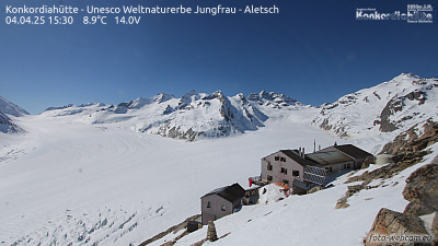
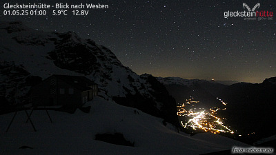
グリュンホルン周辺のライブカメラ


グリュンホルン周辺の歴史
グリュンホルン周辺の町
- Thun42 km先
- Steffisburg44 km先
- Domodossola49 km先
- Sierre49 km先
- Kriens58 km先
- リタウ59 km先