Herzogstand
1,731 m5,679 ft
山 · Walchenseeberge · ドイツ
The Herzogstand is a mountain in the Bavarian foothills of the Alps, 75 kilometres (47 mi) south of the city of Munich. It has an elevation of 1,731 metres (5,679 ft) and is northwest of Lake Walchen. Maximilian II of Bavaria had a hunting lodge built underneath today's so-called Herzogstand-house in 1857.
出典: Wikipedia、CC BY-SA · 記事を読む
山頂 · 6:00 の予報
2 °C晴れ時々曇り · 南の風 7 km/h
 3D で見る
Herzogstand 山頂の天気(1,731 m)
- 6:002 °C南 7 km/h–
- 9:007 °C南 6 km/h–
- 12:0012 °C北 6 km/h–
- 15:0012 °C北 6 km/h–
- 18:006 °C南 3 km/h–
- 21:004 °C南 4 km/h–
- 0:003 °C南 4 km/h–
- 3:002 °C南 4 km/h–
| 日付 | 天気 | 最高 / 最低 | 雨 | 最大風速 |
|---|---|---|---|---|
| 今日 | 快晴 | 13 °C / 2 °C | – | 8 km/h |
| 10月28日(水) | 強い雨 | 5 °C / 1 °C | 11.7 mm | 12 km/h |
| 10月29日(木) | 晴れ時々曇り | 6 °C / -0 °C | – | 14 km/h |
| 10月30日(金) | 快晴 | 4 °C / -3 °C | – | 6 km/h |
| 10月31日(土) | 晴れ | 4 °C / -3 °C | – | 7 km/h |
| 11月1日(日) | 快晴 | 6 °C / -4 °C | – | 5 km/h |
| 11月2日(月) | 快晴 | 4 °C / -3 °C | – | 6 km/h |
MET Norway(CC BY 4.0)による予報。02:17 GMT+1 更新。時刻は現地時間です。
基本データ
- 種類
- 山
- 標高
- 1,731 m (5,679 ft)
- 山脈
- Walchenseeberge
- 国
- ドイツ
- 座標
- 47.614°N 11.308°E
Herzogstand
Mountain in Bavaria, Germany
The Herzogstand is a mountain in the Bavarian foothills of the Alps, 75 kilometres (47 mi) south of the city of Munich. It has an elevation of 1,731 metres (5,679 ft) and is northwest of Lake Walchen. Maximilian II of Bavaria had a hunting lodge built underneath today's so-called Herzogstand-house in 1857. His successor, King Ludwig II, had a royal lodge built further up the mountain in 1865.
出典: Wikipedia、CC BY-SA · 記事を読む
Herzogstand周辺の山
- Jochberg1,565 m · 5 km先地図上
- Krottenkopf2,086 m · 12 km先地図上
- Wank1,780 m · 17 km先地図上
- Wörner2,474 m · 18 km先地図上
- Osterseen591 m · 20 km先地図上
- Teufelstättkopf1,758 m · 24 km先地図上
- Birkkarspitze2,749 m · 25 km先地図上
- Kaltwasserkarspitze2,733 m · 26 km先地図上
- Osterfelderkopf2,057 m · 27 km先地図上
- Dreitorspitze2,682 m · 27 km先地図上
Walchenseebergeの最高峰
- Heimgarten1,790 m地図上
- Herzogstand1,731 m地図上
- Hirschberg1,659 m地図上
- Osterfeuerkopf1,357 m地図上
ドイツの高い山
- ツークシュピッツェ2,962 m地図上
- Hochwanner2,744 m地図上
- Dreitorspitze2,682 m地図上
- ホッホカルター2,607 m地図上
- Biberkopf2,599 m地図上
- Großer Hundstod2,594 m地図上
- Hochvogel2,592 m地図上
- Östliche Karwendelspitze2,538 m地図上
- Hocheisspitze2,523 m地図上
- Hoher Göll2,522 m地図上
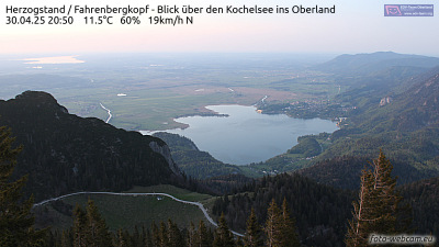
Herzogstand周辺のライブカメラ

Herzogstand周辺の歴史
Herzogstand周辺の町
- Penzberg16 km先
- Garmisch-Partenkirchen21 km先
- Bad Tölz25 km先
- Weilheim28 km先
- Geretsried30 km先
- Wolfratshausen34 km先