オーストリアの山
Hochwanner
2,744 m9,003 ft
山 · ヴェターシュタイン · オーストリア · ドイツ
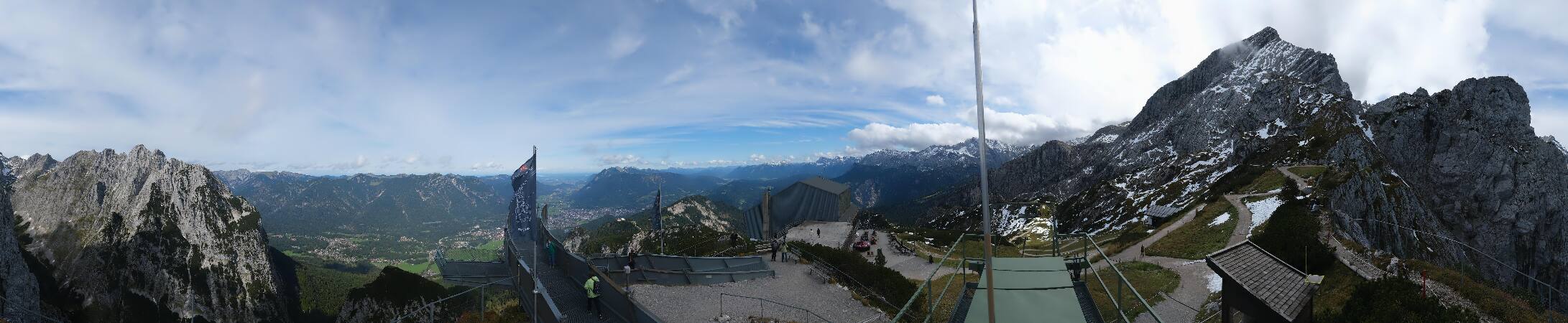
At 2,744 metres (9,003 ft), the Hochwanner is the second highest mountain in Germany after the Zugspitze. In addition the Hochwanner is the highest peak on the main ridge of the Wetterstein (Wettersteinhauptkamm) running from Gatterl to the Upper Wettersteinspitze above Mittenwald in an east–west direction.
出典: Wikipedia、CC BY-SA · 記事を読む
山頂 · 16:00 の予報
6 °C快晴 · 北の風 3 km/h
 3D で見る
Hochwanner 山頂の天気(2,744 m)
- 16:006 °C北 3 km/h–
- 19:00-0 °C北西 1 km/h–
- 22:00-2 °C西 3 km/h–
- 1:00-4 °C西 3 km/h–
- 4:00-5 °C西 3 km/h–
- 7:00-6 °C西 5 km/h–
- 10:00-0 °C北西 4 km/h1.3 mm
- 13:00-1 °C北 8 km/h2 mm
| 日付 | 天気 | 最高 / 最低 | 雨 | 最大風速 |
|---|---|---|---|---|
| 10月28日(水) | 雪 | 1 °C / -6 °C | 5.5 mm | 8 km/h |
| 10月29日(木) | 快晴 | 1 °C / -7 °C | – | 8 km/h |
| 10月30日(金) | 快晴 | 2 °C / -11 °C | – | 6 km/h |
| 10月31日(土) | 快晴 | 4 °C / -12 °C | – | 3 km/h |
| 11月1日(日) | 快晴 | 4 °C / -12 °C | – | 3 km/h |
| 11月2日(月) | 快晴 | 0 °C / -8 °C | – | 5 km/h |
| 11月3日(火) | 快晴 | 0 °C / -11 °C | – | 4 km/h |
MET Norway(CC BY 4.0)による予報。10:21 GMT+1 更新。時刻は現地時間です。
基本データ
- 種類
- 山
- 標高
- 2,744 m (9,003 ft)
- 山脈
- ヴェターシュタイン
- 初登頂
- 1870
- 座標
- 47.396°N 11.056°E
Hochwanner周辺の山
- ツークシュピッツェ2,962 m · 5.9 km先地図上
- Schneefernerkopf2,874 m · 6.6 km先地図上
- Daniel2,340 m · 14 km先地図上
- ノルトケッテ2,637 m · 25 km先地図上
- Thaneller2,341 m · 25 km先地図上
- Birkkarspitze2,749 m · 29 km先地図上
- ベルクイーゼル746 m · 31 km先地図上
- Gehrenspitze2,163 m · 32 km先地図上
- Kellenspitze2,238 m · 34 km先地図上
- Gimpel2,173 m · 35 km先地図上
Hochwannerの下位の山
- Dreitorspitze2,682 m地図上
ヴェターシュタインの最高峰
- ツークシュピッツェ2,962 m地図上
- Hochwanner2,744 m地図上
- Dreitorspitze2,682 m地図上
- Hohe Munde2,662 m地図上
- Wannig2,493 m地図上
- Tschirgant2,370 m地図上
オーストリアの高い山
- グロースグロックナー山3,798 m地図上
- ヴィルトシュピッツェ3,768 m地図上
- ヴァイスクーゲル3,738 m地図上
- Großvenediger3,657 m地図上
- Hintere Schwärze3,624 m地図上
- Großes Wiesbachhorn3,564 m地図上
- Ramolkogel3,549 m地図上
- Schalfkogel3,537 m地図上
- ヴァッツェシュピッツェ3,532 m地図上
- フィンアイルシュピッツェ3,514 m地図上