Mountains in Austria
Hochwanner
2,744 m9,003 ft
Mountain · Wetterstein · Austria · Germany
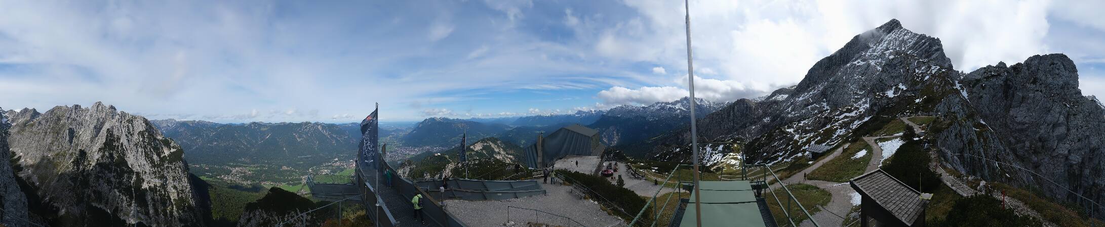
At 2,744 metres (9,003 ft), the Hochwanner is the second highest mountain in Germany after the Zugspitze. In addition the Hochwanner is the highest peak on the main ridge of the Wetterstein (Wettersteinhauptkamm) running from Gatterl to the Upper Wettersteinspitze above Mittenwald in an east–west direction.
From Wikipedia, CC BY-SA · Read the article
At the summit · forecast for 2:00 AM
-7 °CCloudy · wind 6 km/h from the S
 See it in 3D
Weather at the summit of Hochwanner, 2,744 m
- 2:00 AM-7 °CS 6 km/h–
- 5:00 AM-5 °CS 6 km/h–
- 8:00 AM-4 °CSE 8 km/h–
- 11:00 AM4 °CS 4 km/h–
- 2:00 PM8 °CSE 4 km/h–
- 5:00 PM3 °CN 1 km/h–
- 8:00 PM-1 °CW 2 km/h–
- 11:00 PM-3 °CSW 3 km/h–
| Day | Sky | High / low | Rain | Wind up to |
|---|---|---|---|---|
| Today | Clear | 8 °C / -7 °C | – | 8 km/h |
| Wed, Oct 28 | Snow | 0 °C / -6 °C | 4 mm | 8 km/h |
| Thu, Oct 29 | Clear | 1 °C / -6 °C | – | 7 km/h |
| Fri, Oct 30 | Clear | 2 °C / -11 °C | – | 4 km/h |
| Sat, Oct 31 | Clear | 4 °C / -12 °C | – | 3 km/h |
| Sun, Nov 1 | Clear | 4 °C / -12 °C | – | 3 km/h |
| Mon, Nov 2 | Clear | 0 °C / -8 °C | – | 5 km/h |
Forecast by MET Norway (CC BY 4.0), updated 12:20 AM GMT+1. Times are local.
Facts
- What it is
- Mountain
- Height above sea level
- 2,744 m (9,003 ft)
- Range
- Wetterstein
- First ascent
- 1870
- Coordinates
- 47.396°N 11.056°E
- Source
- Wikidata, CC0
Peaks near Hochwanner
- Zugspitze2,962 m · 5.9 km awayOn the map
- Schneefernerkopf2,874 m · 6.6 km awayOn the map
- Daniel2,340 m · 14 km awayOn the map
- Nordkette2,637 m · 25 km awayOn the map
- Thaneller2,341 m · 25 km awayOn the map
- Birkkarspitze2,749 m · 29 km awayOn the map
- Bergisel746 m · 31 km awayOn the map
- Gehrenspitze2,163 m · 32 km awayOn the map
- Kellenspitze2,238 m · 34 km awayOn the map
- Gimpel2,173 m · 35 km awayOn the map
Peaks below Hochwanner
- Dreitorspitze2,682 mOn the map
Highest in the Wetterstein
- Zugspitze2,962 mOn the map
- Hochwanner2,744 mOn the map
- Dreitorspitze2,682 mOn the map
- Hohe Munde2,662 mOn the map
- Wannig2,493 mOn the map
- Tschirgant2,370 mOn the map
Highest mountains in Austria
- Grossglockner3,798 mOn the map
- Wildspitze3,768 mOn the map
- Weißkugel3,738 mOn the map
- Großvenediger3,657 mOn the map
- Hintere Schwärze3,624 mOn the map
- Großes Wiesbachhorn3,564 mOn the map
- Ramolkogel3,549 mOn the map
- Schalfkogel3,537 mOn the map
- Watzespitze3,532 mOn the map
- Fineilspitze3,514 mOn the map