Letterbreckaun
667 m2,188 ft
山 · モームターク山地 · アイルランド
Letterbreckaun is one of the Maumturk Mountains of Connemara in County Galway, Ireland. At 677 metres (2,221 ft), it is the second-tallest of the Maumturks, the 129th–highest peak in Ireland on the Arderin list, and 159th–highest on the Vandeleur-Lynam list.
出典: Wikipedia、CC BY-SA · 記事を読む
山頂 · 1:00 の予報
8 °C小雨 · 南西の風 30 km/h
 3D で見る
Letterbreckaun 山頂の天気(667 m)
- 1:008 °C南西 30 km/h0.7 mm
- 4:008 °C南西 30 km/h0.6 mm
- 7:008 °C南西 23 km/h0.3 mm
- 10:009 °C南西 22 km/h0.6 mm
- 13:0010 °C南西 24 km/h0.5 mm
- 16:009 °C南西 18 km/h0.5 mm
- 19:008 °C南 20 km/h0.4 mm
- 22:008 °C南 23 km/h0.6 mm
| 日付 | 天気 | 最高 / 最低 | 雨 | 最大風速 |
|---|---|---|---|---|
| 今日 | 小雨 | 10 °C / 7 °C | 4 mm | 31 km/h |
| 10月29日(木) | 曇り | 11 °C / 7 °C | 0.9 mm | 35 km/h |
| 10月30日(金) | 晴れ | 10 °C / 5 °C | 9.8 mm | 32 km/h |
| 10月31日(土) | 雨 | 10 °C / 6 °C | 10.7 mm | 13 km/h |
| 11月1日(日) | 晴れ時々曇り | 8 °C / 4 °C | – | 15 km/h |
| 11月2日(月) | 曇り | 8 °C / 5 °C | – | 22 km/h |
| 11月3日(火) | 曇り | 8 °C / 5 °C | 0.4 mm | 19 km/h |
MET Norway(CC BY 4.0)による予報。19:17 GMT 更新。時刻は現地時間です。
基本データ
- 種類
- 山
- 標高
- 667 m (2,188 ft)
- プロミネンス
- 322 m (1,056 ft)
- 山脈
- モームターク山地
- 座標
- 53.534°N 9.725°W
Letterbreckaun
Mountain in Galway, Ireland
Letterbreckaun is one of the Maumturk Mountains of Connemara in County Galway, Ireland. At 677 metres (2,221 ft), it is the second-tallest of the Maumturks, the 129th–highest peak in Ireland on the Arderin list, and 159th–highest on the Vandeleur-Lynam list. Letterbreckaun is in the middle sector of the long north-west to south-east spine of the Maumturks.
出典: Wikipedia、CC BY-SA · 記事を読む
Letterbreckaun周辺の山
- Knocknahillion607 m · 1.9 km先地図上
- Binn idir an dá Log702 m · 3.9 km先地図上
- Leenaun Hill618 m · 4.6 km先地図上
- Binn Chaonaigh633 m · 5.6 km先地図上
- Bencorr711 m · 6.2 km先地図上
- Bencollaghduff696 m · 6.2 km先地図上
- Benbaun729 m · 7.1 km先地図上
- Binn Mhór661 m · 8.4 km先地図上
- Devilsmother645 m · 9.3 km先地図上
- Mullach Glas622 m · 10 km先地図上
モームターク山地の最高峰
- Binn idir an dá Log702 m地図上
- Letterbreckaun667 m地図上
- Binn Mhór661 m地図上
- Leenaun Hill618 m地図上
- Lackavrea396 m地図上
アイルランドの高い山
- キャラントゥール山1,039 m地図上
- ブランドン山952 m地図上
- ラグナキリア山925 m地図上
- ギャルティー山脈918 m地図上
- Baurtregaum851 m地図上
- Mullaghcleevaun849 m地図上
- Mangerton Mountain838 m地図上
- Purple Mountain832 m地図上
- ビーノスキー826 m地図上
- Mweelrea814 m地図上
Letterbreckaun周辺のライブカメラ
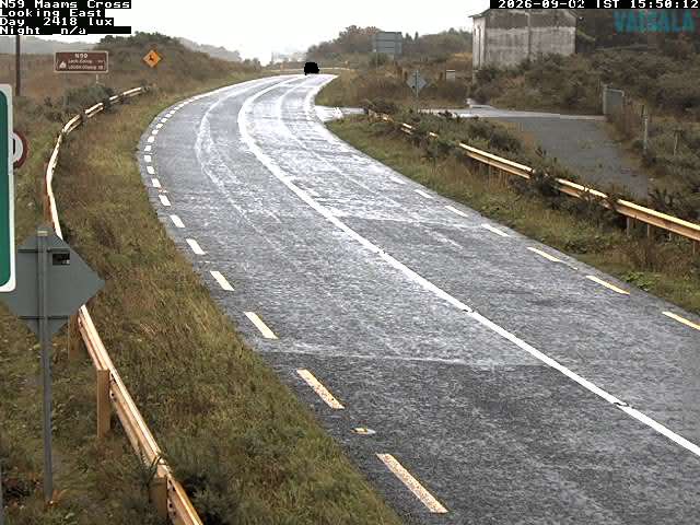
Letterbreckaun周辺の歴史
Letterbreckaun周辺の町
- ゴールウェイ53 km先