Matterhorn Peak
12,301 ft3,749 m
山 · シエラネバダ山脈 · アメリカ合衆国
Matterhorn Peak is located in the Sierra Nevada, in California, at the northern boundary of Yosemite National Park. At 12,285 feet (3,744 m) elevation, it is the tallest peak in the craggy Alps-like Sawtooth Ridge and the northernmost 12,000-foot (3,700 m) peak in the Sierra Nevada.
出典: Wikipedia、CC BY-SA · 記事を読む
山頂 · 13:00 の予報
34 °F快晴 · 南西の風 17 mph
 3D で見る
Matterhorn Peak 山頂の天気(12,301 ft)
- 13:0034 °F南西 17 mph–
- 16:0030 °F南西 16 mph–
- 19:0020 °F南西 11 mph–
- 22:0018 °F南 7 mph–
- 1:0019 °F南 8 mph–
- 4:0019 °F南 8 mph–
- 7:0019 °F南西 7 mph–
- 10:0033 °F南西 7 mph–
| 日付 | 天気 | 最高 / 最低 | 雨 | 最大風速 |
|---|---|---|---|---|
| 10月28日(水) | 晴れ | 36 °F / 18 °F | – | 10 mph |
| 10月29日(木) | 曇り | 34 °F / 20 °F | 0.01 インチ | 14 mph |
| 10月30日(金) | 晴れ時々曇り | 28 °F / 18 °F | 0.05 インチ | 9 mph |
| 10月31日(土) | 雪 | 24 °F / 16 °F | 0.18 インチ | 9 mph |
| 11月1日(日) | 快晴 | 24 °F / 15 °F | 0 インチ | 6 mph |
| 11月2日(月) | 快晴 | 36 °F / 20 °F | – | 4 mph |
| 11月3日(火) | 曇り | 44 °F / 29 °F | – | 3 mph |
MET Norway(CC BY 4.0)による予報。12:17 GMT-7 更新。時刻は現地時間です。
基本データ
- 種類
- 山
- 標高
- 12,301 ft (3,749 m)
- プロミネンス
- 1,559 ft (475 m)
- 山脈
- シエラネバダ山脈
- 初登頂
- 1899
- 座標
- 38.093°N 119.383°W
Matterhorn Peak
Mountain in Sierra Nevada, California
Matterhorn Peak is located in the Sierra Nevada, in California, at the northern boundary of Yosemite National Park. At 12,285 feet (3,744 m) elevation, it is the tallest peak in the craggy Alps-like Sawtooth Ridge and the northernmost 12,000-foot (3,700 m) peak in the Sierra Nevada. The peak also supports the Sierra's northernmost glacier system. It was named after the Matterhorn in the Alps.
出典: Wikipedia、CC BY-SA · 記事を読む
Matterhorn Peak周辺の山
- Whorl Mountain12,034 ft · 2.2 km先地図上
- Twin Peaks12,293 ft · 2.7 km先地図上
- Eagle Peak11,854 ft · 9.9 km先地図上
- Excelsior Mountain12,438 ft · 10 km先地図上
- North Peak12,248 ft · 14 km先地図上
- Mount Conness12,649 ft · 15 km先地図上
- Tower Peak11,755 ft · 16 km先地図上
- Tioga Peak11,526 ft · 20 km先地図上
- Doda Dome8,907 ft · 24 km先地図上
- ランバートドーム9,455 ft · 24 km先地図上
シエラネバダ山脈の最高峰
- ホイットニー山14,505 ft地図上
- ウィリアムソン山14,403 ft地図上
- Mount Russell14,094 ft地図上
- Mount Langley14,032 ft地図上
- ティンダル山14,025 ft地図上
- Mount Humphreys13,992 ft地図上
- Mount Keith13,982 ft地図上
- Mount LeConte13,936 ft地図上
- Matterhorn Peak12,301 ft地図上
アメリカ合衆国の高い山
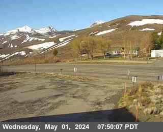
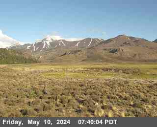
Matterhorn Peak周辺のライブカメラ


Matterhorn Peak周辺の町
- Mammoth Lakes63 km先