Matterhorn Peak
12.301 pés3.749 m
Montanha · Serra Nevada · Estados Unidos
Matterhorn Peak is located in the Sierra Nevada, in California, at the northern boundary of Yosemite National Park. At 12,285 feet (3,744 m) elevation, it is the tallest peak in the craggy Alps-like Sawtooth Ridge and the northernmost 12,000-foot (3,700 m) peak in the Sierra Nevada.
Da Wikipedia, CC BY-SA · Ler o artigo
No cume · previsão para 9:00
29 °FPoucas nuvens · vento de 13 mph de SO
 Ver em 3D
Clima no cume de Matterhorn Peak, 12.301 pés
- 9:0029 °FSO 13 mph–
- 12:0034 °FSO 17 mph–
- 15:0033 °FSO 16 mph–
- 18:0023 °FSO 11 mph–
- 21:0018 °FS 9 mph–
- 0:0018 °FS 9 mph–
- 3:0019 °FS 9 mph–
- 6:0020 °FS 8 mph–
| Dia | Céu | Máx. / mín. | Chuva | Vento até |
|---|---|---|---|---|
| Hoje | Céu limpo | 34 °F / 18 °F | – | 17 mph |
| qua., 28 de out. | Poucas nuvens | 37 °F / 18 °F | – | 9 mph |
| qui., 29 de out. | Nublado | 33 °F / 19 °F | 0,02 pol. | 14 mph |
| sex., 30 de out. | Parcialmente nublado | 28 °F / 18 °F | 0,03 pol. | 9 mph |
| sáb., 31 de out. | Neve | 24 °F / 16 °F | 0,18 pol. | 9 mph |
| dom., 1 de nov. | Céu limpo | 24 °F / 15 °F | 0 pol. | 6 mph |
| seg., 2 de nov. | Céu limpo | 36 °F / 20 °F | – | 4 mph |
Previsão: MET Norway (CC BY 4.0), atualizada às 06:17 GMT-7. Horários locais.
Ficha técnica
- Tipo
- Montanha
- Altitude acima do nível do mar
- 12.301 pés (3.749 m)
- Proeminência
- 1.559 pés (475 m)
- Cordilheira
- Serra Nevada
- País
- Estados Unidos
- Primeira ascensão
- 1899
- Coordenadas
- 38.093°N 119.383°W
- Fonte
- Wikidata, CC0
Matterhorn Peak
Mountain in Sierra Nevada, California
Matterhorn Peak is located in the Sierra Nevada, in California, at the northern boundary of Yosemite National Park. At 12,285 feet (3,744 m) elevation, it is the tallest peak in the craggy Alps-like Sawtooth Ridge and the northernmost 12,000-foot (3,700 m) peak in the Sierra Nevada. The peak also supports the Sierra's northernmost glacier system. It was named after the Matterhorn in the Alps.
Da Wikipedia, CC BY-SA · Ler o artigo
Picos perto de Matterhorn Peak
- Whorl Mountain12.034 pés · a 2,2 kmNo mapa
- Twin Peaks12.293 pés · a 2,7 kmNo mapa
- Eagle Peak11.854 pés · a 9,9 kmNo mapa
- Excelsior Mountain12.438 pés · a 10 kmNo mapa
- North Peak12.248 pés · a 14 kmNo mapa
- Monte Conness12.649 pés · a 15 kmNo mapa
- Tower Peak11.755 pés · a 16 kmNo mapa
- Tioga Peak11.526 pés · a 20 kmNo mapa
- Doda Dome8.907 pés · a 24 kmNo mapa
- Lembert Dome9.455 pés · a 24 kmNo mapa
Os mais altos de Serra Nevada
- Monte Whitney14.505 pésNo mapa
- Mount Williamson14.403 pésNo mapa
- Mount Russell14.094 pésNo mapa
- Mount Langley14.032 pésNo mapa
- Mount Tyndall14.025 pésNo mapa
- Mount Humphreys13.992 pésNo mapa
- Mount Keith13.982 pésNo mapa
- Mount LeConte13.936 pésNo mapa
- Matterhorn Peak12.301 pésNo mapa
Montanhas mais altas de Estados Unidos
- Monte Denali20.308 pésNo mapa
- Monte Santo Elias18.009 pésNo mapa
- Monte Foraker17.402 pésNo mapa
- Mount Bona16.535 pésNo mapa
- Monte Blackburn16.390 pésNo mapa
- Monte Sanford16.237 pésNo mapa
- Monte Vancouver15.787 pésNo mapa
- Monte Churchill15.636 pésNo mapa
- Monte Fairweather15.325 pésNo mapa
- Monte Hubbard14.951 pésNo mapa
Webcams perto de Matterhorn Peak

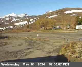

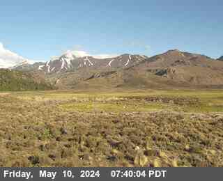
Cidades perto de Matterhorn Peak
- Mammoth Lakesa 63 km