オーストリアの山
Sarojahoehe
1,659 m5,443 ft
山 · Rätikon · オーストリア · リヒテンシュタイン
Sarojahöhe or Saroja is a mountain on the border of Liechtenstein and Austria in the Rätikon range of the Eastern Alps to the east of the village of Planken, with a height of 1,659 metres (5,443 ft).
出典: Wikipedia、CC BY-SA · 記事を読む
山頂 · 21:00 の予報
5 °C晴れ · 南の風 4 km/h
 3D で見る
Sarojahoehe 山頂の天気(1,659 m)
- 21:005 °C南 4 km/h–
- 0:002 °C南 5 km/h–
- 3:001 °C南東 4 km/h–
- 6:002 °C南 5 km/h–
- 9:006 °C南 4 km/h1.1 mm
- 12:006 °C北 7 km/h1.2 mm
- 15:004 °C北 6 km/h1 mm
- 18:003 °C北 5 km/h1 mm
| 日付 | 天気 | 最高 / 最低 | 雨 | 最大風速 |
|---|---|---|---|---|
| 10月28日(水) | 雨 | 7 °C / 1 °C | 4.3 mm | 8 km/h |
| 10月29日(木) | 晴れ | 6 °C / -1 °C | – | 7 km/h |
| 10月30日(金) | 晴れ | 5 °C / -4 °C | – | 6 km/h |
| 10月31日(土) | 晴れ | 4 °C / -5 °C | – | 5 km/h |
| 11月1日(日) | 晴れ | 4 °C / -5 °C | – | 5 km/h |
| 11月2日(月) | 曇り | 2 °C / -4 °C | – | 6 km/h |
| 11月3日(火) | 曇り | 2 °C / -7 °C | – | 6 km/h |
MET Norway(CC BY 4.0)による予報。20:17 GMT+1 更新。時刻は現地時間です。
基本データ
- 種類
- 山
- 標高
- 1,659 m (5,443 ft)
- 山脈
- Rätikon
- 座標
- 47.191°N 9.572°E
Sarojahoehe周辺の山
Rätikonの最高峰
- Schesaplana2,965 m地図上
- Drei Türme2,830 m地図上
- Madrisahorn2,826 m地図上
- Sulzfluh2,818 m地図上
- Seekopf2,698 m地図上
- グラウシュピッツ2,599 m地図上
- Schollberg2,570 m地図上
- Kirchlispitzen2,551 m地図上
- Sarojahoehe1,659 m地図上
オーストリアの高い山
- グロースグロックナー山3,798 m地図上
- ヴィルトシュピッツェ3,768 m地図上
- ヴァイスクーゲル3,738 m地図上
- Großvenediger3,657 m地図上
- Hintere Schwärze3,624 m地図上
- Großes Wiesbachhorn3,564 m地図上
- Ramolkogel3,549 m地図上
- Schalfkogel3,537 m地図上
- ヴァッツェシュピッツェ3,532 m地図上
- フィンアイルシュピッツェ3,514 m地図上
Sarojahoehe周辺のライブカメラ


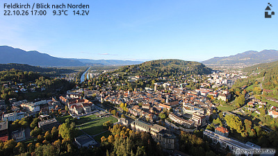
Sarojahoehe周辺の歴史
- Battle of Frastanz1499
- Schlacht am Stoss1405
- Battle of Feldkirch1799
- 2016 Nenzing shooting2016
- The home and office of Klaus Zumwinkel, CEO of Deutsche Post, is searched by police investigating tax evasion2008
- Vaduz Convention1960
- The 1939 Liechtenstein putsch takes place; members of the (VDBL) unsuccessfully attempt to provoke a clash with the Liechtenstein government with the aim…1939
- Rotter kidnapping1933