Teisenberg
1,333 m4,373 ft
山 · キームガウ・アルプス山脈 · ドイツ
Teisenberg is a mountain in Bavaria located between the villages Inzell, Anger and Teisendorf. It's the northernmost thousand-metre peak in the German Alps and belongs to the Chiemgau Alps. It offers a view of the Northern Limestone Alps, which tower over it here by about 500 metres in altitude.
出典: Wikipedia、CC BY-SA · 記事を読む
山頂 · 6:00 の予報
3 °C晴れ時々曇り · 南西の風 11 km/h
 3D で見る
Teisenberg 山頂の天気(1,333 m)
- 6:003 °C南西 11 km/h–
- 9:008 °C西 13 km/h0.3 mm
- 12:008 °C西 17 km/h1.7 mm
- 15:006 °C西 14 km/h0.5 mm
- 18:005 °C西 16 km/h0.3 mm
- 21:004 °C西 13 km/h0.8 mm
- 0:003 °C西 10 km/h–
- 3:003 °C西 9 km/h–
| 日付 | 天気 | 最高 / 最低 | 雨 | 最大風速 |
|---|---|---|---|---|
| 今日 | 雨 | 9 °C / 3 °C | 3.6 mm | 17 km/h |
| 10月29日(木) | 雨 | 5 °C / -1 °C | 1.9 mm | 10 km/h |
| 10月30日(金) | 晴れ時々曇り | 5 °C / -4 °C | – | 13 km/h |
| 10月31日(土) | 快晴 | 5 °C / -5 °C | 0.4 mm | 6 km/h |
| 11月1日(日) | みぞれ | 3 °C / -0 °C | 1.7 mm | 5 km/h |
| 11月2日(月) | 大雪 | -0 °C / -2 °C | 15.4 mm | 8 km/h |
| 11月3日(火) | 雪 | 0 °C / -1 °C | 12 mm | 8 km/h |
MET Norway(CC BY 4.0)による予報。02:17 GMT+1 更新。時刻は現地時間です。
基本データ
- 種類
- 山
- 標高
- 1,333 m (4,373 ft)
- 山脈
- キームガウ・アルプス山脈
- 国
- ドイツ
- 座標
- 47.806°N 12.768°E
Teisenberg
Mountain in Bavaria, Germany
Teisenberg is a mountain in Bavaria located between the villages Inzell, Anger and Teisendorf. It's the northernmost thousand-metre peak in the German Alps and belongs to the Chiemgau Alps. It offers a view of the Northern Limestone Alps, which tower over it here by about 500 metres in altitude. Below the summit at an altitude of 1270 m is the Stoißer Alm, popular among hikers and mountain bikers.
出典: Wikipedia、CC BY-SA · 記事を読む
Teisenberg周辺の山
- Hochstaufen1,771 m · 8.2 km先地図上
- Sonntagshorn1,961 m · 15 km先地図上
- Karkopf1,738 m · 16 km先地図上
- Berchtesgadener Hochthron1,972 m · 20 km先地図上
- Festungsberg542 m · 21 km先地図上
- Edelweißlahnerkopf1,893 m · 22 km先地図上
- Kapuzinerberg636 m · 22 km先地図上
- Großer Rauhenkopf1,604 m · 22 km先地図上
- Schottmalhorn1,982 m · 22 km先地図上
- Stadelhorn2,286 m · 24 km先地図上
キームガウ・アルプス山脈の最高峰
- Sonntagshorn1,961 m地図上
- Steinplatte1,869 m地図上
- Geigelstein1,808 m地図上
- Dürrnbachhorn1,776 m地図上
- Fellhorn1,764 m地図上
- Hochgern1,748 m地図上
- Gurnwandkopf1,691 m地図上
- Hochfelln1,674 m地図上
- Teisenberg1,333 m地図上
ドイツの高い山
- ツークシュピッツェ2,962 m地図上
- Hochwanner2,744 m地図上
- Dreitorspitze2,682 m地図上
- ホッホカルター2,607 m地図上
- Biberkopf2,599 m地図上
- Großer Hundstod2,594 m地図上
- Hochvogel2,592 m地図上
- Östliche Karwendelspitze2,538 m地図上
- Hocheisspitze2,523 m地図上
- Hoher Göll2,522 m地図上
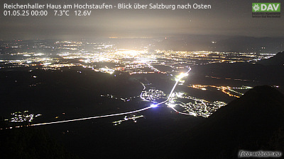
Teisenberg周辺のライブカメラ

Teisenberg周辺の歴史
Teisenberg周辺の町
- Traunstein12 km先
- Bad Reichenhall12 km先
- Freilassing16 km先
- Salzburg21 km先
- Traunreut22 km先
- ブルクハウゼン41 km先