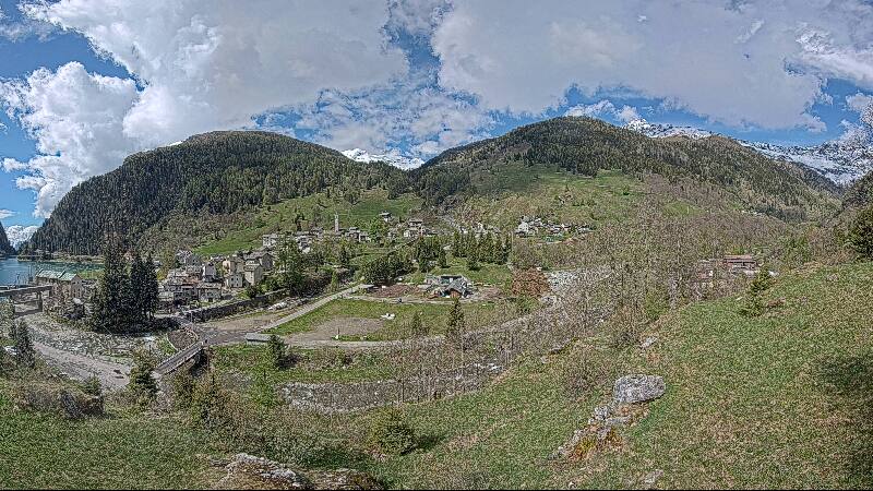
Vogelberg
3,218 m10,558 ft
山 · Adula Group · スイス
The Vogelberg is a 3,218 metres high mountain of the Lepontine Alps, located on the border between the Swiss cantons of Ticino and Graubünden. It is the highest summit of the Lepontine Alps south of the Rheinwaldhorn.
出典: Wikipedia、CC BY-SA · 記事を読む
山頂 · 13:00 の予報
4 °C快晴 · 北の風 6 km/h
 3D で見る
Vogelberg 山頂の天気(3,218 m)
- 13:004 °C北 6 km/h–
- 16:003 °C北 6 km/h–
- 19:00-1 °C北東 4 km/h–
- 22:00-3 °C北東 5 km/h–
- 1:00-4 °C北東 6 km/h–
- 4:00-4 °C北東 6 km/h–
- 7:00-4 °C北東 6 km/h–
- 10:00-2 °C北 8 km/h–
| 日付 | 天気 | 最高 / 最低 | 雨 | 最大風速 |
|---|---|---|---|---|
| 10月28日(水) | 晴れ時々曇り | -0 °C / -6 °C | – | 10 km/h |
| 10月29日(木) | 快晴 | -1 °C / -9 °C | – | 6 km/h |
| 10月30日(金) | 快晴 | -1 °C / -7 °C | – | 2 km/h |
| 10月31日(土) | 快晴 | -2 °C / -7 °C | – | 4 km/h |
| 11月1日(日) | 快晴 | 1 °C / -6 °C | – | 4 km/h |
| 11月2日(月) | 快晴 | 0 °C / -8 °C | – | 7 km/h |
| 11月3日(火) | 晴れ時々曇り | -1 °C / -8 °C | – | 6 km/h |
MET Norway(CC BY 4.0)による予報。06:20 GMT+1 更新。時刻は現地時間です。
基本データ
- 種類
- 山
- 標高
- 3,218 m (10,558 ft)
- プロミネンス
- 303 m (994 ft)
- 山脈
- Adula Group
- 親ピーク
- Rheinwaldhorn
- 国
- スイス
- 座標
- 46.478°N 9.065°E
Vogelberg
Mountain in Switzerland
The Vogelberg is a 3,218 metres high mountain of the Lepontine Alps, located on the border between the Swiss cantons of Ticino and Graubünden. It is the highest summit of the Lepontine Alps south of the Rheinwaldhorn. The Vogelberg is a large glaciated massif consisting of several secondary summits: Pizzo Cramorino on the west side and Rheinquellhorn on the east.
出典: Wikipedia、CC BY-SA · 記事を読む
Vogelberg周辺の山
- Rheinwaldhorn3,402 m · 2.6 km先地図上
- Güferhorn3,379 m · 3.8 km先地図上
- Piz Medel3,210 m · 20 km先地図上
- Pizzo di Claro2,727 m · 20 km先地図上
- Scopi3,190 m · 21 km先地図上
- Alperschällihorn3,036 m · 22 km先地図上
- Bruschghorn3,056 m · 25 km先地図上
- Pizzo Campo Tencia3,072 m · 27 km先地図上
- Piz Beverin2,998 m · 30 km先地図上
- Pizzo Centrale2,999 m · 36 km先地図上
親ピーク
プロミネンスの基準となる、最も近いより高い山。
- Rheinwaldhorn3,402 m地図上
Vogelbergの下位の山
- Puntone dei Fraciòn3,202 m地図上
- Cima Rossa3,161 m地図上
- Zapporthorn3,152 m地図上
Adula Groupの最高峰
- Rheinwaldhorn3,402 m地図上
- Güferhorn3,379 m地図上
- Vogelberg3,218 m地図上
- Fanellhorn3,124 m地図上
- Torent Alto2,952 m地図上
- Pizzo del Ramulazz2,939 m地図上
- Cima di Gana Bianca2,842 m地図上
- シマ・デ・ガジェラ2,805 m地図上