Achsel
2,673 m8,770 ft
Mountain · Venediger Group · Austria
Die Achsel ist ein 2673 m ü. A. hoher Berggipfel des Umbalkamms in der Venedigergruppe in Osttirol (Österreich). Sie liegt im Nordwesten Osttirols in der Gemeinde Prägraten am Großvenediger. Bei dem alpinistisch unbedeutenden Berggipfel handelt es sich um den einzigen benannten Zweitausender des Umbalkams.
From German Wikipedia, CC BY-SA · Read the article
At the summit · forecast for 12:00 AM
-4 °CClear · wind 6 km/h from the N
 See it in 3D

Weather at the summit of Achsel, 2,673 m
- 12:00 AM-4 °CN 6 km/h–
- 3:00 AM-3 °CN 5 km/h–
- 6:00 AM-1 °CN 5 km/h–
- 9:00 AM1 °CN 4 km/h–
- 12:00 PM2 °CN 4 km/h–
- 3:00 PM2 °CN 5 km/h–
- 6:00 PM-1 °CN 6 km/h–
- 9:00 PM-1 °CN 5 km/h–
| Day | Sky | High / low | Rain | Wind up to |
|---|---|---|---|---|
| Tue, Oct 27 | Clear | 3 °C / -4 °C | – | 6 km/h |
| Wed, Oct 28 | Snow | 0 °C / -4 °C | 1.2 mm | 8 km/h |
| Thu, Oct 29 | Clear | -1 °C / -7 °C | – | 8 km/h |
| Fri, Oct 30 | Clear | -0 °C / -7 °C | – | 7 km/h |
| Sat, Oct 31 | Clear | -1 °C / -8 °C | – | 10 km/h |
| Sun, Nov 1 | Mostly clear | -1 °C / -9 °C | – | 9 km/h |
| Mon, Nov 2 | Light snow | -6 °C / -9 °C | 1.2 mm | 9 km/h |
Forecast by MET Norway (CC BY 4.0), updated 08:16 PM GMT+1. Times are local.
Facts
- What it is
- Mountain
- Height above sea level
- 2,673 m (8,770 ft)
- Range
- Venediger Group
- Country
- Austria
- Coordinates
- 47.010°N 12.240°E
- Source
- Wikidata, CC0
Achsel (Venedigergruppe)
Berg der Hohen Tauern in Tirol
Die Achsel ist ein 2673 m ü. A. hoher Berggipfel des Umbalkamms in der Venedigergruppe in Osttirol (Österreich). Sie liegt im Nordwesten Osttirols in der Gemeinde Prägraten am Großvenediger. Bei dem alpinistisch unbedeutenden Berggipfel handelt es sich um den einzigen benannten Zweitausender des Umbalkams. Die Achsel liegt am Ostgrat des Hohen Kreuz, der vom Hohen Kreuz ins Umbaltal abfällt.
From German Wikipedia, CC BY-SA · Read the article
Peaks near Achsel
- Rötspitze3,496 m · 3.3 km awayOn the map
- Dreiherrnspitze3,499 m · 6.6 km awayOn the map
- Hochgall3,436 m · 13 km awayOn the map
- Großvenediger3,657 m · 14 km awayOn the map
- Rainerhorn3,559 m · 14 km awayOn the map
- Schneebiger Nock3,358 m · 17 km awayOn the map
- Großer Löffler3,379 m · 25 km awayOn the map
- Großer Muntanitz3,232 m · 27 km awayOn the map
- Schwarzenstein3,369 m · 28 km awayOn the map
- Turnerkamp3,418 m · 33 km awayOn the map
Highest in the Venediger Group
- Großvenediger3,657 mOn the map
- Dreiherrnspitze3,499 mOn the map
- Rötspitze3,496 mOn the map
- Hoher Eichham3,371 mOn the map
- Großer Geiger3,360 mOn the map
- Keeskogel3,291 mOn the map
- Schlieferspitze3,290 mOn the map
- Achsel2,673 mOn the map
Highest mountains in Austria
- Grossglockner3,798 mOn the map
- Wildspitze3,768 mOn the map
- Weißkugel3,738 mOn the map
- Großvenediger3,657 mOn the map
- Hintere Schwärze3,624 mOn the map
- Großes Wiesbachhorn3,564 mOn the map
- Ramolkogel3,549 mOn the map
- Schalfkogel3,537 mOn the map
- Watzespitze3,532 mOn the map
- Fineilspitze3,514 mOn the map
Webcams near Achsel
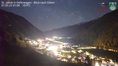 St. Jakob in Defereggen - Blick nach Osten12 km from the summit
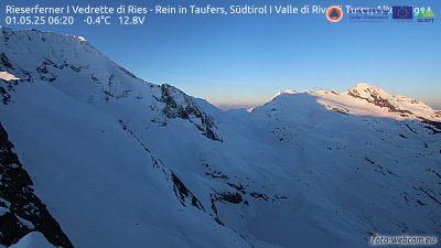 Rieserferner I Vedrette di Ries - Rein in Taufers, Südtirol I Valle di Riva di Tures, Alto Adige12 km from the summit
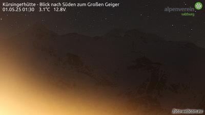 Kürsingerhütte - Blick nach Süden zum Großen Geiger13 km from the summit
 Kürsingerhütte - Blick nach Osten zum Großvenediger13 km from the summit
Towns near Achsel
- Bressanone55 km away
- Saalfelden am Steinernen Meer65 km away
- Innsbruck70 km away