Mountains in Austria
Ameisberg
941 m3,087 ft
Mountain · Bohemian Forest · Austria
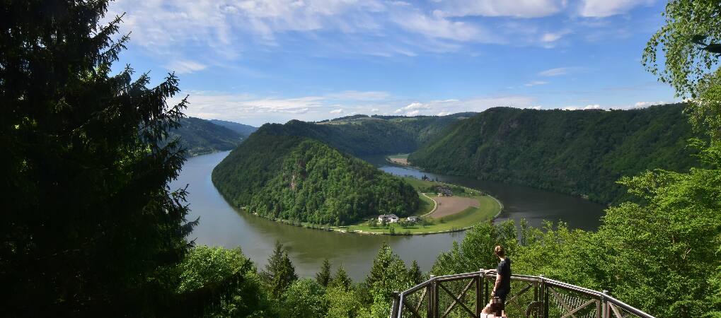
Der Ameisberg ist ein Berg im Westen des oberösterreichischen Mühlviertels und die höchste Erhebung des so genannten Ameisbergzugs. Er liegt auf dem Gebiet der Gemeinde Atzesberg.
From German Wikipedia, CC BY-SA · Read the article
At the summit · forecast for 12:00 AM
0 °CMostly clear · wind 6 km/h from the E
 See it in 3D
Weather at the summit of Ameisberg, 941 m
- 12:00 AM0 °CE 6 km/h–
- 3:00 AM-0 °CNE 7 km/h–
- 6:00 AM0 °CNE 8 km/h–
- 9:00 AM4 °CE 9 km/h–
- 12:00 PM8 °CSE 9 km/h–
- 3:00 PM9 °CSE 10 km/h–
- 6:00 PM5 °CE 11 km/h–
- 9:00 PM4 °CE 10 km/h–
| Day | Sky | High / low | Rain | Wind up to |
|---|---|---|---|---|
| Tue, Oct 27 | Clear | 9 °C / -0 °C | – | 12 km/h |
| Wed, Oct 28 | Light rain | 9 °C / 2 °C | 3.7 mm | 14 km/h |
| Thu, Oct 29 | Cloudy | 9 °C / 3 °C | – | 8 km/h |
| Fri, Oct 30 | Clear | 8 °C / -1 °C | – | 4 km/h |
| Sat, Oct 31 | Cloudy | 5 °C / -1 °C | – | 10 km/h |
| Sun, Nov 1 | Cloudy | 5 °C / -2 °C | – | 4 km/h |
| Mon, Nov 2 | Cloudy | 4 °C / 0 °C | 0.1 mm | 8 km/h |
Forecast by MET Norway (CC BY 4.0), updated 08:16 PM GMT+1. Times are local.
Facts
- What it is
- Mountain
- Height above sea level
- 941 m (3,087 ft)
- Prominence
- 253 m (830 ft)
- Range
- Bohemian Forest
- Country
- Austria
- Coordinates
- 48.555°N 13.834°E
- Source
- Wikidata, CC0
Peaks near Ameisberg
- Staffelberg793 m · 17 km awayOn the map
- Bärenstein1,077 m · 18 km awayOn the map
- Hochficht1,338 m · 21 km awayOn the map
- Mayrhofberg654 m · 22 km awayOn the map
- Plechý / Plöckenstein1,379 m · 24 km awayOn the map
- Bayerischer Plöckenstein1,362 m · 24 km awayOn the map
- Hansberg850 m · 25 km awayOn the map
- Dreisesselberg1,333 m · 26 km awayOn the map
- Haidel1,166 m · 31 km awayOn the map
- Sternstein1,122 m · 32 km awayOn the map
Highest in the Bohemian Forest
- Großer Arber1,456 mOn the map
- Plechý / Plöckenstein1,379 mOn the map
- Boubín1,362 mOn the map
- Hochficht1,338 mOn the map
- Černá hora1,316 mOn the map
- mountain-1177099971,290 mOn the map
- Tetřev1,258 mOn the map
- Knížecí stolec1,236 mOn the map
- Ameisberg941 mOn the map
Highest mountains in Austria
- Grossglockner3,798 mOn the map
- Wildspitze3,768 mOn the map
- Weißkugel3,738 mOn the map
- Großvenediger3,657 mOn the map
- Hintere Schwärze3,624 mOn the map
- Großes Wiesbachhorn3,564 mOn the map
- Ramolkogel3,549 mOn the map
- Schalfkogel3,537 mOn the map
- Watzespitze3,532 mOn the map
- Fineilspitze3,514 mOn the map