Biberlichopf (Hill)
566 m1,857 ft
Hill · Switzerland
Der Biberlichopf ist eine grösstenteils bewaldete Erhebung mit zwei Kuppen, die von Norden in die Linthebene hineinragen. Sie liegt auf dem Gebiet der Gemeinde Schänis östlich von Ziegelbrücke im schweizerischen Kanton St. Gallen.
From German Wikipedia, CC BY-SA · Read the article
At the summit · forecast for 5:00 AM
11 °CClear · wind 4 km/h from the SE
 See it in 3D
Weather at the summit of Biberlichopf (Hill), 566 m
- 5:00 AM11 °CSE 4 km/h–
- 8:00 AM11 °CSE 6 km/h–
- 11:00 AM20 °CN 4 km/h–
- 2:00 PM20 °CNW 6 km/h–
- 5:00 PM16 °CW 2 km/h–
- 8:00 PM12 °CSE 3 km/h–
- 11:00 PM11 °CSE 3 km/h–
- 2:00 AM11 °CS 2 km/h–
| Day | Sky | High / low | Rain | Wind up to |
|---|---|---|---|---|
| Today | Clear | 20 °C / 9 °C | – | 7 km/h |
| Wed, Oct 28 | Light rain | 12 °C / 10 °C | 3 mm | 7 km/h |
| Thu, Oct 29 | Mostly clear | 14 °C / 7 °C | – | 8 km/h |
| Fri, Oct 30 | Mostly clear | 13 °C / 6 °C | – | 5 km/h |
| Sat, Oct 31 | Mostly clear | 13 °C / 3 °C | – | 6 km/h |
| Sun, Nov 1 | Clear | 14 °C / 5 °C | – | 5 km/h |
| Mon, Nov 2 | Clear | 14 °C / 6 °C | 0.1 mm | 5 km/h |
Forecast by MET Norway (CC BY 4.0), updated 02:17 AM GMT+1. Times are local.
Facts
- What it is
- Hill
- Height above sea level
- 566 m (1,857 ft)
- Country
- Switzerland
- Coordinates
- 47.133°N 9.069°E
- Source
- Wikidata, CC0
Biberlichopf
Hügel in Schänis im Kanton St. Gallen, Schweiz
Der Biberlichopf ist eine grösstenteils bewaldete Erhebung mit zwei Kuppen, die von Norden in die Linthebene hineinragen. Sie liegt auf dem Gebiet der Gemeinde Schänis östlich von Ziegelbrücke im schweizerischen Kanton St. Gallen. Die Kuppen erreichen eine Höhe von 554 und 565 m ü. M. Der letztgenannte Punkt ist ein vielbesuchter Rastplatz rund 140 Meter über der Ebene.
From German Wikipedia, CC BY-SA · Read the article
Peaks near Biberlichopf (Hill)
- Säntis2,501 m · 24 km awayOn the map
- Altmann2,435 m · 26 km awayOn the map
- Piz Sardona3,056 m · 27 km awayOn the map
- Piz Segnas3,098 m · 28 km awayOn the map
- Hausstock3,158 m · 29 km awayOn the map
- Vorab3,028 m · 30 km awayOn the map
- Pizol2,844 m · 31 km awayOn the map
- Grosser Mythen1,898 m · 31 km awayOn the map
- Ringelspitz3,247 m · 33 km awayOn the map
- Pfannenstiel853 m · 35 km awayOn the map
Highest mountains in Switzerland
- Dufourspitze4,634 mOn the map
- Dom4,546 mOn the map
- Lyskamm4,532 mOn the map
- Weisshorn4,505 mOn the map
- Matterhorn4,478 mOn the map
- Dent Blanche4,357 mOn the map
- Grand Combin4,309 mOn the map
- Finsteraarhorn4,274 mOn the map
- Zinalrothorn4,221 mOn the map
- Alphubel4,206 mOn the map
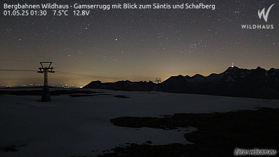
Webcams near Biberlichopf (Hill)



History around Biberlichopf (Hill)
Towns near Biberlichopf (Hill)
- Jona20 km away
- Rapperswil21 km away
- Einsiedeln24 km away
- Wetzikon30 km away
- Herisau32 km away
- Schwyz34 km away