 See it in 3D

Facts
- What it is
- Mountain
- Height above sea level
- 358 m (1,175 ft)
- Prominence
- 140 m (459 ft)
- Country
- Austria
- Coordinates
- 48.321°N 16.363°E
- Source
- Wikidata, CC0
Peaks near Bisamberg
- Leopoldsberg425 m · 4.8 km awayOn the map
- Kahlenberg484 m · 5.4 km awayOn the map
- Burgstall295 m · 5.7 km awayOn the map
- Vogelsangberg516 m · 6.6 km awayOn the map
- Latisberg492 m · 7 km awayOn the map
- Reisenberg382 m · 7 km awayOn the map
- Hermannskogel544 m · 7.5 km awayOn the map
- Hohe Warte220 m · 7.9 km awayOn the map
- Meiselberg291 m · 8.2 km awayOn the map
- Neuberg418 m · 8.3 km awayOn the map
Highest mountains in Austria
- Grossglockner3,798 mOn the map
- Wildspitze3,768 mOn the map
- Weißkugel3,738 mOn the map
- Großvenediger3,657 mOn the map
- Hintere Schwärze3,624 mOn the map
- Großes Wiesbachhorn3,564 mOn the map
- Ramolkogel3,549 mOn the map
- Schalfkogel3,537 mOn the map
- Watzespitze3,532 mOn the map
- Fineilspitze3,514 mOn the map
Webcams near Bisamberg
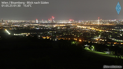 Wien / Bisamberg - Blick nach Süden1.8 km from the summit
A22, bei Strebersdorf, Blickrichtung Stockerau - Km 12,502.3 km from the summit
A22, bei Strebersdorf, Blickrichtung Kaisermühlen - Km 12,502.3 km from the summit
A22, zwischen Korneuburg Ost und Raststation Korneuburg West, Blickrichtung Kaisermühlen - Km 17,283.7 km from the summit
History around Bisamberg
Towns near Bisamberg
- Klosterneuburg3.3 km away
- Vienna13 km away
- Stockerau13 km away
- Perchtoldsdorf24 km away
- Mödling27 km away
- Baden36 km away