Mountains in United States
See it in 3DBrawley Peaks
9,291 ft2,832 m
Mountain · United States
The Brawley Peaks are a mountain range in Mono County, California.
From Wikipedia, CC BY-SA · Read the article
Facts
- What it is
- Mountain
- Height above sea level
- 9,291 ft (2,832 m)
- Country
- United States
- Coordinates
- 38.237°N 118.934°W
- Source
- Wikidata, CC0
Peaks near Brawley Peaks
- Powell Mountain (Mineral County, Nevada)9,524 ft · 23 km awayOn the map
- Dunderberg Peak12,379 ft · 35 km awayOn the map
- Mount Warren12,326 ft · 37 km awayOn the map
- Mount Patterson11,673 ft · 39 km awayOn the map
- Mono–Inyo Craters9,172 ft · 40 km awayOn the map
- Excelsior Mountain12,438 ft · 40 km awayOn the map
- Twin Peaks12,293 ft · 41 km awayOn the map
- Eagle Peak11,854 ft · 42 km awayOn the map
- Tioga Peak11,526 ft · 42 km awayOn the map
- Matterhorn Peak12,301 ft · 42 km awayOn the map
Highest mountains in United States
- Denali20,308 ftOn the map
- Mount Saint Elias18,009 ftOn the map
- Mount Foraker17,402 ftOn the map
- Mount Bona16,535 ftOn the map
- Mount Blackburn16,390 ftOn the map
- Mount Sanford16,237 ftOn the map
- Mount Vancouver15,787 ftOn the map
- Mount Churchill15,636 ftOn the map
- Mount Fairweather15,325 ftOn the map
- Mount Hubbard14,951 ftOn the map
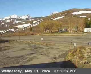
Webcams near Brawley Peaks

Towns near Brawley Peaks
- Mammoth Lakes68 km away