Bumpass Mountain
8,757 ft2,669 m
Mountain · California Cascades · United States
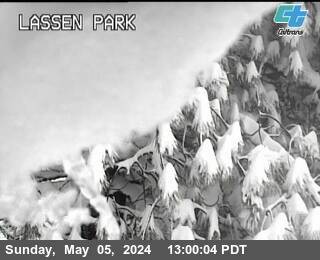
Bumpass Mountain is a mountain located south of Lassen Peak in Lassen Volcanic National Park, California. It rises to an elevation of 8,753 feet (2,668 m) near Bumpass Hell and Lake Helen. The mountain receives heavy snowfall during the winter, which can lead to deep snowpacks of over 300 inches near the mountain.
From Wikipedia, CC BY-SA · Read the article
At the summit · forecast for 5:00 PM
33 °FClear · wind 7 mph from the SW
 See it in 3D
Weather at the summit of Bumpass Mountain, 8,757 ft
- 5:00 PM33 °FSW 7 mph–
- 8:00 PM25 °FS 4 mph–
- 11:00 PM25 °FS 4 mph–
- 2:00 AM25 °FS 4 mph–
- 5:00 AM24 °FSW 5 mph–
- 8:00 AM25 °FSW 5 mph–
- 11:00 AM33 °FSW 8 mph–
- 2:00 PM35 °FW 9 mph–
| Day | Sky | High / low | Rain | Wind up to |
|---|---|---|---|---|
| Tue, Oct 27 | Partly cloudy | 36 °F / 23 °F | – | 9 mph |
| Wed, Oct 28 | Mostly clear | 44 °F / 23 °F | – | 6 mph |
| Thu, Oct 29 | Cloudy | 39 °F / 25 °F | – | 8 mph |
| Fri, Oct 30 | Clear | 34 °F / 23 °F | – | 9 mph |
| Sat, Oct 31 | Partly cloudy | 30 °F / 20 °F | – | 11 mph |
| Sun, Nov 1 | Clear | 37 °F / 19 °F | – | 5 mph |
| Mon, Nov 2 | Clear | 47 °F / 26 °F | – | 6 mph |
Forecast by MET Norway (CC BY 4.0), updated 04:20 PM PDT. Times are local.
Facts
- What it is
- Mountain
- Height above sea level
- 8,757 ft (2,669 m)
- Range
- California Cascades
- Country
- United States
- Coordinates
- 40.461°N 121.499°W
- Source
- Wikidata, CC0
Bumpass Mountain
Mountain in California, U.S.
Bumpass Mountain is a mountain located south of Lassen Peak in Lassen Volcanic National Park, California. It rises to an elevation of 8,753 feet (2,668 m) near Bumpass Hell and Lake Helen. The mountain receives heavy snowfall during the winter, which can lead to deep snowpacks of over 300 inches near the mountain.
From Wikipedia, CC BY-SA · Read the article
Peaks near Bumpass Mountain
- Lassen Peak10,463 ft · 3 km awayOn the map
- Mount Tehama9,239 ft · 5.4 km awayOn the map
- Chaos Crags8,123 ft · 7.2 km awayOn the map
- Cinder Cone and the Fantastic Lava Beds6,907 ft · 18 km awayOn the map
- Twin Buttes5,340 ft · 36 km awayOn the map
- Big Cave4,131 ft · 56 km awayOn the map
- Mount Helen8,842 ft · 1.1 km awayOn the map
- Eagle Peak9,222 ft · 2.4 km awayOn the map
- Diamond Peak7,968 ft · 2.5 km awayOn the map
- Pilot PinnacleMountain · 3 km awayOn the map
Highest in the California Cascades
- Mount Shasta14,180 ftOn the map
- Shastina12,335 ftOn the map
- Lassen Peak10,463 ftOn the map
- Mount Tehama9,239 ftOn the map
- Bumpass Mountain8,757 ftOn the map
- Crater Peak8,684 ftOn the map
- Loomis Peak8,658 ftOn the map
- Prospect Peak8,323 ftOn the map
- Mount Conard8,117 ftOn the map
Highest mountains in United States
- Denali20,308 ftOn the map
- Mount Saint Elias18,009 ftOn the map
- Mount Foraker17,402 ftOn the map
- Mount Bona16,535 ftOn the map
- Mount Blackburn16,390 ftOn the map
- Mount Sanford16,237 ftOn the map
- Mount Vancouver15,787 ftOn the map
- Mount Churchill15,636 ftOn the map
- Mount Fairweather15,325 ftOn the map
- Mount Hubbard14,951 ftOn the map