Campbell Hill, New South Wales
123 m404 ft
Mountain · Australia
Campbell Hill is a mountain located in Piggabeen, New South Wales, Australia.
From Wikipedia, CC BY-SA · Read the article
At the summit · forecast for 7:00 PM
18 °CPartly cloudy · wind 17 km/h from the SE
Weather at the summit of Campbell Hill, New South Wales, 123 m
- 7:00 PM18 °CSE 17 km/h–
- 10:00 PM15 °CSW 11 km/h–
- 1:00 AM14 °CW 9 km/h–
- 4:00 AM14 °CSW 11 km/h–
- 7:00 AM19 °CSW 11 km/h–
- 10:00 AM23 °CE 12 km/h0.8 mm
- 1:00 PM23 °CE 19 km/h0.6 mm
- 4:00 PM21 °CE 16 km/h–
| Day | Sky | High / low | Rain | Wind up to |
|---|---|---|---|---|
| Fri, Oct 30 | Partly cloudy | 24 °C / 14 °C | 1.4 mm | 20 km/h |
| Sat, Oct 31 | Mostly clear | 23 °C / 13 °C | – | 26 km/h |
| Sun, Nov 1 | Rain | 25 °C / 17 °C | 2.2 mm | 22 km/h |
| Mon, Nov 2 | Rain | 28 °C / 18 °C | 2.5 mm | 9 km/h |
| Tue, Nov 3 | Heavy rain | 27 °C / 19 °C | 6.2 mm | 17 km/h |
| Wed, Nov 4 | Rain | 29 °C / 18 °C | 2.4 mm | 17 km/h |
| Thu, Nov 5 | Rain | 28 °C / 19 °C | 1.8 mm | 19 km/h |
Forecast by MET Norway (CC BY 4.0), updated 11:17 AM GMT+10. Times are local.
Facts
- What it is
- Mountain
- Height above sea level
- 123 m (404 ft)
- Country
- Australia
- Coordinates
- 28.200°S 153.450°E
- Source
- Wikidata, CC0
Campbell Hill (New South Wales)
Mountain in New South Wales, Australia
Campbell Hill is a mountain located in Piggabeen, New South Wales, Australia. It is located in the region of the Tweed Shire in the state of New South Wales, in the eastern part of the country, 900 kilometres (560 mi) north of the capital, Canberra, approximately 107 kilometres (66 mi) from Brisbane and 24 kilometres (15 mi) from Surfers Paradise. Campbell Hill is approximately 123 metres (404 ft) above sea level.
From Wikipedia, CC BY-SA · Read the article
Peaks near Campbell Hill, New South Wales
- Mount Nimmel489 m · 16 km awayOn the map
- Mount Warning1,156 m · 28 km awayOn the map
- Mount Chincogan260 m · 37 km awayOn the map
- Currumbin RockMountain · 8.9 km awayOn the map
- Mount BithongabelMountain · 27 km awayOn the map
- Tweed VolcanoVolcano · 28 km awayOn the map
- Glow-Worm Caves Tamborine MountainMountain · 39 km awayOn the map
- Tamborine Mountain525 m · 39 km awayOn the map
- Mount NardiMountain · 42 km awayOn the map
- Bar MountainMountain · 43 km awayOn the map
Highest mountains in Australia
- Mawson Peak2,745 mOn the map
- Mount Kosciuszko2,228 mOn the map
- Rams Head2,190 mOn the map
- Mount Bogong1,986 mOn the map
- Mount Feathertop1,922 mOn the map
- Bimberi Peak1,912 mOn the map
- Mount Loch1,865 mOn the map
- Mount Hotham1,861 mOn the map
- Mount Gingera1,857 mOn the map
- Mount Kelly1,829 mOn the map
Webcams near Campbell Hill, New South Wales
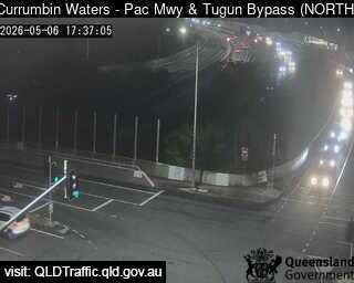 Currumbin Waters - Pacific Motorway M1 & Tugun Bypass - North6.7 km from the summit
 Tugun - Gold Coast Highway & Wyberba Street - South7.6 km from the summit
 Bilinga - Gold Coast Highway & Terminal Drive - North7.6 km from the summit
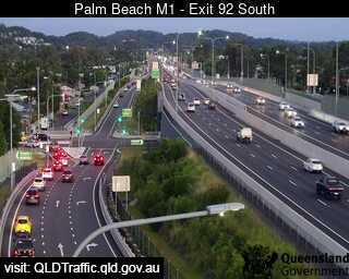 Palm Beach - Pacific Motorway Exit 92 - South - 42218.7 km from the summit
History around Campbell Hill, New South Wales
Towns near Campbell Hill, New South Wales
- Gold Coast22 km away
- Logan City71 km away
- Capalaba77 km away