Corn Hill
118 ft36 m
Mountain · United States
Corn Hill is a hill in Barnstable County, Massachusetts. It is located 2.2 miles (3.5 km) south of North Truro in the Town of Truro. Smalls Hill is located east of Corn Hill.
From Wikipedia, CC BY-SA · Read the article
At the summit · forecast for 7:00 PM
60 °FClear · wind 14 mph from the W
Weather at the summit of Corn Hill, 118 ft
- 7:00 PM60 °FW 14 mph–
- 10:00 PM59 °FNW 19 mph–
- 1:00 AM56 °FN 20 mph–
- 4:00 AM54 °FN 26 mph–
- 7:00 AM50 °FN 23 mph–
- 10:00 AM48 °FN 19 mph–
- 1:00 PM47 °FN 16 mph–
- 4:00 PM46 °FN 12 mph–
| Day | Sky | High / low | Rain | Wind up to |
|---|---|---|---|---|
| Tue, Oct 27 | Mostly clear | 57 °F / 46 °F | – | 26 mph |
| Wed, Oct 28 | Mostly clear | 53 °F / 49 °F | – | 15 mph |
| Thu, Oct 29 | Cloudy | 58 °F / 53 °F | – | 21 mph |
| Fri, Oct 30 | Mostly clear | 59 °F / 56 °F | – | 19 mph |
| Sat, Oct 31 | Partly cloudy | 57 °F / 54 °F | – | 19 mph |
| Sun, Nov 1 | Clear | 56 °F / 54 °F | – | 6 mph |
| Mon, Nov 2 | Clear | 57 °F / 54 °F | – | 13 mph |
Forecast by MET Norway (CC BY 4.0), updated 03:16 PM EDT. Times are local.
Facts
- What it is
- Mountain
- Height above sea level
- 118 ft (36 m)
- Country
- United States
- Coordinates
- 42.004°N 70.080°W
- Source
- Wikidata, CC0
Corn Hill (Massachusetts)
Hill in Massachusetts, US
Corn Hill is a hill in Barnstable County, Massachusetts. It is located 2.2 miles (3.5 km) south of North Truro in the Town of Truro. Smalls Hill is located east of Corn Hill. The Pilgrims are believed to have discovered a cache of Payomet Indian seed corn from the top of Corn Hill in November 1620, before they moved on from their landing at today’s Provincetown to the current location of Plymouth.
From Wikipedia, CC BY-SA · Read the article
Peaks near Corn Hill
- Griffin Island75 ft · 7 km awayOn the map
- High Pole Hill85 ft · 10 km awayOn the map
- Town Hill56 ft · 11 km awayOn the map
- Little Beach Hill3 ft · 11 km awayOn the map
- Skiff Hill46 ft · 22 km awayOn the map
- Scargo Hill160 ft · 31 km awayOn the map
- Hokum Rock98 ft · 31 km awayOn the map
- Barrier Dunes2 ft · 49 km awayOn the map
- Pine Hill306 ft · 52 km awayOn the map
- Wills Hill33 ft · 56 km awayOn the map
Highest mountains in United States
- Denali20,308 ftOn the map
- Mount Saint Elias18,009 ftOn the map
- Mount Foraker17,402 ftOn the map
- Mount Bona16,535 ftOn the map
- Mount Blackburn16,390 ftOn the map
- Mount Sanford16,237 ftOn the map
- Mount Vancouver15,787 ftOn the map
- Mount Churchill15,636 ftOn the map
- Mount Fairweather15,325 ftOn the map
- Mount Hubbard14,951 ftOn the map
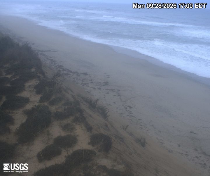
Webcams near Corn Hill

Towns near Corn Hill
- Yarmouth35 km away
- Barnstable38 km away
- Duxbury49 km away
- Hanover62 km away
- Middleborough70 km away
- Rockland70 km away