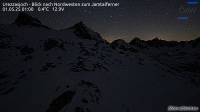
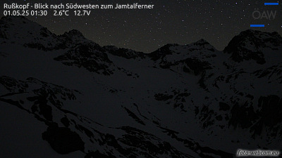
Dreiländerspitze
3,197 m10,489 ft
Mountain · Silvretta Alps · Austria · Switzerland
The Dreiländerspitze is with 3,197 m (10,489 ft) one of the higher mountains in the Silvretta range in the eastern Alps and located on the Austria–Switzerland border. The borders of the Swiss canton of Graubünden and the Austrian states of Vorarlberg and Tyrol meet at the peak.
From Wikipedia, CC BY-SA · Read the article
At the summit · forecast for 12:00 AM
-5 °CClear · wind 3 km/h from the NE
 See it in 3D
Weather at the summit of Dreiländerspitze, 3,197 m
- 12:00 AM-5 °CNE 3 km/h–
- 3:00 AM-5 °CN 3 km/h–
- 6:00 AM-5 °CN 4 km/h–
- 9:00 AM-3 °CNW 4 km/h–
- 12:00 PM-2 °CN 7 km/h0.4 mm
- 3:00 PM-3 °CN 7 km/h–
- 6:00 PM-5 °CN 4 km/h–
- 9:00 PM-6 °CN 4 km/h–
| Day | Sky | High / low | Rain | Wind up to |
|---|---|---|---|---|
| Today | Light snow | -2 °C / -6 °C | 0.4 mm | 7 km/h |
| Thu, Oct 29 | Clear | -1 °C / -11 °C | – | 9 km/h |
| Fri, Oct 30 | Clear | -1 °C / -9 °C | – | 7 km/h |
| Sat, Oct 31 | Clear | -0 °C / -10 °C | – | 3 km/h |
| Sun, Nov 1 | Clear | -1 °C / -10 °C | – | 8 km/h |
| Mon, Nov 2 | Clear | -4 °C / -10 °C | – | 10 km/h |
| Tue, Nov 3 | Partly cloudy | -5 °C / -12 °C | 0.4 mm | 10 km/h |
Forecast by MET Norway (CC BY 4.0), updated 08:17 PM GMT+1. Times are local.
Facts
- What it is
- Mountain
- Height above sea level
- 3,197 m (10,489 ft)
- Prominence
- 306 m (1,004 ft)
- Isolation
- 1.9 km to higher ground
- Range
- Silvretta Alps
- Parent peak
- Augstenberg
- Countries
- Austria, Switzerland
- First ascent
- July 14, 1870
- Coordinates
- 46.851°N 10.145°E
- Source
- Wikidata, CC0
Dreiländerspitze
Mountain in Switzerland
The Dreiländerspitze is with 3,197 m (10,489 ft) one of the higher mountains in the Silvretta range in the eastern Alps and located on the Austria–Switzerland border. The borders of the Swiss canton of Graubünden and the Austrian states of Vorarlberg and Tyrol meet at the peak. Its name refers to a meeting point between the territories of three ancient tribes and their languages.
From Wikipedia, CC BY-SA · Read the article
Peaks near Dreiländerspitze
- Piz Buin3,312 m · 2.1 km awayOn the map
- Silvrettahorn3,244 m · 4.1 km awayOn the map
- Fluchthorn3,397 m · 7.8 km awayOn the map
- Piz Linard3,411 m · 8.1 km awayOn the map
- Patteriol3,056 m · 22 km awayOn the map
- Galzig2,185 m · 32 km awayOn the map
- Piz Kesch3,418 m · 33 km awayOn the map
- Valluga2,809 m · 35 km awayOn the map
- Untere Wildgrubenspitze2,753 m · 35 km awayOn the map
- Roggspitze2,747 m · 35 km awayOn the map
Parent peak
The nearest higher peak its prominence is measured to.
- Augstenberg3,228 mOn the map
Highest in the Silvretta Alps
- Piz Linard3,411 mOn the map
- Fluchthorn3,397 mOn the map
- Piz Buin3,312 mOn the map
- Verstanclahorn3,298 mOn the map
- Piz Fliana3,281 mOn the map
- Augstenberg3,228 mOn the map
- Plattenhörner3,220 mOn the map
- Dreiländerspitze3,197 mOn the map
- Piz Tasna3,179 mOn the map
Highest mountains in Austria
- Grossglockner3,798 mOn the map
- Wildspitze3,768 mOn the map
- Weißkugel3,738 mOn the map
- Großvenediger3,657 mOn the map
- Hintere Schwärze3,624 mOn the map
- Großes Wiesbachhorn3,564 mOn the map
- Ramolkogel3,549 mOn the map
- Schalfkogel3,537 mOn the map
- Watzespitze3,532 mOn the map
- Fineilspitze3,514 mOn the map