Eiger
3,967 m13,015 ft
Mountain · Jungfrau-Fiescherhorn Group · Switzerland
The Eiger is a 3,967-metre (13,015 ft) mountain of the Bernese Alps, overlooking Grindelwald and Lauterbrunnen in the Bernese Oberland of Switzerland, just north of the main watershed and border with Valais.
From Wikipedia, CC BY-SA · Read the article
At the summit · forecast for 12:00 AM
-5 °CPartly cloudy · wind 4 km/h from the SW
 See it in 3D
Weather at the summit of Eiger, 3,967 m
- 12:00 AM-5 °CSW 4 km/h–
- 3:00 AM-7 °CS 4 km/h–
- 6:00 AM-7 °CS 4 km/h–
- 9:00 AM-3 °CSW 4 km/h–
- 12:00 PM-0 °CNW 3 km/h–
- 3:00 PM-1 °CNW 5 km/h–
- 6:00 PM-6 °CSW 3 km/h–
- 9:00 PM-9 °CS 5 km/h–
| Day | Sky | High / low | Rain | Wind up to |
|---|---|---|---|---|
| Tue, Oct 27 | Clear | -0 °C / -11 °C | – | 5 km/h |
| Wed, Oct 28 | Partly cloudy | -7 °C / -12 °C | 0.5 mm | 6 km/h |
| Thu, Oct 29 | Clear | -4 °C / -11 °C | – | 5 km/h |
| Fri, Oct 30 | Clear | -4 °C / -10 °C | – | 3 km/h |
| Sat, Oct 31 | Mostly clear | -4 °C / -9 °C | – | 4 km/h |
| Sun, Nov 1 | Clear | -5 °C / -11 °C | – | 4 km/h |
| Mon, Nov 2 | Clear | -7 °C / -14 °C | – | 4 km/h |
Forecast by MET Norway (CC BY 4.0), updated 08:17 PM GMT+1. Times are local.
Facts
- What it is
- Mountain
- Height above sea level
- 3,967 m (13,015 ft)
- Prominence
- 361 m (1,184 ft)
- Isolation
- 2.2 km to higher ground
- Range
- Jungfrau-Fiescherhorn Group
- Parent peak
- Mönch
- Country
- Switzerland
- Coordinates
- 46.578°N 8.005°E
- Source
- Wikidata, CC0
Eiger
Mountain in the Bernese Alps, Switzerland
The Eiger is a 3,967-metre (13,015 ft) mountain of the Bernese Alps, overlooking Grindelwald and Lauterbrunnen in the Bernese Oberland of Switzerland, just north of the main watershed and border with Valais. It is the easternmost peak of a ridge crest that extends across the Mönch to the Jungfrau at 4,158 m (13,642 ft), constituting one of the most emblematic sights of the Swiss Alps.
From Wikipedia, CC BY-SA · Read the article
Peaks near Eiger
- Mönch4,110 m · 2.2 km awayOn the map
- Trugberg3,932 m · 3.5 km awayOn the map
- Gross Fiescherhorn4,049 m · 5.2 km awayOn the map
- Jungfrau4,158 m · 5.6 km awayOn the map
- Hinter Fiescherhorn4,025 m · 5.9 km awayOn the map
- Männlichen2,343 m · 6.8 km awayOn the map
- Gross Grünhorn4,043 m · 7.5 km awayOn the map
- Gletscherhorn3,982 m · 7.8 km awayOn the map
- Ebnefluh3,961 m · 8.7 km awayOn the map
- Schreckhorn4,078 m · 8.7 km awayOn the map
Parent peak
The nearest higher peak its prominence is measured to.
- Mönch4,110 mOn the map
Highest in the Jungfrau-Fiescherhorn Group
- Jungfrau4,158 mOn the map
- Mönch4,110 mOn the map
- Gross Fiescherhorn4,049 mOn the map
- Gross Grünhorn4,043 mOn the map
- Eiger3,967 mOn the map
- Trugberg3,932 mOn the map
- Gross Wannenhorn3,906 mOn the map
- Strahlhorn3,027 mOn the map
- Eggishorn2,926 mOn the map
Highest mountains in Switzerland
- Dufourspitze4,634 mOn the map
- Dom4,546 mOn the map
- Lyskamm4,532 mOn the map
- Weisshorn4,505 mOn the map
- Matterhorn4,478 mOn the map
- Dent Blanche4,357 mOn the map
- Grand Combin4,309 mOn the map
- Finsteraarhorn4,274 mOn the map
- Zinalrothorn4,221 mOn the map
- Alphubel4,206 mOn the map
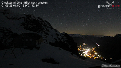
Webcams near Eiger



History around Eiger
Towns near Eiger
- Thun35 km away
- Steffisburg36 km away
- Sierre48 km away
- Kriens55 km away
- Domodossola56 km away
- Littau56 km away