Mountains in Austria
Funtenseetauern
2,578 m8,458 ft
Mountain · Steinernes Meer · Austria · Germany
The Funtenseetauern is a 2,579 m high border peak between Germany and Austria on the northern edge of the Steinernes Meer, one of the nine massifs of the Berchtesgaden Alps. The Funtenseetauern rises south of Berchtesgaden, its broad shoulder towering over the lakes of Königssee and Obersee.
From Wikipedia, CC BY-SA · Read the article
At the summit · forecast for 7:00 AM
-0 °CCloudy · wind 3 km/h from the SW
 See it in 3D
Weather at the summit of Funtenseetauern, 2,578 m
- 7:00 AM-0 °CSW 3 km/h–
- 10:00 AM0 °CSW 3 km/h–
- 1:00 PM3 °CW 3 km/h–
- 4:00 PM2 °CSW 2 km/h–
- 7:00 PM-2 °CS 4 km/h–
- 10:00 PM-0 °CSW 4 km/h–
- 1:00 AM2 °CNW 4 km/h–
- 4:00 AM-0 °CNW 5 km/h–
| Day | Sky | High / low | Rain | Wind up to |
|---|---|---|---|---|
| Today | Partly cloudy | 3 °C / -2 °C | – | 5 km/h |
| Wed, Oct 28 | Snow | 2 °C / -4 °C | 10.3 mm | 9 km/h |
| Thu, Oct 29 | Cloudy | -2 °C / -5 °C | – | 5 km/h |
| Fri, Oct 30 | Clear | 1 °C / -7 °C | – | 4 km/h |
| Sat, Oct 31 | Clear | 4 °C / -5 °C | – | 4 km/h |
| Sun, Nov 1 | Clear | 4 °C / -3 °C | – | 3 km/h |
| Mon, Nov 2 | Mostly clear | -1 °C / -8 °C | – | 4 km/h |
Forecast by MET Norway (CC BY 4.0), updated 02:17 AM GMT+1. Times are local.
Facts
- What it is
- Mountain
- Height above sea level
- 2,578 m (8,458 ft)
- Isolation
- 3.9 km to higher ground
- Range
- Steinernes Meer
- Coordinates
- 47.485°N 12.977°E
- Source
- Wikidata, CC0
Peaks near Funtenseetauern
- Grießkogel2,543 m · 1.2 km awayOn the map
- Schönfeldspitze2,653 m · 4.2 km awayOn the map
- Breithorn2,504 m · 6.4 km awayOn the map
- Persailhorn2,347 m · 7 km awayOn the map
- Großer Hundstod2,594 m · 7.5 km awayOn the map
- Hochkönig2,941 m · 9.6 km awayOn the map
- Hochkalter2,607 m · 13 km awayOn the map
- Hoher Göll2,522 m · 14 km awayOn the map
- Schottmalhorn1,982 m · 18 km awayOn the map
- Stadelhorn2,286 m · 18 km awayOn the map
Highest in the Steinernes Meer
- Selbhorn2,655 mOn the map
- Schönfeldspitze2,653 mOn the map
- Brandhorn2,610 mOn the map
- Großer Hundstod2,594 mOn the map
- Funtenseetauern2,578 mOn the map
- Breithorn2,504 mOn the map
- Schneiber2,330 mOn the map
- Schottmalhorn2,225 mOn the map
- Rauchkopf1,953 mOn the map
Highest mountains in Austria
- Grossglockner3,798 mOn the map
- Wildspitze3,768 mOn the map
- Weißkugel3,738 mOn the map
- Großvenediger3,657 mOn the map
- Hintere Schwärze3,624 mOn the map
- Großes Wiesbachhorn3,564 mOn the map
- Ramolkogel3,549 mOn the map
- Schalfkogel3,537 mOn the map
- Watzespitze3,532 mOn the map
- Fineilspitze3,514 mOn the map
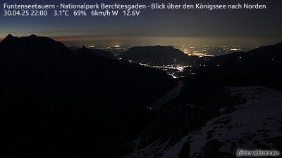
Webcams near Funtenseetauern


History around Funtenseetauern
Towns near Funtenseetauern
- Saalfelden am Steinernen Meer12 km away
- Bad Reichenhall28 km away
- Salzburg35 km away
- Freilassing40 km away
- Traunstein49 km away
- Traunreut60 km away