Mountains in Austria
Geißkopf
1,198 m3,930 ft
Mountain · Bregenz Forest Mountains · Austria
Der Geißkopf ist ein 1198 m ü. A. hoher Berg im Bregenzerwaldgebirge. Er liegt in der Bregenzerwälder Gemeinde Schwarzenberg im Bezirk Bregenz in Vorarlberg in Österreich.
From German Wikipedia, CC BY-SA · Read the article
 See it in 3D
Facts
- What it is
- Mountain
- Height above sea level
- 1,198 m (3,930 ft)
- Prominence
- 114 m (374 ft)
- Isolation
- 1.7 km to higher ground
- Range
- Bregenz Forest Mountains
- Parent peak
- Hochälpele
- Country
- Austria
- Coordinates
- 47.429°N 9.825°E
- Source
- Wikidata, CC0
Peaks near Geißkopf
- Pfänder1,062 m · 9.3 km awayOn the map
- Damülser Mittagsspitze2,095 m · 14 km awayOn the map
- Glatthorn2,133 m · 19 km awayOn the map
- Hochgrat1,834 m · 20 km awayOn the map
- Hoher Ifen2,230 m · 22 km awayOn the map
- Widderstein2,533 m · 28 km awayOn the map
- Braunarlspitze2,649 m · 29 km awayOn the map
- Rote Wand2,703 m · 30 km awayOn the map
- Mohnenfluh2,542 m · 30 km awayOn the map
- Kanzelwand2,058 m · 31 km awayOn the map
Parent peak
The nearest higher peak its prominence is measured to.
- Hochälpele1,463 mOn the map
Peaks below Geißkopf
- Brüggelekopf1,182 mOn the map
Highest in the Bregenz Forest Mountains
- Damülser Mittagsspitze2,095 mOn the map
- Winterstaude1,877 mOn the map
- Hirschberg1,834 mOn the map
- Geißkopf1,198 mOn the map
Highest mountains in Austria
- Grossglockner3,798 mOn the map
- Wildspitze3,768 mOn the map
- Weißkugel3,738 mOn the map
- Großvenediger3,657 mOn the map
- Hintere Schwärze3,624 mOn the map
- Großes Wiesbachhorn3,564 mOn the map
- Ramolkogel3,549 mOn the map
- Schalfkogel3,537 mOn the map
- Watzespitze3,532 mOn the map
- Fineilspitze3,514 mOn the map
Webcams near Geißkopf
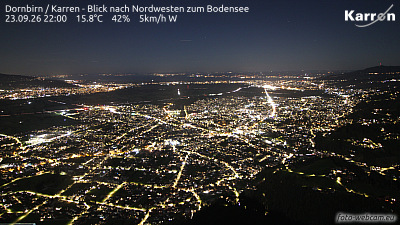 Dornbirn / Karren - Blick nach Nordwesten zum Bodensee7.2 km from the summit
A14, bei Dornbirn Nord, Blickrichtung Hörbranz A / D - Km 14,447.8 km from the summit
A14, bei Dornbirn Nord, Blickrichtung Bregenz - Km 13,648 km from the summit
A14, bei Wolfurt, Blickrichtung Innsbruck - Km 12,438.4 km from the summit