Mountains in Austria
Glungezer
2,677 m8,783 ft
Mountain · Tux Alps · Austria
At the summit · forecast for 12:00 AM
-6 °CMostly clear · wind 3 km/h from the SE
 See it in 3D
Weather at the summit of Glungezer, 2,677 m
- 12:00 AM-6 °CSE 3 km/h–
- 3:00 AM-5 °CSE 2 km/h–
- 6:00 AM-4 °CSE 2 km/h–
- 9:00 AM1 °CSE 3 km/h–
- 12:00 PM6 °CN 4 km/h–
- 3:00 PM7 °CNW 4 km/h–
- 6:00 PM2 °CSE 2 km/h–
- 9:00 PM-2 °CSE 2 km/h–
| Day | Sky | High / low | Rain | Wind up to |
|---|---|---|---|---|
| Today | Clear | 7 °C / -6 °C | – | 4 km/h |
| Wed, Oct 28 | Cloudy | 2 °C / -4 °C | 0.9 mm | 7 km/h |
| Thu, Oct 29 | Partly cloudy | 1 °C / -6 °C | – | 6 km/h |
| Fri, Oct 30 | Clear | 4 °C / -7 °C | – | 2 km/h |
| Sat, Oct 31 | Clear | 3 °C / -7 °C | – | 4 km/h |
| Sun, Nov 1 | Clear | 2 °C / -8 °C | – | 3 km/h |
| Mon, Nov 2 | Light snow | -4 °C / -7 °C | 1.8 mm | 3 km/h |
Forecast by MET Norway (CC BY 4.0), updated 08:16 PM GMT+1. Times are local.
Facts
- What it is
- Mountain
- Height above sea level
- 2,677 m (8,783 ft)
- Prominence
- 36 m (118 ft)
- Isolation
- 1.1 km to higher ground
- Range
- Tux Alps
- Country
- Austria
- Coordinates
- 47.209°N 11.528°E
- Source
- Wikidata, CC0
Peaks near Glungezer
- Patscherkofel2,246 m · 5.1 km awayOn the map
- Bergisel746 m · 11 km awayOn the map
- Serles2,717 m · 15 km awayOn the map
- Nordkette2,637 m · 17 km awayOn the map
- Olperer3,476 m · 20 km awayOn the map
- Birkkarspitze2,749 m · 24 km awayOn the map
- Habicht3,277 m · 26 km awayOn the map
- Pflerscher Tribulaun3,097 m · 29 km awayOn the map
- Hochfeiler3,509 m · 30 km awayOn the map
- Großer Möseler3,480 m · 31 km awayOn the map
Highest in the Tux Alps
- Lizumer Reckner2,886 mOn the map
- Rosenjoch2,796 mOn the map
- Rastkogel2,762 mOn the map
- Malgrübler2,749 mOn the map
- Hirzer2,725 mOn the map
- Glungezer2,677 mOn the map
- Pangert2,550 mOn the map
- Marchkopf2,499 mOn the map
- Mölser Berg2,479 mOn the map
Highest mountains in Austria
- Grossglockner3,798 mOn the map
- Wildspitze3,768 mOn the map
- Weißkugel3,738 mOn the map
- Großvenediger3,657 mOn the map
- Hintere Schwärze3,624 mOn the map
- Großes Wiesbachhorn3,564 mOn the map
- Ramolkogel3,549 mOn the map
- Schalfkogel3,537 mOn the map
- Watzespitze3,532 mOn the map
- Fineilspitze3,514 mOn the map
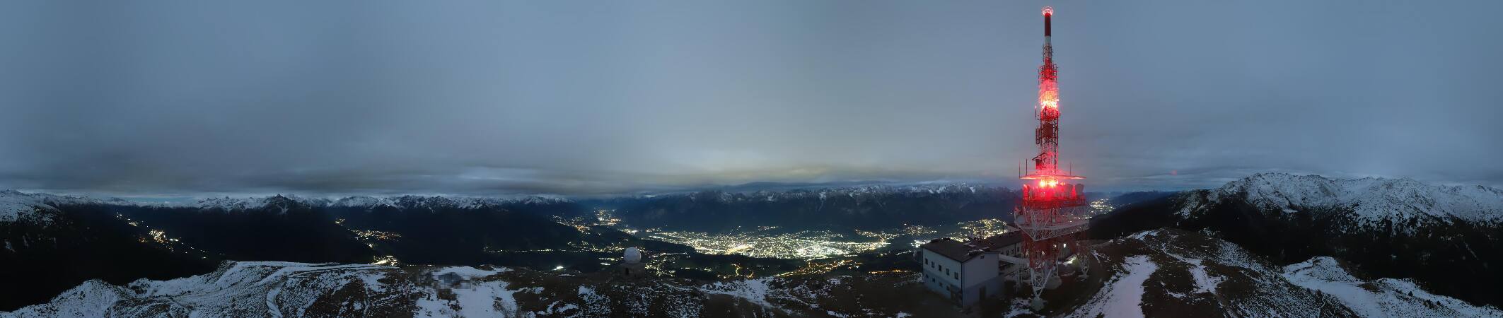
Webcams near Glungezer



History around Glungezer
Towns near Glungezer
- Innsbruck12 km away
- Telfs36 km away
- Garmisch-Partenkirchen45 km away
- Bressanone56 km away
- Bad Tölz61 km away
- Penzberg62 km away