Mountains in Italy
Helm
2,433 m7,982 ft
Mountain · Western Carnic Alps · Italy · Austria
The Helm is a mountain in the Puster Valley in South Tyrol, Italy.
From Wikipedia, CC BY-SA · Read the article
 See it in 3D
Facts
- What it is
- Mountain
- Height above sea level
- 2,433 m (7,982 ft)
- Range
- Western Carnic Alps
- Coordinates
- 46.715°N 12.387°E
- Source
- Wikidata, CC0
Peaks near Helm
- Dreischusterspitze3,145 m · 7 km awayOn the map
- Zwölferkofel3,094 m · 11 km awayOn the map
- Paternkofel2,744 m · 11 km awayOn the map
- Dolomites3,343 m · 21 km awayOn the map
- Monte Cristallo3,221 m · 21 km awayOn the map
- Hohe Gaisl3,146 m · 21 km awayOn the map
- Monte Brentoni2,545 m · 26 km awayOn the map
- Peralba2,694 m · 27 km awayOn the map
- Hochgall3,436 m · 29 km awayOn the map
- Antelao3,264 m · 31 km awayOn the map
Highest in the Western Carnic Alps
- Coglians2,780 mOn the map
- Peralba2,694 mOn the map
- Monte Cavallino2,689 mOn the map
- Porze2,600 mOn the map
- Raudenspitze2,507 mOn the map
- Helm2,433 mOn the map
- Monte Ferro2,348 mOn the map
Highest mountains in Italy
- Mont Blanc4,806 mOn the map
- Lyskamm4,532 mOn the map
- Matterhorn4,478 mOn the map
- Pointe Walker4,208 mOn the map
- Grandes Jorasses4,208 mOn the map
- Dent d'Hérens4,173 mOn the map
- Breithorn4,160 mOn the map
- Helm2,433 mOn the map
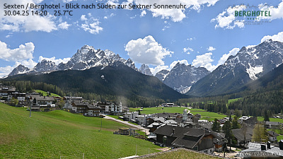
Webcams near Helm



History around Helm
Towns near Helm
- Bressanone56 km away
- Belluno65 km away