Hintere Hintereisspitze
3,485 m11,434 ft
Mountain · Weißkamm · Italy · Austria
Die Hintere Hintereisspitze ist ein 3485 m hoher Gipfel in den Ötztaler Alpen. Sie bildet zusammen mit der Vorderen und Mittleren Hintereisspitze sowie der Hochvernaglwand die südöstliche Umrahmung des Gepatschferners.
From German Wikipedia, CC BY-SA · Read the article
At the summit · forecast for 10:00 PM
-7 °CFog · wind 5 km/h from the N
 See it in 3D
Weather at the summit of Hintere Hintereisspitze, 3,485 m
- 10:00 PM-7 °CN 5 km/h–
- 1:00 AM-9 °CN 4 km/h–
- 4:00 AM-10 °CN 5 km/h–
- 7:00 AM-10 °CN 5 km/h–
- 10:00 AM-5 °CN 5 km/h–
- 1:00 PM-5 °CN 6 km/h–
- 4:00 PM-7 °CN 6 km/h–
- 7:00 PM-12 °CNE 5 km/h–
| Day | Sky | High / low | Rain | Wind up to |
|---|---|---|---|---|
| Thu, Oct 29 | Clear | -5 °C / -12 °C | – | 8 km/h |
| Fri, Oct 30 | Clear | -6 °C / -13 °C | – | 4 km/h |
| Sat, Oct 31 | Clear | -6 °C / -15 °C | – | 6 km/h |
| Sun, Nov 1 | Light snow | -14 °C / -19 °C | 0.7 mm | 10 km/h |
| Mon, Nov 2 | Partly cloudy | -8 °C / -19 °C | – | 6 km/h |
| Tue, Nov 3 | Clear | -6 °C / -12 °C | 0.1 mm | 4 km/h |
| Wed, Nov 4 | Clear | -6 °C / -14 °C | 0.3 mm | 6 km/h |
Forecast by MET Norway (CC BY 4.0), updated 12:19 PM GMT+1. Times are local.
Facts
- What it is
- Mountain
- Height above sea level
- 3,485 m (11,434 ft)
- Isolation
- 2.4 km to higher ground
- Range
- Weißkamm
- Coordinates
- 46.823°N 10.764°E
- Source
- Wikidata, CC0
Hintere Hintereisspitze
Berg in den Ötztaler Alpen an der Grenze Tirol / Südtirol
Die Hintere Hintereisspitze ist ein 3485 m hoher Gipfel in den Ötztaler Alpen. Sie bildet zusammen mit der Vorderen und Mittleren Hintereisspitze sowie der Hochvernaglwand die südöstliche Umrahmung des Gepatschferners. Der Gratkamm dieser benachbarten Gipfel, der Teil des Weißkamms ist, erhebt sich ungefähr 100 m über das Eisfeld.
From German Wikipedia, CC BY-SA · Read the article
Peaks near Hintere Hintereisspitze
- Weißkugel3,738 m · 4 km awayOn the map
- Äußerer Bärenbartkogel3,473 m · 5.7 km awayOn the map
- Schwemser Spitze3,459 m · 6 km awayOn the map
- Saldurspitze3,433 m · 9.4 km awayOn the map
- Wildspitze3,768 m · 10 km awayOn the map
- Similaun3,597 m · 11 km awayOn the map
- Hintere Schwärze3,624 m · 13 km awayOn the map
- Piz Sesvenna3,204 m · 30 km awayOn the map
- Muttler3,294 m · 31 km awayOn the map
- Zuckerhütl3,507 m · 34 km awayOn the map
Highest in the Weißkamm
- Wildspitze3,768 mOn the map
- Weißkugel3,738 mOn the map
- Weißseespitze3,498 mOn the map
- Hintere Hintereisspitze3,485 mOn the map
Highest mountains in Italy
- Mont Blanc4,806 mOn the map
- Lyskamm4,532 mOn the map
- Matterhorn4,478 mOn the map
- Pointe Walker4,208 mOn the map
- Grandes Jorasses4,208 mOn the map
- Dent d'Hérens4,173 mOn the map
- Breithorn4,160 mOn the map
- Hintere Hintereisspitze3,485 mOn the map
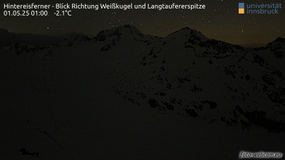
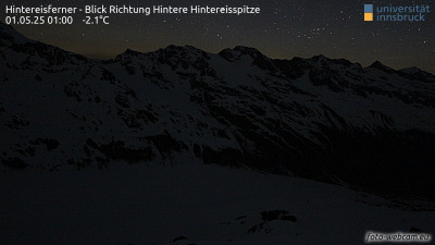
Webcams near Hintere Hintereisspitze


Towns near Hintere Hintereisspitze
- Merano35 km away
- Bolzano57 km away
- Telfs59 km away
- Innsbruck68 km away
- Bressanone69 km away
- Garmisch-Partenkirchen79 km away