Hinterer Seekopf
3,234 m10,610 ft
Mountain · Venediger Group · Austria
Der Hintere Seekopf ist ein 3234 m ü. A. hoher Berggipfel des Eichhamstocks in der Venedigergruppe in Osttirol (Österreich). Er liegt an der Grenze zwischen den Gemeinden Matrei in Osttirol und Prägraten am Großvenediger.
From German Wikipedia, CC BY-SA · Read the article
At the summit · forecast for 12:00 AM
-7 °CClear · wind 4 km/h from the W
 See it in 3D
Weather at the summit of Hinterer Seekopf, 3,234 m
- 12:00 AM-7 °CW 4 km/h–
- 3:00 AM-9 °CW 5 km/h–
- 6:00 AM-11 °CW 6 km/h–
- 9:00 AM-6 °CW 8 km/h–
- 12:00 PM-4 °CNW 6 km/h0.8 mm
- 3:00 PM-5 °CN 6 km/h2.5 mm
- 6:00 PM-5 °CN 7 km/h1.8 mm
- 9:00 PM-6 °CN 7 km/h0.1 mm
| Day | Sky | High / low | Rain | Wind up to |
|---|---|---|---|---|
| Wed, Oct 28 | Snow | -4 °C / -11 °C | 5.2 mm | 8 km/h |
| Thu, Oct 29 | Mostly clear | -6 °C / -15 °C | – | 6 km/h |
| Fri, Oct 30 | Clear | -5 °C / -16 °C | – | 6 km/h |
| Sat, Oct 31 | Clear | -5 °C / -15 °C | – | 3 km/h |
| Sun, Nov 1 | Clear | -6 °C / -14 °C | – | 7 km/h |
| Mon, Nov 2 | Mostly clear | -8 °C / -14 °C | 2.2 mm | 9 km/h |
| Tue, Nov 3 | Snow | -10 °C / -12 °C | 10.5 mm | 10 km/h |
Forecast by MET Norway (CC BY 4.0), updated 08:17 PM GMT+1. Times are local.
Facts
- What it is
- Mountain
- Height above sea level
- 3,234 m (10,610 ft)
- Isolation
- 0.3 km to higher ground
- Range
- Venediger Group
- Country
- Austria
- First ascent
- August 13, 1898
- Coordinates
- 47.071°N 12.409°E
- Source
- Wikidata, CC0
Hinterer Seekopf
Berg in der Venedigergruppe in Tirol
Der Hintere Seekopf ist ein 3234 m ü. A. hoher Berggipfel des Eichhamstocks in der Venedigergruppe in Osttirol (Österreich). Er liegt an der Grenze zwischen den Gemeinden Matrei in Osttirol und Prägraten am Großvenediger. Benachbarte Gipfel sind der Vorderer Seekopf im Nordosten, die Hohe Achsel im Osten und der Kleine Hexenkopf im Süden. Die Erstbesteigung erfolgte am 13. August 1898 durch H. v. Ficker und L.
From German Wikipedia, CC BY-SA · Read the article
Peaks near Hinterer Seekopf
- Rainerhorn3,559 m · 4.8 km awayOn the map
- Großvenediger3,657 m · 6.3 km awayOn the map
- Dreiherrnspitze3,499 m · 13 km awayOn the map
- Großer Muntanitz3,232 m · 14 km awayOn the map
- Rötspitze3,496 m · 16 km awayOn the map
- Glocknerwand3,721 m · 21 km awayOn the map
- Grossglockner3,798 m · 22 km awayOn the map
- Lenkstein3,236 m · 23 km awayOn the map
- Kitzsteinhorn3,203 m · 25 km awayOn the map
- Hochgall3,436 m · 27 km awayOn the map
Highest in the Venediger Group
- Großvenediger3,657 mOn the map
- Dreiherrnspitze3,499 mOn the map
- Rötspitze3,496 mOn the map
- Hoher Eichham3,371 mOn the map
- Großer Geiger3,360 mOn the map
- Keeskogel3,291 mOn the map
- Schlieferspitze3,290 mOn the map
- Hinterer Seekopf3,234 mOn the map
Highest mountains in Austria
- Grossglockner3,798 mOn the map
- Wildspitze3,768 mOn the map
- Weißkugel3,738 mOn the map
- Großvenediger3,657 mOn the map
- Hintere Schwärze3,624 mOn the map
- Großes Wiesbachhorn3,564 mOn the map
- Ramolkogel3,549 mOn the map
- Schalfkogel3,537 mOn the map
- Watzespitze3,532 mOn the map
- Fineilspitze3,514 mOn the map
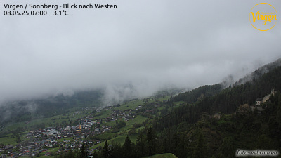
Webcams near Hinterer Seekopf

Towns near Hinterer Seekopf
- Saalfelden am Steinernen Meer52 km away
- Bressanone70 km away
- Innsbruck80 km away