Mountains in Austria
Hochkar
1,808 m5,932 ft
Mountain · Göstlinger Alpen · Austria
Hochkar is a mountain and a ski area located 150 kilometers (93 mi) from Vienna. Located near the small resort of Göstling an der Ybbs on the Steiermark and Lower Austria border, it is popular among skiers who want to leave Vienna for a day, being about a two-hour drive away.
From Wikipedia, CC BY-SA · Read the article
At the summit · forecast for 1:00 AM
-6 °CMostly clear · wind 7 km/h from the SE
 See it in 3D
Weather at the summit of Hochkar, 1,808 m
- 1:00 AM-6 °CSE 7 km/h–
- 4:00 AM-6 °CSE 6 km/h–
- 7:00 AM-5 °CSE 7 km/h–
- 10:00 AM5 °CW 4 km/h–
- 1:00 PM7 °CNW 6 km/h–
- 4:00 PM5 °CN 3 km/h–
- 7:00 PM-1 °CSE 7 km/h–
- 10:00 PM-2 °CSE 11 km/h–
| Day | Sky | High / low | Rain | Wind up to |
|---|---|---|---|---|
| Today | Mostly clear | 7 °C / -6 °C | – | 11 km/h |
| Wed, Oct 28 | Light rain | 7 °C / -2 °C | 5.5 mm | 16 km/h |
| Thu, Oct 29 | Cloudy | 1 °C / -2 °C | 4.3 mm | 15 km/h |
| Fri, Oct 30 | Mostly clear | 5 °C / -3 °C | – | 8 km/h |
| Sat, Oct 31 | Clear | 6 °C / -6 °C | – | 6 km/h |
| Sun, Nov 1 | Clear | 9 °C / -4 °C | – | 10 km/h |
| Mon, Nov 2 | Cloudy | 0 °C / -2 °C | 0.6 mm | 14 km/h |
Forecast by MET Norway (CC BY 4.0), updated 12:20 AM GMT+1. Times are local.
Facts
- What it is
- Mountain
- Height above sea level
- 1,808 m (5,932 ft)
- Prominence
- 607 m (1,991 ft)
- Isolation
- 12 km to higher ground
- Range
- Göstlinger Alpen
- Country
- Austria
- Coordinates
- 47.711°N 14.901°E
- Source
- Wikidata, CC0
Peaks near Hochkar
- Königsberg1,452 m · 10 km awayOn the map
- Hochstadl1,919 m · 13 km awayOn the map
- Kräuterin1,919 m · 13 km awayOn the map
- Brandstein2,003 m · 14 km awayOn the map
- Dürrenstein1,878 m · 14 km awayOn the map
- Kothaufenberg1,000 m · 17 km awayOn the map
- Griesmauer2,034 m · 19 km awayOn the map
- Kaiserschild2,085 m · 20 km awayOn the map
- Erzberg mine1,466 m · 21 km awayOn the map
- Hochschwab2,277 m · 21 km awayOn the map
Highest in the Göstlinger Alpen
- Dürrenstein1,878 mOn the map
- Hochkar1,808 mOn the map
- Ringkogel1,668 mOn the map
Highest mountains in Austria
- Grossglockner3,798 mOn the map
- Wildspitze3,768 mOn the map
- Weißkugel3,738 mOn the map
- Großvenediger3,657 mOn the map
- Hintere Schwärze3,624 mOn the map
- Großes Wiesbachhorn3,564 mOn the map
- Ramolkogel3,549 mOn the map
- Schalfkogel3,537 mOn the map
- Watzespitze3,532 mOn the map
- Fineilspitze3,514 mOn the map
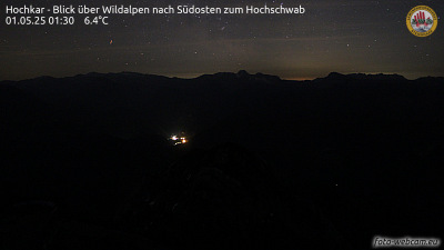
Webcams near Hochkar



Towns near Hochkar
- Amstetten46 km away
- Steyr51 km away
- Ansfelden72 km away
- Traun75 km away
- Sankt Pölten78 km away