Lavic Lake volcanic field
Volcano · United States
The Lavic Lake volcanic field is a volcanic field with extinct cinder cones in the Mojave Desert, in San Bernardino County, California, United States, at 762 m (2,500 ft) elevation.
From Wikipedia, CC BY-SA · Read the article
At the summit · forecast for 2:00 PM
75 °FClear · wind 9 mph from the SE
 See it in 3D
Lavic Lake volcanic field weather forecast
- 2:00 PM75 °FSE 9 mph–
- 5:00 PM73 °FE 11 mph–
- 8:00 PM66 °FSE 4 mph–
- 11:00 PM64 °FSE 4 mph–
- 2:00 AM60 °FNW 4 mph–
- 5:00 AM59 °FW 3 mph–
- 8:00 AM60 °FW 2 mph–
- 11:00 AM71 °FE 7 mph–
| Day | Sky | High / low | Rain | Wind up to |
|---|---|---|---|---|
| Thu, Oct 29 | Partly cloudy | 76 °F / 58 °F | – | 12 mph |
| Fri, Oct 30 | Mostly clear | 70 °F / 55 °F | – | 10 mph |
| Sat, Oct 31 | Cloudy | 65 °F / 57 °F | 0.27 in | 13 mph |
| Sun, Nov 1 | Cloudy | 65 °F / 52 °F | 0.25 in | 16 mph |
| Mon, Nov 2 | Clear | 63 °F / 49 °F | – | 10 mph |
| Tue, Nov 3 | Partly cloudy | 65 °F / 51 °F | – | 6 mph |
| Wed, Nov 4 | Clear | 68 °F / 52 °F | – | 3 mph |
Forecast by MET Norway (CC BY 4.0), updated 04:19 AM PDT. Times are local.
Facts
- What it is
- Volcano
- Country
- United States
- Coordinates
- 34.746°N 116.375°W
- Volcano number
- 323190 at the Global Volcanism Program
- Source
- Wikidata, CC0
Lavic Lake volcanic field
Volcanic field in San Bernardino County, California, United States
The Lavic Lake volcanic field is a volcanic field with extinct cinder cones in the Mojave Desert, in San Bernardino County, California, United States, at 762 m (2,500 ft) elevation. Its cones lie directly alongside historic Route 66 and modern Interstate 40, between Barstow to the west and Ludlow 10 miles (16 km) to the east.
From Wikipedia, CC BY-SA · Read the article
Peaks near Lavic Lake volcanic field
- Pisgah Crater2,545 ft · 0 km awayOn the map
- Amboy Crater944 ft · 58 km awayOn the map
- PipkinVolcano · 23 km awayOn the map
Highest mountains in United States
- Denali20,308 ftOn the map
- Mount Saint Elias18,009 ftOn the map
- Mount Foraker17,402 ftOn the map
- Mount Bona16,535 ftOn the map
- Mount Blackburn16,390 ftOn the map
- Mount Sanford16,237 ftOn the map
- Mount Vancouver15,787 ftOn the map
- Mount Churchill15,636 ftOn the map
- Mount Fairweather15,325 ftOn the map
- Mount Hubbard14,951 ftOn the map
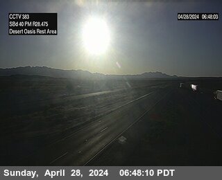
Webcams near Lavic Lake volcanic field
History around Lavic Lake volcanic field
Towns near Lavic Lake volcanic field
- Barstow62 km away
- Barstow Heights64 km away
- Yucca Valley70 km away
- Twentynine Palms74 km away
- Apple Valley79 km away