Maiden Peak
7,823 ft2,385 m
Mountain · Oregon Cascades · United States
Maiden Peak is a steep-sided shield volcano in the Cascade Range of central Oregon. It is the highest point in the 43-mile (69 km) distance between Mount Bachelor and Diamond Peak.
From Wikipedia, CC BY-SA · Read the article
At the summit · forecast for 4:00 PM
29 °FPartly cloudy · wind 11 mph from the W
 See it in 3D
Weather at the summit of Maiden Peak, 7,823 ft
- 4:00 PM29 °FW 11 mph–
- 7:00 PM26 °FSW 6 mph–
- 10:00 PM26 °FSW 6 mph0.04 in
- 1:00 AM26 °FSW 5 mph0.09 in
- 4:00 AM25 °FSW 4 mph0.17 in
- 7:00 AM25 °FSW 4 mph0.15 in
- 10:00 AM26 °FW 5 mph0.11 in
- 1:00 PM28 °FW 9 mph–
| Day | Sky | High / low | Rain | Wind up to |
|---|---|---|---|---|
| Tue, Oct 27 | Cloudy | 28 °F / 22 °F | 0.54 in | 9 mph |
| Wed, Oct 28 | Cloudy | 28 °F / 19 °F | 0.04 in | 10 mph |
| Thu, Oct 29 | Mostly clear | 28 °F / 18 °F | – | 4 mph |
| Fri, Oct 30 | Mostly clear | 27 °F / 15 °F | – | 4 mph |
| Sat, Oct 31 | Clear | 28 °F / 12 °F | 0.05 in | 4 mph |
| Sun, Nov 1 | Clear | 31 °F / 18 °F | – | 2 mph |
| Mon, Nov 2 | Cloudy | 35 °F / 20 °F | – | 4 mph |
Forecast by MET Norway (CC BY 4.0), updated 12:16 PM PDT. Times are local.
Facts
- What it is
- Mountain
- Height above sea level
- 7,823 ft (2,385 m)
- Prominence
- 2,578 ft (786 m)
- Range
- Oregon Cascades
- Country
- United States
- Coordinates
- 43.627°N 121.965°W
- Source
- Wikidata, CC0
Maiden Peak (Oregon)
Shield volcano in Oregon, United States of America
Maiden Peak is a steep-sided shield volcano in the Cascade Range of central Oregon. It is the highest point in the 43-mile (69 km) distance between Mount Bachelor and Diamond Peak. Ice Age glaciers carved a large cirque into the northeast flank of the mountain, exposing magma which hardened in the volcano's conduits to form the numerous rock pinnacles now found in the upper part of the cirque.
From Wikipedia, CC BY-SA · Read the article
Peaks near Maiden Peak
- Waldo Mountain6,361 ft · 19 km awayOn the map
- Diamond Peak8,748 ft · 19 km awayOn the map
- Williamson Mountain6,304 ft · 35 km awayOn the map
- Cinnamon Butte6,427 ft · 44 km awayOn the map
- Mount Bachelor9,068 ft · 45 km awayOn the map
- Howlock Mountain8,401 ft · 49 km awayOn the map
- Tumalo Mountain7,776 ft · 49 km awayOn the map
- Swastika Mountain4,197 ft · 52 km awayOn the map
- Mount Thielsen9,183 ft · 53 km awayOn the map
- Broken Top9,177 ft · 55 km awayOn the map
Highest in the Oregon Cascades
- Mount Hood11,237 ftOn the map
- Mount Jefferson10,495 ftOn the map
- Three Sisters10,364 ftOn the map
- Mount Bachelor9,068 ftOn the map
- Mount Scott8,930 ftOn the map
- Diamond Peak8,748 ftOn the map
- Newberry Volcano7,986 ftOn the map
- Three Fingered Jack7,844 ftOn the map
- Maiden Peak7,823 ftOn the map
Highest mountains in United States
- Denali20,308 ftOn the map
- Mount Saint Elias18,009 ftOn the map
- Mount Foraker17,402 ftOn the map
- Mount Bona16,535 ftOn the map
- Mount Blackburn16,390 ftOn the map
- Mount Sanford16,237 ftOn the map
- Mount Vancouver15,787 ftOn the map
- Mount Churchill15,636 ftOn the map
- Mount Fairweather15,325 ftOn the map
- Mount Hubbard14,951 ftOn the map
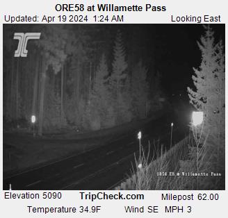
Webcams near Maiden Peak


History around Maiden Peak
- Cedar Creek Fire2022
Towns near Maiden Peak
- Bend71 km away