Mittagskogel
3,159 m10,364 ft
Mountain · Weißkamm · Austria
Der Mittagskogel ist ein 3159 m ü. A. hoher Berg, er dominiert im inneren Pitztal beim Blick in Richtung Talende, da er aus dieser Richtung die hinter ihm liegenden wesentlich höheren Gipfel des Weißkamms verdeckt.
From German Wikipedia, CC BY-SA · Read the article
At the summit · forecast for 1:00 AM
-6 °CClear · wind 6 km/h from the W
 See it in 3D
Weather at the summit of Mittagskogel, 3,159 m
- 1:00 AM-6 °CW 6 km/h–
- 4:00 AM-6 °CSW 5 km/h–
- 7:00 AM-6 °CW 5 km/h0.2 mm
- 10:00 AM-2 °CW 5 km/h–
- 1:00 PM-2 °CNW 8 km/h0.5 mm
- 4:00 PM-3 °CN 7 km/h0.3 mm
- 7:00 PM-4 °CN 6 km/h–
- 10:00 PM-7 °CSW 4 km/h–
| Day | Sky | High / low | Rain | Wind up to |
|---|---|---|---|---|
| Today | Partly cloudy | -2 °C / -9 °C | 1 mm | 8 km/h |
| Thu, Oct 29 | Clear | -2 °C / -12 °C | – | 6 km/h |
| Fri, Oct 30 | Clear | -3 °C / -11 °C | – | 4 km/h |
| Sat, Oct 31 | Clear | -2 °C / -11 °C | – | 3 km/h |
| Sun, Nov 1 | Clear | -4 °C / -12 °C | – | 6 km/h |
| Mon, Nov 2 | Snow | -10 °C / -12 °C | 4.3 mm | 10 km/h |
| Tue, Nov 3 | Cloudy | -11 °C / -13 °C | 1.1 mm | 10 km/h |
Forecast by MET Norway (CC BY 4.0), updated 12:18 AM GMT+1. Times are local.
Facts
- What it is
- Mountain
- Height above sea level
- 3,159 m (10,364 ft)
- Prominence
- 105 m (344 ft)
- Isolation
- 1 km to higher ground
- Range
- Weißkamm
- Country
- Austria
- Coordinates
- 46.934°N 10.871°E
- Source
- Wikidata, CC0
Mittagskogel (Pitztal)
Berg in dem Ötztaler Alpen in Tirol
Der Mittagskogel ist ein 3159 m ü. A. hoher Berg, er dominiert im inneren Pitztal beim Blick in Richtung Talende, da er aus dieser Richtung die hinter ihm liegenden wesentlich höheren Gipfel des Weißkamms verdeckt. Sein Gipfel bietet einen umfassenden Rundblick, nach Norden überblickt man einen weiten Teil des Pitztals, nach Süden hin bietet sich ein großartiger Blick auf die Wildspitze.
From German Wikipedia, CC BY-SA · Read the article
Peaks near Mittagskogel
- Wildspitze3,768 m · 5.4 km awayOn the map
- Weißkugel3,738 m · 19 km awayOn the map
- Similaun3,597 m · 19 km awayOn the map
- Zuckerhütl3,507 m · 22 km awayOn the map
- Muttler3,294 m · 38 km awayOn the map
- Parseierspitze3,036 m · 40 km awayOn the map
- Vorderseespitze2,889 m · 47 km awayOn the map
- Feuerspitze2,851 m · 48 km awayOn the map
- Wetterspitze2,895 m · 49 km awayOn the map
- Fluchthorn3,397 m · 49 km awayOn the map
Highest in the Weißkamm
- Wildspitze3,768 mOn the map
- Weißkugel3,738 mOn the map
- Weißseespitze3,498 mOn the map
- Mittagskogel3,159 mOn the map
Highest mountains in Austria
- Grossglockner3,798 mOn the map
- Wildspitze3,768 mOn the map
- Weißkugel3,738 mOn the map
- Großvenediger3,657 mOn the map
- Hintere Schwärze3,624 mOn the map
- Großes Wiesbachhorn3,564 mOn the map
- Ramolkogel3,549 mOn the map
- Schalfkogel3,537 mOn the map
- Watzespitze3,532 mOn the map
- Fineilspitze3,514 mOn the map
Webcams near Mittagskogel
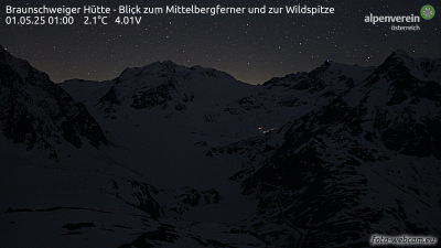



Towns near Mittagskogel
- Merano37 km away
- Telfs44 km away
- Innsbruck54 km away
- Bolzano61 km away
- Garmisch-Partenkirchen64 km away
- Bressanone64 km away